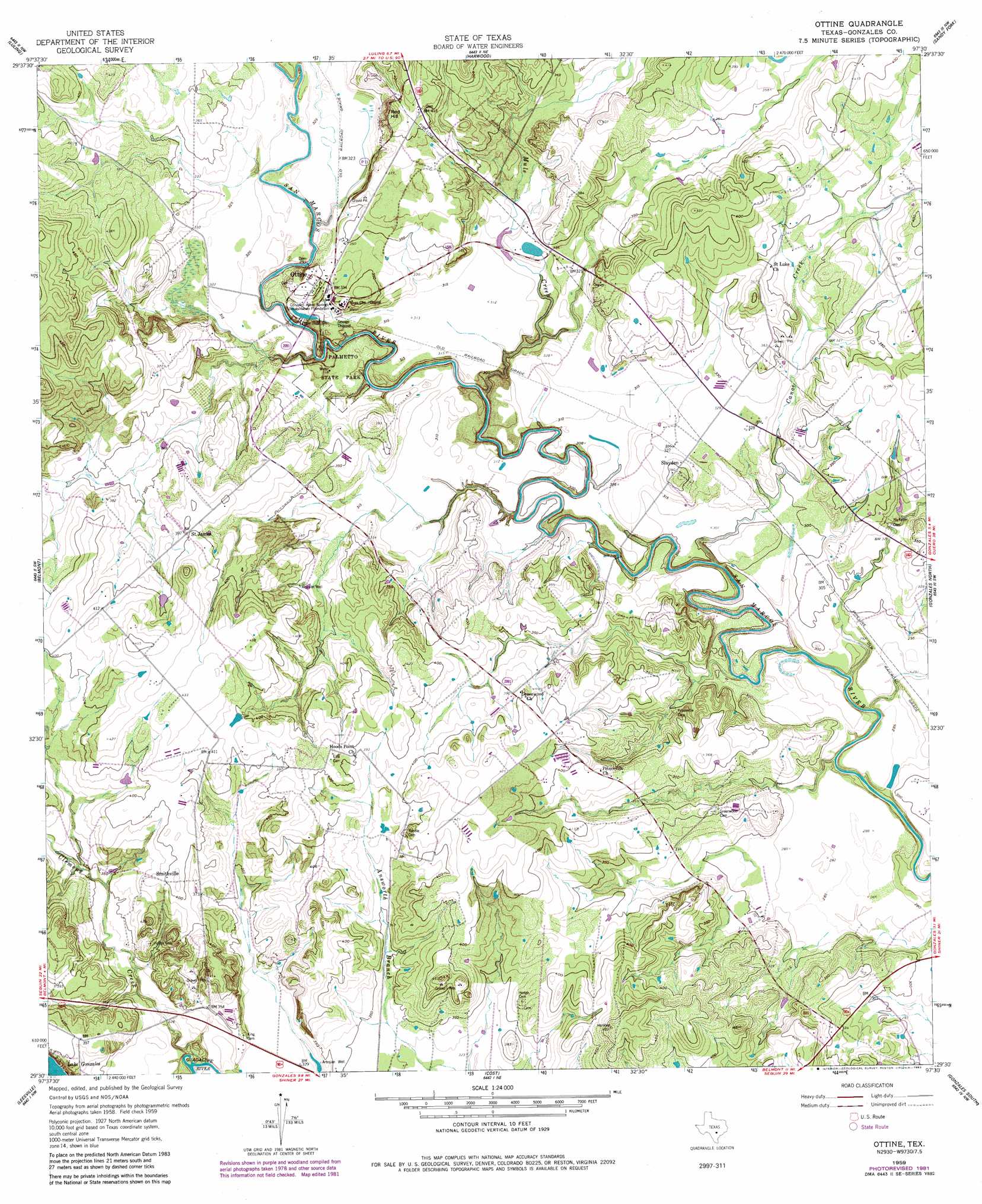
Ottine Topo Map Texas
To zoom in, hover over the map of Ottine
USGS Topo Quad 29097e5 - 1:24,000 scale
| Topo Map Name: | Ottine |
| USGS Topo Quad ID: | 29097e5 |
| Print Size: | ca. 21 1/4" wide x 27" high |
| Southeast Coordinates: | 29.5° N latitude / 97.5° W longitude |
| Map Center Coordinates: | 29.5625° N latitude / 97.5625° W longitude |
| U.S. State: | TX |
| Filename: | o29097e5.jpg |
| Download Map JPG Image: | Ottine topo map 1:24,000 scale |
| Map Type: | Topographic |
| Topo Series: | 7.5´ |
| Map Scale: | 1:24,000 |
| Source of Map Images: | United States Geological Survey (USGS) |
| Alternate Map Versions: |
Ottine TX 1959, updated 1960 Download PDF Buy paper map Ottine TX 1959, updated 1983 Download PDF Buy paper map Ottine TX 2010 Download PDF Buy paper map Ottine TX 2013 Download PDF Buy paper map Ottine TX 2016 Download PDF Buy paper map |
1:24,000 Topo Quads surrounding Ottine
Martindale |
Lockhart South |
Mcmahan |
Delhi |
Jeddo |
Kingsbury |
Luling |
Harwood |
Sandy Fork |
Waelder |
Darst Creek |
Belmont |
Ottine |
Gonzales North |
Dilworth |
Dewville |
Leesville |
Cost |
Gonzales South |
Hamon |
Nixon |
Smiley |
Pilgrim |
Cheapside |
Hochheim |
> Back to 29097e1 at 1:100,000 scale
> Back to 29096a1 at 1:250,000 scale
> Back to U.S. Topo Maps home
Ottine topo map: Gazetteer
Ottine: Dams
Benke Lake Dam elevation 101m 331′Glasscock Lake Dam elevation 100m 328′
Zedler Dam elevation 90m 295′
Ottine: Parks
Palmetto State Park elevation 95m 311′Palmetto State Park elevation 106m 347′
Ottine: Populated Places
Ottine elevation 103m 337′Saint James elevation 121m 396′
Slayden elevation 100m 328′
Smithville elevation 123m 403′
Ottine: Reservoirs
Benke Lake elevation 101m 331′Glasscock Lake elevation 100m 328′
Zedler Lake elevation 90m 295′
Ottine: Streams
Artesia Creek elevation 92m 301′Canoe Creek elevation 81m 265′
Clemens Creek elevation 93m 305′
Mule Creek elevation 84m 275′
Ottine: Summits
Red Hill elevation 135m 442′Ottine: Trails
Palmetto State Park - Lake Trail elevation 95m 311′Palmetto State Park - Nature and Hiking Trail elevation 87m 285′
Palmetto State Park - Palmetto Trail elevation 97m 318′
Palmetto State Park - River Trail elevation 86m 282′
Ottine digital topo map on disk
Buy this Ottine topo map showing relief, roads, GPS coordinates and other geographical features, as a high-resolution digital map file on DVD: