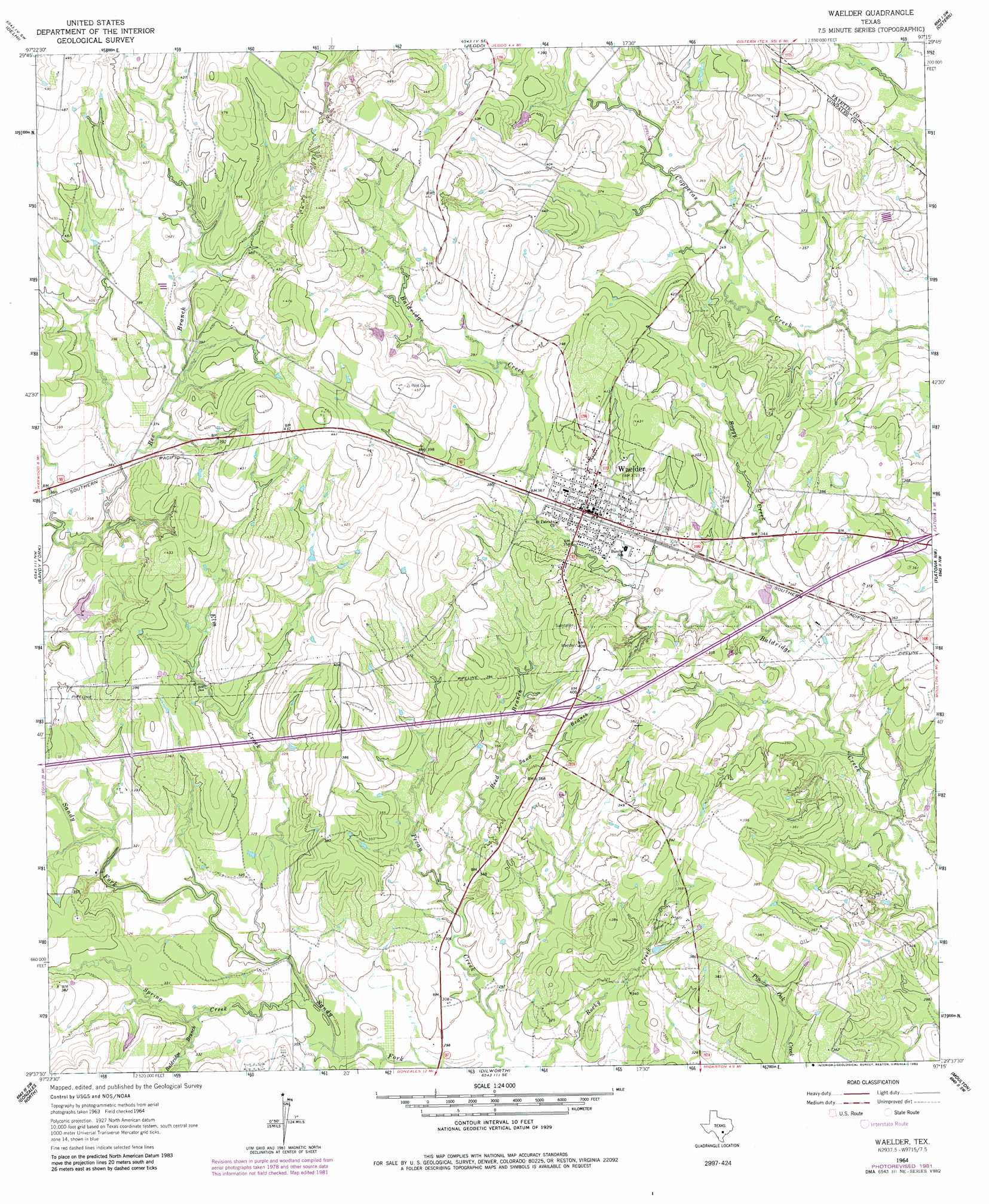
Waelder Topo Map Texas
To zoom in, hover over the map of Waelder
USGS Topo Quad 29097f3 - 1:24,000 scale
| Topo Map Name: | Waelder |
| USGS Topo Quad ID: | 29097f3 |
| Print Size: | ca. 21 1/4" wide x 27" high |
| Southeast Coordinates: | 29.625° N latitude / 97.25° W longitude |
| Map Center Coordinates: | 29.6875° N latitude / 97.3125° W longitude |
| U.S. State: | TX |
| Filename: | o29097f3.jpg |
| Download Map JPG Image: | Waelder topo map 1:24,000 scale |
| Map Type: | Topographic |
| Topo Series: | 7.5´ |
| Map Scale: | 1:24,000 |
| Source of Map Images: | United States Geological Survey (USGS) |
| Alternate Map Versions: |
Waelder TX 1964, updated 1966 Download PDF Buy paper map Waelder TX 1964, updated 1982 Download PDF Buy paper map Waelder TX 2010 Download PDF Buy paper map Waelder TX 2013 Download PDF Buy paper map Waelder TX 2016 Download PDF Buy paper map |
1:24,000 Topo Quads surrounding Waelder
Dale |
Red Rock |
Rosanky |
Togo |
West Point |
Mcmahan |
Delhi |
Jeddo |
Cistern |
Muldoon |
Harwood |
Sandy Fork |
Waelder |
Flatonia Nw |
Flatonia |
Ottine |
Gonzales North |
Dilworth |
Moulton |
Komensky |
Cost |
Gonzales South |
Hamon |
Shiner |
Wied |
> Back to 29097e1 at 1:100,000 scale
> Back to 29096a1 at 1:250,000 scale
> Back to U.S. Topo Maps home
Waelder topo map: Gazetteer
Waelder: Dams
Jenecka Lake Dam elevation 104m 341′Waelder: Populated Places
Waelder elevation 116m 380′Welder elevation 113m 370′
Waelder: Reservoirs
Jenecka Lake elevation 104m 341′Waelder: Streams
Baldridge Branch elevation 95m 311′Boggy Creek elevation 97m 318′
Elm Creek elevation 90m 295′
Reed Branch elevation 92m 301′
Sand Branch elevation 100m 328′
Spring Creek elevation 89m 291′
Waelder digital topo map on disk
Buy this Waelder topo map showing relief, roads, GPS coordinates and other geographical features, as a high-resolution digital map file on DVD: