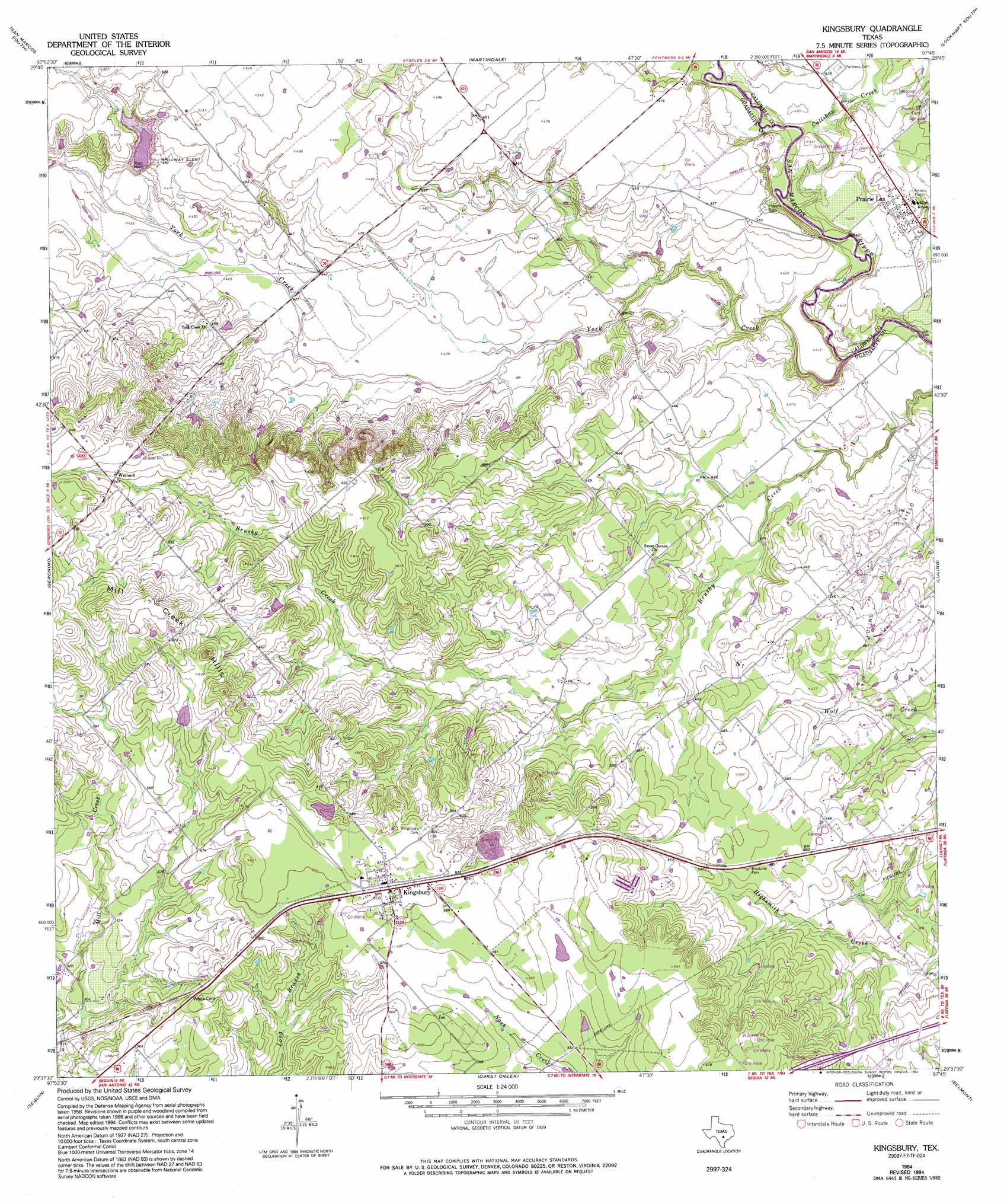
Kingsbury Topo Map Texas
To zoom in, hover over the map of Kingsbury
USGS Topo Quad 29097f7 - 1:24,000 scale
| Topo Map Name: | Kingsbury |
| USGS Topo Quad ID: | 29097f7 |
| Print Size: | ca. 21 1/4" wide x 27" high |
| Southeast Coordinates: | 29.625° N latitude / 97.75° W longitude |
| Map Center Coordinates: | 29.6875° N latitude / 97.8125° W longitude |
| U.S. State: | TX |
| Filename: | o29097f7.jpg |
| Download Map JPG Image: | Kingsbury topo map 1:24,000 scale |
| Map Type: | Topographic |
| Topo Series: | 7.5´ |
| Map Scale: | 1:24,000 |
| Source of Map Images: | United States Geological Survey (USGS) |
| Alternate Map Versions: |
Kingsbury TX 1964, updated 1965 Download PDF Buy paper map Kingsbury TX 1964, updated 1975 Download PDF Buy paper map Kingsbury TX 1964, updated 1994 Download PDF Buy paper map Kingsbury TX 2010 Download PDF Buy paper map Kingsbury TX 2013 Download PDF Buy paper map Kingsbury TX 2016 Download PDF Buy paper map |
1:24,000 Topo Quads surrounding Kingsbury
Wimberley |
San Marcos North |
Uhland |
Lockhart North |
Dale |
Hunter |
San Marcos South |
Martindale |
Lockhart South |
Mcmahan |
New Braunfels East |
Geronimo |
Kingsbury |
Luling |
Harwood |
Mcqueeney |
Seguin |
Darst Creek |
Belmont |
Ottine |
New Berlin |
Thomas Springs |
Dewville |
Leesville |
Cost |
> Back to 29097e1 at 1:100,000 scale
> Back to 29096a1 at 1:250,000 scale
> Back to U.S. Topo Maps home
Kingsbury topo map: Gazetteer
Kingsbury: Dams
Baker Lake Dam elevation 184m 603′Soil Conservation Service Site 16 Dam elevation 143m 469′
Kingsbury: Populated Places
Kingsbury elevation 184m 603′Prairie Lea elevation 137m 449′
Weinert elevation 186m 610′
Kingsbury: Reservoirs
Baker Lake elevation 184m 603′Soil Conservation Service Site 16 Reservoir elevation 143m 469′
Kingsbury: Streams
Callihan Creek elevation 121m 396′Cottonwood Creek elevation 132m 433′
York Creek elevation 118m 387′
Kingsbury: Summits
Mill Creek Hills elevation 214m 702′Kingsbury digital topo map on disk
Buy this Kingsbury topo map showing relief, roads, GPS coordinates and other geographical features, as a high-resolution digital map file on DVD: