Cistern Topo Map Texas
To zoom in, hover over the map of Cistern
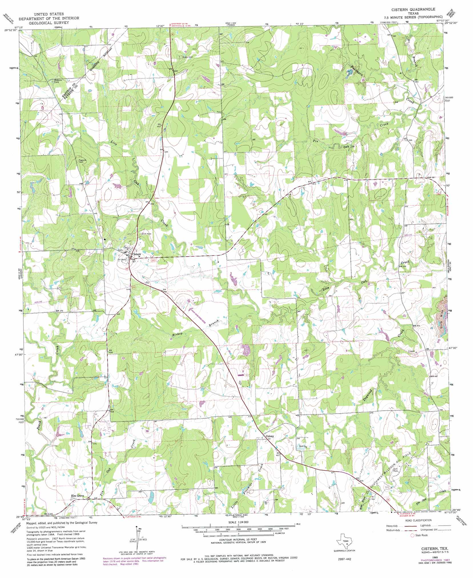
USGS Topo Quad 29097g2 - 1:24,000 scale
| Topo Map Name: | Cistern |
| USGS Topo Quad ID: | 29097g2 |
| Print Size: | ca. 21 1/4" wide x 27" high |
| Southeast Coordinates: | 29.75° N latitude / 97.125° W longitude |
| Map Center Coordinates: | 29.8125° N latitude / 97.1875° W longitude |
| U.S. State: | TX |
| Filename: | o29097g2.jpg |
| Download Map JPG Image: | Cistern topo map 1:24,000 scale |
| Map Type: | Topographic |
| Topo Series: | 7.5´ |
| Map Scale: | 1:24,000 |
| Source of Map Images: | United States Geological Survey (USGS) |
| Alternate Map Versions: |
Cistern TX 1965, updated 1967 Download PDF Buy paper map Cistern TX 1965, updated 1982 Download PDF Buy paper map Cistern TX 2010 Download PDF Buy paper map Cistern TX 2013 Download PDF Buy paper map Cistern TX 2016 Download PDF Buy paper map |
1:24,000 Topo Quads surrounding Cistern
Bastrop Sw |
Bastrap |
Smithville |
Winchester |
Warda |
Red Rock |
Rosanky |
Togo |
West Point |
La Grange West |
Delhi |
Jeddo |
Cistern |
Muldoon |
Swiss Alp |
Sandy Fork |
Waelder |
Flatonia Nw |
Flatonia |
Schulenburg |
Gonzales North |
Dilworth |
Moulton |
Komensky |
Moravia |
> Back to 29097e1 at 1:100,000 scale
> Back to 29096a1 at 1:250,000 scale
> Back to U.S. Topo Maps home
Cistern topo map: Gazetteer
Cistern: Bridges
Buckners Creek Bridge elevation 101m 331′Cistern: Oilfields
Southwest Muldoon Oil Field elevation 127m 416′Cistern: Populated Places
Cistern elevation 142m 465′Colony elevation 132m 433′
Elm Grove elevation 107m 351′
Cistern: Streams
Bishop Branch elevation 110m 360′Bo Branch elevation 101m 331′
Pin Oak Creek elevation 98m 321′
Cistern digital topo map on disk
Buy this Cistern topo map showing relief, roads, GPS coordinates and other geographical features, as a high-resolution digital map file on DVD: