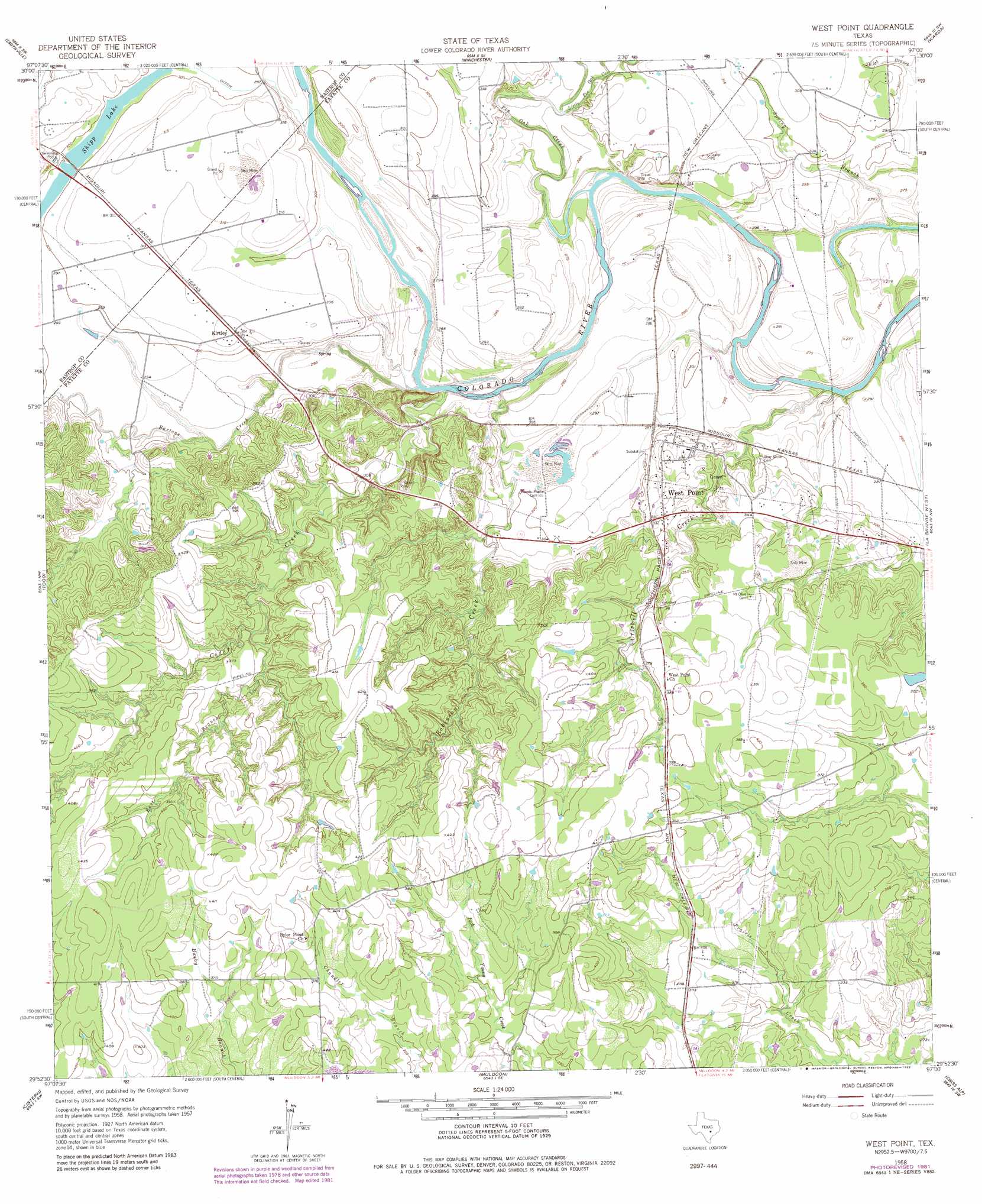
West Point Topo Map Texas
To zoom in, hover over the map of West Point
USGS Topo Quad 29097h1 - 1:24,000 scale
| Topo Map Name: | West Point |
| USGS Topo Quad ID: | 29097h1 |
| Print Size: | ca. 21 1/4" wide x 27" high |
| Southeast Coordinates: | 29.875° N latitude / 97° W longitude |
| Map Center Coordinates: | 29.9375° N latitude / 97.0625° W longitude |
| U.S. State: | TX |
| Filename: | o29097h1.jpg |
| Download Map JPG Image: | West Point topo map 1:24,000 scale |
| Map Type: | Topographic |
| Topo Series: | 7.5´ |
| Map Scale: | 1:24,000 |
| Source of Map Images: | United States Geological Survey (USGS) |
| Alternate Map Versions: |
West Point TX 1958, updated 1958 Download PDF Buy paper map West Point TX 1958, updated 1968 Download PDF Buy paper map West Point TX 1958, updated 1982 Download PDF Buy paper map West Point TX 2010 Download PDF Buy paper map West Point TX 2013 Download PDF Buy paper map West Point TX 2016 Download PDF Buy paper map |
1:24,000 Topo Quads surrounding West Point
Lake Bastrop |
Smithville Nw |
Paige |
Giddings |
Ledbetter |
Bastrap |
Smithville |
Winchester |
Warda |
Nechanitz |
Rosanky |
Togo |
West Point |
La Grange West |
La Grange East |
Jeddo |
Cistern |
Muldoon |
Swiss Alp |
Ammannsville |
Waelder |
Flatonia Nw |
Flatonia |
Schulenburg |
Weimar |
> Back to 29097e1 at 1:100,000 scale
> Back to 29096a1 at 1:250,000 scale
> Back to U.S. Topo Maps home
West Point topo map: Gazetteer
West Point: Populated Places
Kirtley elevation 95m 311′Lena elevation 102m 334′
West Point elevation 104m 341′
West Point: Streams
Bartons Creek elevation 78m 255′Cedar Creek elevation 81m 265′
Criswell Creek elevation 77m 252′
East Branch Cedar Creek elevation 103m 337′
Little Pin Oak Creek elevation 82m 269′
Pin Oak Creek elevation 79m 259′
Robinson Creek elevation 82m 269′
Spring Branch elevation 79m 259′
West Point digital topo map on disk
Buy this West Point topo map showing relief, roads, GPS coordinates and other geographical features, as a high-resolution digital map file on DVD: