La Vernia Topo Map Texas
To zoom in, hover over the map of La Vernia
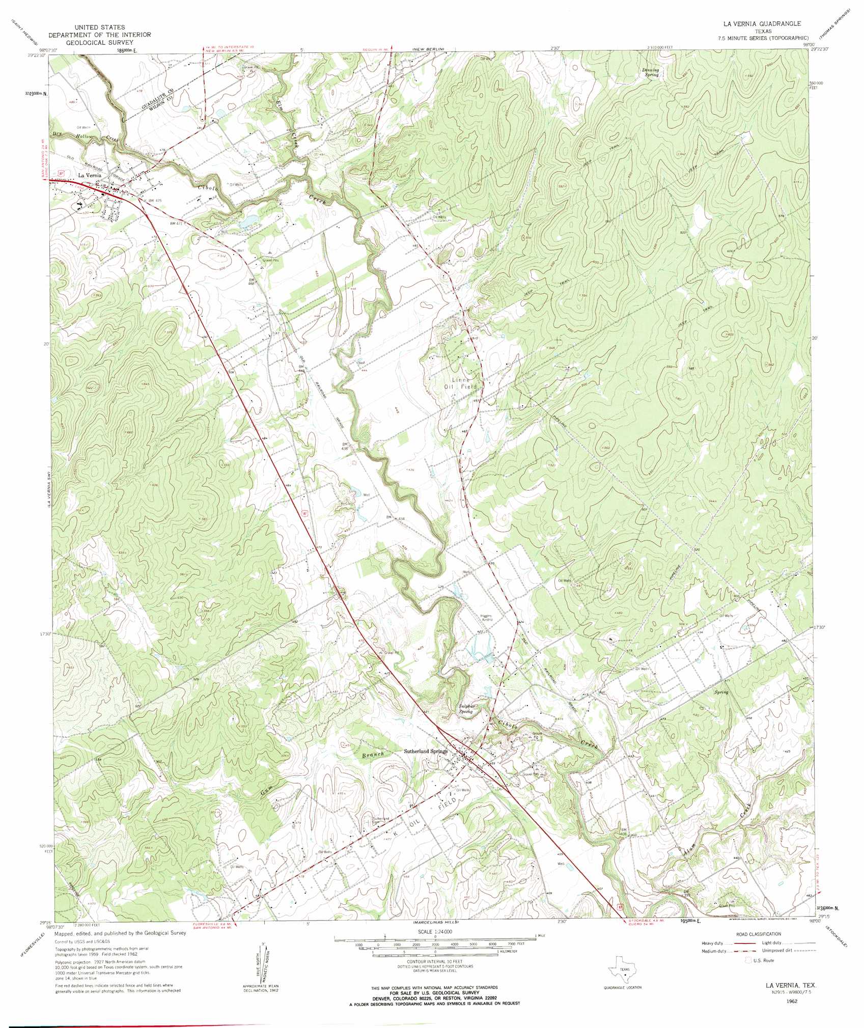
USGS Topo Quad 29098c1 - 1:24,000 scale
| Topo Map Name: | La Vernia |
| USGS Topo Quad ID: | 29098c1 |
| Print Size: | ca. 21 1/4" wide x 27" high |
| Southeast Coordinates: | 29.25° N latitude / 98° W longitude |
| Map Center Coordinates: | 29.3125° N latitude / 98.0625° W longitude |
| U.S. State: | TX |
| Filename: | o29098c1.jpg |
| Download Map JPG Image: | La Vernia topo map 1:24,000 scale |
| Map Type: | Topographic |
| Topo Series: | 7.5´ |
| Map Scale: | 1:24,000 |
| Source of Map Images: | United States Geological Survey (USGS) |
| Alternate Map Versions: |
La Vernia TX 1962, updated 1963 Download PDF Buy paper map La Vernia TX 1962, updated 1963 Download PDF Buy paper map La Vernia TX 2010 Download PDF Buy paper map La Vernia TX 2013 Download PDF Buy paper map La Vernia TX 2016 Download PDF Buy paper map |
1:24,000 Topo Quads surrounding La Vernia
Schertz |
Marion |
Mcqueeney |
Seguin |
Darst Creek |
Martinez |
Saint Hedwig |
New Berlin |
Thomas Springs |
Dewville |
Elmendorf |
La Vernia Sw |
La Vernia |
Alum |
Nixon |
Saspamco |
Floresville |
Marcelinas Hills |
Stockdale |
Gillett |
Saspamco Se |
Dewees |
Poth |
Kosciusko |
Ecleto |
> Back to 29098a1 at 1:100,000 scale
> Back to 29098a1 at 1:250,000 scale
> Back to U.S. Topo Maps home
La Vernia topo map: Gazetteer
La Vernia: Dams
Dagen Lake Dam elevation 137m 449′La Vernia: Oilfields
K Oil Field elevation 142m 465′Linne Oil Field elevation 152m 498′
La Vernia: Populated Places
La Vernia elevation 149m 488′Sutherland Springs elevation 143m 469′
La Vernia: Reservoirs
Dagen Lake elevation 137m 449′La Vernia: Springs
Denning Spring elevation 189m 620′Sulphur Spring elevation 121m 396′
Sutherland Springs elevation 126m 413′
La Vernia: Streams
Alum Creek elevation 113m 370′Dry Hollow Creek elevation 134m 439′
Elm Creek elevation 125m 410′
Gum Branch elevation 117m 383′
La Vernia digital topo map on disk
Buy this La Vernia topo map showing relief, roads, GPS coordinates and other geographical features, as a high-resolution digital map file on DVD: