Saint Hedwig Topo Map Texas
To zoom in, hover over the map of Saint Hedwig
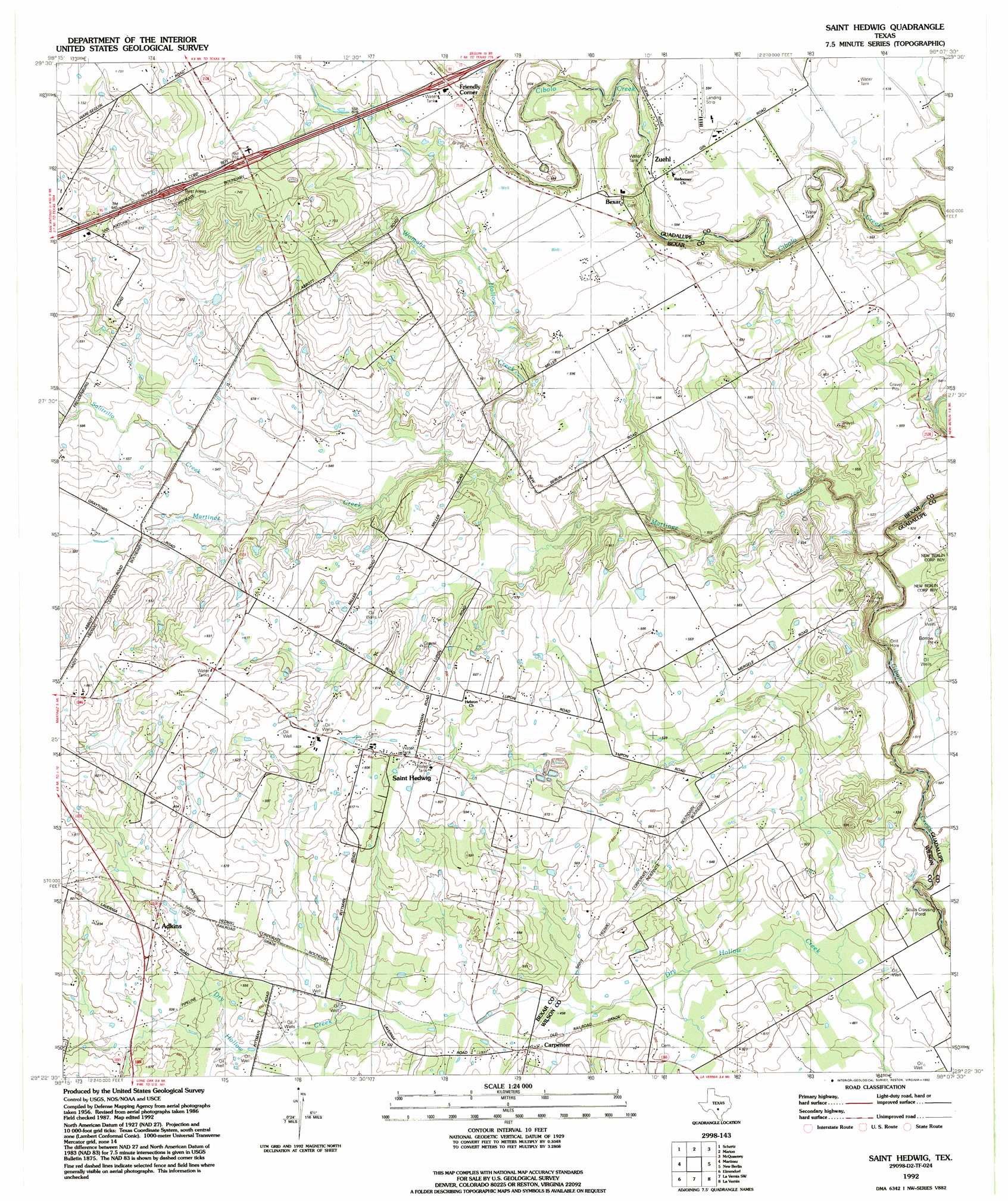
USGS Topo Quad 29098d2 - 1:24,000 scale
| Topo Map Name: | Saint Hedwig |
| USGS Topo Quad ID: | 29098d2 |
| Print Size: | ca. 21 1/4" wide x 27" high |
| Southeast Coordinates: | 29.375° N latitude / 98.125° W longitude |
| Map Center Coordinates: | 29.4375° N latitude / 98.1875° W longitude |
| U.S. State: | TX |
| Filename: | o29098d2.jpg |
| Download Map JPG Image: | Saint Hedwig topo map 1:24,000 scale |
| Map Type: | Topographic |
| Topo Series: | 7.5´ |
| Map Scale: | 1:24,000 |
| Source of Map Images: | United States Geological Survey (USGS) |
| Alternate Map Versions: |
Saint Hedwig TX 1958, updated 1961 Download PDF Buy paper map Saint Hedwig TX 1958, updated 1975 Download PDF Buy paper map Saint Hedwig TX 1992, updated 1992 Download PDF Buy paper map Saint Hedwig TX 2010 Download PDF Buy paper map Saint Hedwig TX 2013 Download PDF Buy paper map Saint Hedwig TX 2016 Download PDF Buy paper map |
1:24,000 Topo Quads surrounding Saint Hedwig
Bulverde |
Bat Cave |
New Braunfels West |
New Braunfels East |
Geronimo |
Longhorn |
Schertz |
Marion |
Mcqueeney |
Seguin |
San Antonio East |
Martinez |
Saint Hedwig |
New Berlin |
Thomas Springs |
Southton |
Elmendorf |
La Vernia Sw |
La Vernia |
Alum |
Losoya |
Saspamco |
Floresville |
Marcelinas Hills |
Stockdale |
> Back to 29098a1 at 1:100,000 scale
> Back to 29098a1 at 1:250,000 scale
> Back to U.S. Topo Maps home
Saint Hedwig topo map: Gazetteer
Saint Hedwig: Airports
Idle Airpark elevation 171m 561′Zuehl Airport elevation 178m 583′
Saint Hedwig: Crossings
Interchange 591 elevation 211m 692′Interchange 593 elevation 194m 636′
Sculls Crossing elevation 141m 462′
Saint Hedwig: Populated Places
Adkins elevation 170m 557′Bexar elevation 182m 597′
Carpenter elevation 155m 508′
Friendly Corner elevation 194m 636′
Saint Hedwig elevation 176m 577′
Zuehl elevation 178m 583′
Saint Hedwig: Springs
Martinez Springs elevation 178m 583′Saint Hedwig: Streams
Martinez Creek elevation 149m 488′Salitrillo Creek elevation 165m 541′
Santa Clara Creek elevation 157m 515′
Womans Hollow Creek elevation 162m 531′
Saint Hedwig digital topo map on disk
Buy this Saint Hedwig topo map showing relief, roads, GPS coordinates and other geographical features, as a high-resolution digital map file on DVD: