Riomedina Topo Map Texas
To zoom in, hover over the map of Riomedina
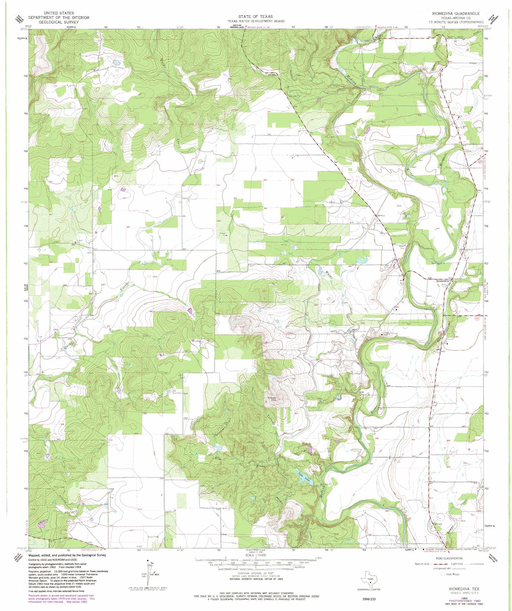
USGS Topo Quad 29098d8 - 1:24,000 scale
| Topo Map Name: | Riomedina |
| USGS Topo Quad ID: | 29098d8 |
| Print Size: | ca. 21 1/4" wide x 27" high |
| Southeast Coordinates: | 29.375° N latitude / 98.875° W longitude |
| Map Center Coordinates: | 29.4375° N latitude / 98.9375° W longitude |
| U.S. State: | TX |
| Filename: | o29098d8.jpg |
| Download Map JPG Image: | Riomedina topo map 1:24,000 scale |
| Map Type: | Topographic |
| Topo Series: | 7.5´ |
| Map Scale: | 1:24,000 |
| Source of Map Images: | United States Geological Survey (USGS) |
| Alternate Map Versions: |
Riomedina TX 1964, updated 1966 Download PDF Buy paper map Riomedina TX 1964, updated 1982 Download PDF Buy paper map Riomedina TX 2010 Download PDF Buy paper map Riomedina TX 2013 Download PDF Buy paper map Riomedina TX 2016 Download PDF Buy paper map |
1:24,000 Topo Quads surrounding Riomedina
Tarpley Pass |
Bandera |
Pipe Creek |
Jack Mountain |
Van Raub |
Twin Hollow |
Timber Creek |
Medina Lake |
San Geronimo |
Helotes |
Mustang Valley |
Quihi |
Riomedina |
Lacoste Ne |
Culebra Hill |
Hondo |
Murphy School |
Castroville |
Lacoste |
Macdona |
Yancey |
Biry |
Devine |
Lytle |
Somerset |
> Back to 29098a1 at 1:100,000 scale
> Back to 29098a1 at 1:250,000 scale
> Back to U.S. Topo Maps home
Riomedina topo map: Gazetteer
Riomedina: Airports
Weiblen Airport elevation 252m 826′Riomedina: Dams
Gabe Lake Dam elevation 242m 793′Jones Lake Dam elevation 281m 921′
Riomedina: Populated Places
Riomedina elevation 255m 836′Riomedina: Reservoirs
Gabe Lake elevation 243m 797′Jones Lake elevation 281m 921′
Riomedina: Springs
Haby 1 Springs elevation 250m 820′Haby 2 Springs elevation 278m 912′
Riomedina: Streams
Deep Creek elevation 256m 839′Elm Creek elevation 234m 767′
Mesquite Creek elevation 250m 820′
Opossum Creek elevation 272m 892′
San Geronimo Creek elevation 239m 784′
Water Creek elevation 238m 780′
Yellow Creek elevation 233m 764′
Riomedina: Summits
Indian Hill elevation 323m 1059′Riomedina digital topo map on disk
Buy this Riomedina topo map showing relief, roads, GPS coordinates and other geographical features, as a high-resolution digital map file on DVD: