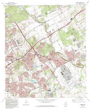
Schertz Topo Map Texas
To zoom in, hover over the map of Schertz
USGS Topo Quad 29098e3 - 1:24,000 scale
| Topo Map Name: | Schertz |
| USGS Topo Quad ID: | 29098e3 |
| Print Size: | ca. 21 1/4" wide x 27" high |
| Southeast Coordinates: | 29.5° N latitude / 98.25° W longitude |
| Map Center Coordinates: | 29.5625° N latitude / 98.3125° W longitude |
| U.S. State: | TX |
| Filename: | o29098e3.jpg |
| Download Map JPG Image: | Schertz topo map 1:24,000 scale |
| Map Type: | Topographic |
| Topo Series: | 7.5´ |
| Map Scale: | 1:24,000 |
| Source of Map Images: | United States Geological Survey (USGS) |
| Alternate Map Versions: |
Schertz TX 1953, updated 1959 Download PDF Buy paper map Schertz TX 1967, updated 1970 Download PDF Buy paper map Schertz TX 1967, updated 1975 Download PDF Buy paper map Schertz TX 1992, updated 1992 Download PDF Buy paper map Schertz TX 2010 Download PDF Buy paper map Schertz TX 2013 Download PDF Buy paper map Schertz TX 2016 Download PDF Buy paper map |
1:24,000 Topo Quads surrounding Schertz
> Back to 29098e1 at 1:100,000 scale
> Back to 29098a1 at 1:250,000 scale
> Back to U.S. Topo Maps home
Schertz topo map: Gazetteer
Schertz: Airports
Randolph Air Force Base elevation 223m 731′Schertz: Arroyos
Selma Creek elevation 218m 715′Schertz: Crossings
Interchange 169 elevation 260m 853′Interchange 170 elevation 286m 938′
Interchange 171 elevation 285m 935′
Interchange 172 elevation 278m 912′
Interchange 173 elevation 237m 777′
Interchange 174 elevation 230m 754′
Interchange 175 elevation 248m 813′
Interchange 177 elevation 254m 833′
Schertz: Dams
Crea Brothers Lake Dam elevation 257m 843′Harmark Lake Dam elevation 252m 826′
Martinez Creek Dam Number 4 elevation 222m 728′
Martinez Creek Dam Number 5 elevation 238m 780′
Soil Conservation Service Site 4 Dam elevation 224m 734′
Soil Conservation Service Site 5 Dam elevation 238m 780′
Schertz: Parks
Chuck Klein Park elevation 263m 862′City Park elevation 238m 780′
Clemens Stadium elevation 214m 702′
Comanche Lookout Park elevation 312m 1023′
Converse City Park elevation 206m 675′
Cut Off Park elevation 215m 705′
Eberle Park elevation 219m 718′
Judson Stadium elevation 204m 669′
Live Oak City Park elevation 239m 784′
Pickrell Park elevation 217m 711′
Randolph Stadium elevation 201m 659′
Red Horse Park elevation 230m 754′
Thulemeyer Park elevation 216m 708′
Universal City Park elevation 233m 764′
Universal City Park elevation 236m 774′
Schertz: Populated Places
Airport City elevation 222m 728′Bracken elevation 244m 800′
Converse elevation 219m 718′
Live Oak elevation 278m 912′
Luxello elevation 231m 757′
Schertz elevation 217m 711′
Selma elevation 230m 754′
Universal City elevation 233m 764′
Schertz: Post Offices
Northeast Annex Post Office elevation 266m 872′Universal City Post Office elevation 236m 774′
Schertz: Reservoirs
Crea Brothers Lake elevation 257m 843′Harmark Lake elevation 252m 826′
Soil Conservation Service Site 4 Reservoir elevation 224m 734′
Soil Conservation Service Site 5 Reservoir elevation 238m 780′
Schertz: Springs
Selma Spring elevation 229m 751′Schertz digital topo map on disk
Buy this Schertz topo map showing relief, roads, GPS coordinates and other geographical features, as a high-resolution digital map file on DVD:


