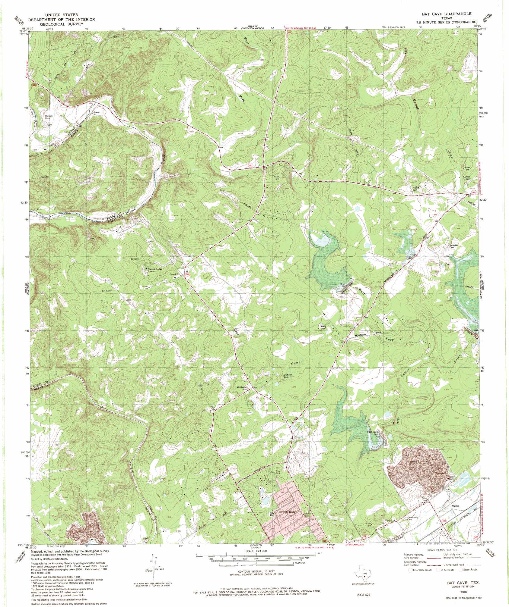
Bat Cave Topo Map Texas
To zoom in, hover over the map of Bat Cave
USGS Topo Quad 29098f3 - 1:24,000 scale
| Topo Map Name: | Bat Cave |
| USGS Topo Quad ID: | 29098f3 |
| Print Size: | ca. 21 1/4" wide x 27" high |
| Southeast Coordinates: | 29.625° N latitude / 98.25° W longitude |
| Map Center Coordinates: | 29.6875° N latitude / 98.3125° W longitude |
| U.S. State: | TX |
| Filename: | o29098f3.jpg |
| Download Map JPG Image: | Bat Cave topo map 1:24,000 scale |
| Map Type: | Topographic |
| Topo Series: | 7.5´ |
| Map Scale: | 1:24,000 |
| Source of Map Images: | United States Geological Survey (USGS) |
| Alternate Map Versions: |
Bat Cave TX 1953, updated 1959 Download PDF Buy paper map Bat Cave TX 1967, updated 1969 Download PDF Buy paper map Bat Cave TX 1967, updated 1975 Download PDF Buy paper map Bat Cave TX 1988, updated 1988 Download PDF Buy paper map Bat Cave TX 2010 Download PDF Buy paper map Bat Cave TX 2013 Download PDF Buy paper map Bat Cave TX 2016 Download PDF Buy paper map |
1:24,000 Topo Quads surrounding Bat Cave
Kendalia |
Spring Branch |
Fischer |
Devils Backbone |
Wimberley |
Bergheim |
Anhalt |
Smithson Valley |
Sattler |
Hunter |
Camp Bullis |
Bulverde |
Bat Cave |
New Braunfels West |
New Braunfels East |
Castle Hills |
Longhorn |
Schertz |
Marion |
Mcqueeney |
San Antonio West |
San Antonio East |
Martinez |
Saint Hedwig |
New Berlin |
> Back to 29098e1 at 1:100,000 scale
> Back to 29098a1 at 1:250,000 scale
> Back to U.S. Topo Maps home
Bat Cave topo map: Gazetteer
Bat Cave: Airports
Kitty Hawk Flying Field elevation 235m 770′Bat Cave: Arches
Natural Bridge of Texas elevation 311m 1020′Bat Cave: Dams
Soil Conservation Service Site 1 Dam elevation 264m 866′Soil Conservation Service Site 4 Dam elevation 232m 761′
Soil Conservation Service Site 5 Dam elevation 262m 859′
Soil Conservation Service Site Number 2 Dam elevation 244m 800′
Bat Cave: Populated Places
Garden Ridge elevation 272m 892′Ogden elevation 219m 718′
Bat Cave: Reservoirs
Soil Conservation Service Site 1 Reservoir elevation 264m 866′Soil Conservation Service Site 4 Reservoir elevation 232m 761′
Soil Conservation Service Site 5 Reservoir elevation 262m 859′
Soil Conservation Service Site Number 2 Reservoir elevation 244m 800′
Bat Cave: Streams
Bear Creek elevation 220m 721′West Fork Dry Comal Creek elevation 237m 777′
Bat Cave digital topo map on disk
Buy this Bat Cave topo map showing relief, roads, GPS coordinates and other geographical features, as a high-resolution digital map file on DVD: