Pipe Creek Topo Map Texas
To zoom in, hover over the map of Pipe Creek
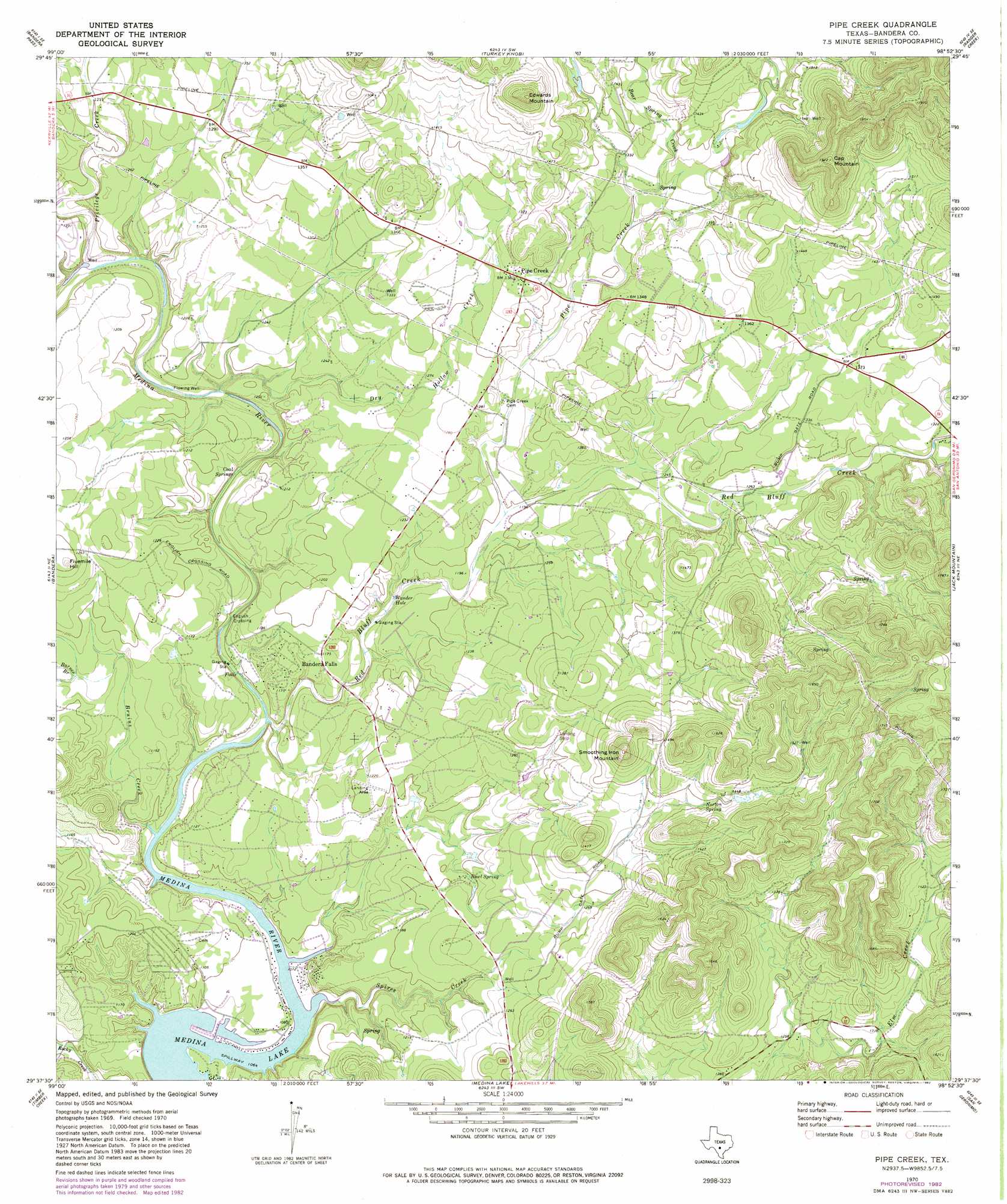
USGS Topo Quad 29098f8 - 1:24,000 scale
| Topo Map Name: | Pipe Creek |
| USGS Topo Quad ID: | 29098f8 |
| Print Size: | ca. 21 1/4" wide x 27" high |
| Southeast Coordinates: | 29.625° N latitude / 98.875° W longitude |
| Map Center Coordinates: | 29.6875° N latitude / 98.9375° W longitude |
| U.S. State: | TX |
| Filename: | o29098f8.jpg |
| Download Map JPG Image: | Pipe Creek topo map 1:24,000 scale |
| Map Type: | Topographic |
| Topo Series: | 7.5´ |
| Map Scale: | 1:24,000 |
| Source of Map Images: | United States Geological Survey (USGS) |
| Alternate Map Versions: |
Pipe Creek TX 1970, updated 1973 Download PDF Buy paper map Pipe Creek TX 1970, updated 1982 Download PDF Buy paper map Pipe Creek TX 1970, updated 1982 Download PDF Buy paper map Pipe Creek TX 2010 Download PDF Buy paper map Pipe Creek TX 2013 Download PDF Buy paper map Pipe Creek TX 2016 Download PDF Buy paper map |
1:24,000 Topo Quads surrounding Pipe Creek
Fall Creek |
Center Point |
Comfort |
Waring |
Sisterdale |
Rock Cliff Reservoir |
Bandera Pass |
Turkey Knob |
Ranger Creek |
Boerne |
Tarpley Pass |
Bandera |
Pipe Creek |
Jack Mountain |
Van Raub |
Twin Hollow |
Timber Creek |
Medina Lake |
San Geronimo |
Helotes |
Mustang Valley |
Quihi |
Riomedina |
Lacoste Ne |
Culebra Hill |
> Back to 29098e1 at 1:100,000 scale
> Back to 29098a1 at 1:250,000 scale
> Back to U.S. Topo Maps home
Pipe Creek topo map: Gazetteer
Pipe Creek: Airports
Medina River Ranch Airport elevation 371m 1217′Taylors Saddle Mountain Ranch Airport elevation 367m 1204′
Pipe Creek: Lakes
Wonder Hole elevation 340m 1115′Pipe Creek: Populated Places
Bandera Falls elevation 358m 1174′English Crossing elevation 329m 1079′
Lakehills elevation 411m 1348′
Pipe Creek elevation 415m 1361′
Pipe Creek: Springs
Bowl Spring elevation 364m 1194′Coal Springs elevation 334m 1095′
Cold Springs elevation 390m 1279′
Norton Spring elevation 421m 1381′
Pipe Creek: Streams
Barnes Branch elevation 353m 1158′Bear Springs Creek elevation 394m 1292′
Bruins Creek elevation 324m 1062′
Dry Hollow Creek elevation 337m 1105′
Pipe Creek elevation 362m 1187′
Privilege Creek elevation 345m 1131′
Red Bluff Creek elevation 326m 1069′
Spires Creek elevation 325m 1066′
Pipe Creek: Summits
Cap Mountain elevation 585m 1919′Edwards Mountain elevation 550m 1804′
Fivemile Hill elevation 413m 1354′
Smoothing Iron Mountain elevation 517m 1696′
Pipe Creek digital topo map on disk
Buy this Pipe Creek topo map showing relief, roads, GPS coordinates and other geographical features, as a high-resolution digital map file on DVD: