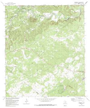
Wimberley Topo Map Texas
To zoom in, hover over the map of Wimberley
USGS Topo Quad 29098h1 - 1:24,000 scale
| Topo Map Name: | Wimberley |
| USGS Topo Quad ID: | 29098h1 |
| Print Size: | ca. 21 1/4" wide x 27" high |
| Southeast Coordinates: | 29.875° N latitude / 98° W longitude |
| Map Center Coordinates: | 29.9375° N latitude / 98.0625° W longitude |
| U.S. State: | TX |
| Filename: | o29098h1.jpg |
| Download Map JPG Image: | Wimberley topo map 1:24,000 scale |
| Map Type: | Topographic |
| Topo Series: | 7.5´ |
| Map Scale: | 1:24,000 |
| Source of Map Images: | United States Geological Survey (USGS) |
| Alternate Map Versions: |
Wimberley TX 1964, updated 1966 Download PDF Buy paper map Wimberley TX 1964, updated 1968 Download PDF Buy paper map Wimberley TX 1989, updated 1989 Download PDF Buy paper map Wimberley TX 2010 Download PDF Buy paper map Wimberley TX 2013 Download PDF Buy paper map Wimberley TX 2016 Download PDF Buy paper map |
1:24,000 Topo Quads surrounding Wimberley
> Back to 29098e1 at 1:100,000 scale
> Back to 29098a1 at 1:250,000 scale
> Back to U.S. Topo Maps home
Wimberley topo map: Gazetteer
Wimberley: Airports
Winn Ranch Airport elevation 329m 1079′Wimberley: Flats
Flight Acres elevation 249m 816′Wimberley: Parks
Baptist Academy San Marocs Football Field elevation 253m 830′Wimberley: Populated Places
Cloptins Crossing elevation 253m 830′Pioneer Town elevation 258m 846′
Wimberley elevation 262m 859′
Wimberley: Streams
Cypress Creek elevation 248m 813′Lone Man Creek elevation 221m 725′
Pierce Creek elevation 243m 797′
Spoke Pile Creek elevation 242m 793′
Sycamore Creek elevation 227m 744′
Wilson Creek elevation 249m 816′
Wimberley: Summits
Eagle Mountain elevation 305m 1000′Wimberley: Valleys
Heaton Hollow elevation 264m 866′Leath Hollow elevation 248m 813′
Wimberley digital topo map on disk
Buy this Wimberley topo map showing relief, roads, GPS coordinates and other geographical features, as a high-resolution digital map file on DVD:


