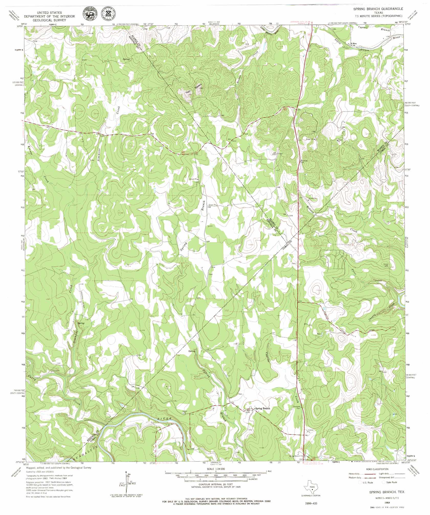
Spring Branch Topo Map Texas
To zoom in, hover over the map of Spring Branch
USGS Topo Quad 29098h4 - 1:24,000 scale
| Topo Map Name: | Spring Branch |
| USGS Topo Quad ID: | 29098h4 |
| Print Size: | ca. 21 1/4" wide x 27" high |
| Southeast Coordinates: | 29.875° N latitude / 98.375° W longitude |
| Map Center Coordinates: | 29.9375° N latitude / 98.4375° W longitude |
| U.S. State: | TX |
| Filename: | o29098h4.jpg |
| Download Map JPG Image: | Spring Branch topo map 1:24,000 scale |
| Map Type: | Topographic |
| Topo Series: | 7.5´ |
| Map Scale: | 1:24,000 |
| Source of Map Images: | United States Geological Survey (USGS) |
| Alternate Map Versions: |
Spring Branch TX 1964, updated 1967 Download PDF Buy paper map Spring Branch TX 1964, updated 1979 Download PDF Buy paper map Spring Branch TX 2010 Download PDF Buy paper map Spring Branch TX 2013 Download PDF Buy paper map Spring Branch TX 2016 Download PDF Buy paper map |
1:24,000 Topo Quads surrounding Spring Branch
Stonewall |
Hye |
Monument Hill |
Yeager Creek |
Henly |
Whitworth Ranch |
Crabapple Creek |
Blanco |
Payton |
Rough Hollow |
Sisterdale |
Kendalia |
Spring Branch |
Fischer |
Devils Backbone |
Boerne |
Bergheim |
Anhalt |
Smithson Valley |
Sattler |
Van Raub |
Camp Bullis |
Bulverde |
Bat Cave |
New Braunfels West |
> Back to 29098e1 at 1:100,000 scale
> Back to 29098a1 at 1:250,000 scale
> Back to U.S. Topo Maps home
Spring Branch topo map: Gazetteer
Spring Branch: Airports
Double U Ranch Airport elevation 352m 1154′Spring Branch: Dams
Shaeferkoeter Dam 2 elevation 369m 1210′Spring Branch: Populated Places
Spring Branch elevation 340m 1115′Spring Branch: Post Offices
Spring Branch Post Office elevation 313m 1026′Spring Branch: Reservoirs
Shaeferkoeter Lake 2 elevation 369m 1210′Spring Branch: Springs
Spring Branch Springs elevation 376m 1233′Spring Branch: Streams
Cherry Creek elevation 308m 1010′Curry Creek elevation 304m 997′
Krause Creek elevation 372m 1220′
Puter Creek elevation 308m 1010′
Rochou Creek elevation 390m 1279′
Simmons Creek elevation 316m 1036′
Spring Branch: Summits
Twin Sisters elevation 537m 1761′Spring Branch digital topo map on disk
Buy this Spring Branch topo map showing relief, roads, GPS coordinates and other geographical features, as a high-resolution digital map file on DVD: