Sisterdale Topo Map Texas
To zoom in, hover over the map of Sisterdale
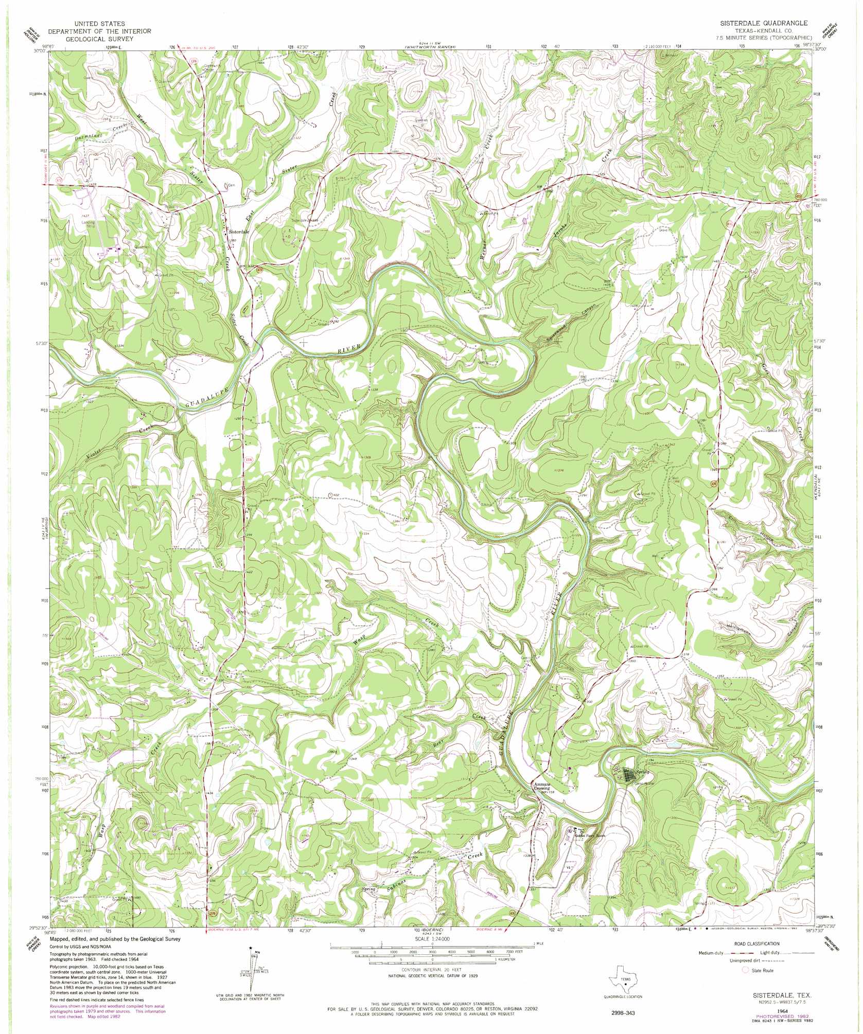
USGS Topo Quad 29098h6 - 1:24,000 scale
| Topo Map Name: | Sisterdale |
| USGS Topo Quad ID: | 29098h6 |
| Print Size: | ca. 21 1/4" wide x 27" high |
| Southeast Coordinates: | 29.875° N latitude / 98.625° W longitude |
| Map Center Coordinates: | 29.9375° N latitude / 98.6875° W longitude |
| U.S. State: | TX |
| Filename: | o29098h6.jpg |
| Download Map JPG Image: | Sisterdale topo map 1:24,000 scale |
| Map Type: | Topographic |
| Topo Series: | 7.5´ |
| Map Scale: | 1:24,000 |
| Source of Map Images: | United States Geological Survey (USGS) |
| Alternate Map Versions: |
Sisterdale TX 1964, updated 1967 Download PDF Buy paper map Sisterdale TX 1964, updated 1982 Download PDF Buy paper map Sisterdale TX 2010 Download PDF Buy paper map Sisterdale TX 2013 Download PDF Buy paper map Sisterdale TX 2016 Download PDF Buy paper map |
1:24,000 Topo Quads surrounding Sisterdale
Oak Crest Park |
Cain City |
Stonewall |
Hye |
Monument Hill |
Cypress Creek |
Rafter Hollow |
Whitworth Ranch |
Crabapple Creek |
Blanco |
Comfort |
Waring |
Sisterdale |
Kendalia |
Spring Branch |
Turkey Knob |
Ranger Creek |
Boerne |
Bergheim |
Anhalt |
Pipe Creek |
Jack Mountain |
Van Raub |
Camp Bullis |
Bulverde |
> Back to 29098e1 at 1:100,000 scale
> Back to 29098a1 at 1:250,000 scale
> Back to U.S. Topo Maps home
Sisterdale topo map: Gazetteer
Sisterdale: Airports
B J McCombs Sisterdale Airport elevation 436m 1430′Sisterdale: Populated Places
Ammans Crossing elevation 362m 1187′Sisterdale elevation 390m 1279′
Sisterdale: Post Offices
Sisterdale Post Office elevation 391m 1282′Sisterdale: Streams
Bear Creek elevation 354m 1161′Darmstadt Creek elevation 396m 1299′
East Sister Creek elevation 384m 1259′
Jacobs Creek elevation 377m 1236′
Sabinas Creek elevation 354m 1161′
Sister Creek elevation 378m 1240′
Violet Creek elevation 378m 1240′
Wasp Creek elevation 354m 1161′
Werner Creek elevation 373m 1223′
West Sister Creek elevation 384m 1259′
Sisterdale: Valleys
Elm Hollow elevation 355m 1164′Spicewood Canyon elevation 398m 1305′
Sisterdale digital topo map on disk
Buy this Sisterdale topo map showing relief, roads, GPS coordinates and other geographical features, as a high-resolution digital map file on DVD: