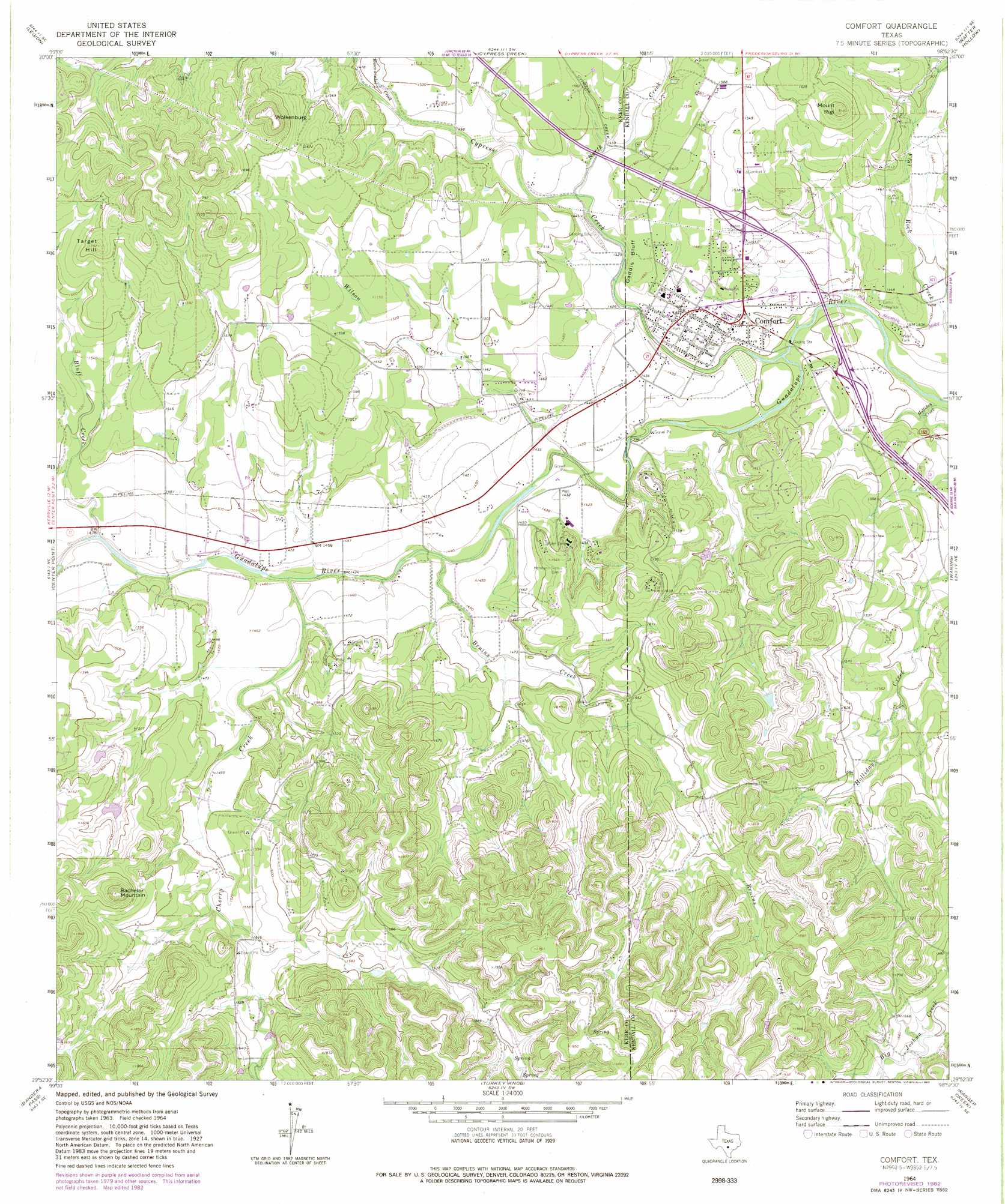
Comfort Topo Map Texas
To zoom in, hover over the map of Comfort
USGS Topo Quad 29098h8 - 1:24,000 scale
| Topo Map Name: | Comfort |
| USGS Topo Quad ID: | 29098h8 |
| Print Size: | ca. 21 1/4" wide x 27" high |
| Southeast Coordinates: | 29.875° N latitude / 98.875° W longitude |
| Map Center Coordinates: | 29.9375° N latitude / 98.9375° W longitude |
| U.S. State: | TX |
| Filename: | o29098h8.jpg |
| Download Map JPG Image: | Comfort topo map 1:24,000 scale |
| Map Type: | Topographic |
| Topo Series: | 7.5´ |
| Map Scale: | 1:24,000 |
| Source of Map Images: | United States Geological Survey (USGS) |
| Alternate Map Versions: |
Comfort TX 1964, updated 1966 Download PDF Buy paper map Comfort TX 1964, updated 1982 Download PDF Buy paper map Comfort TX 2010 Download PDF Buy paper map Comfort TX 2013 Download PDF Buy paper map Comfort TX 2016 Download PDF Buy paper map |
1:24,000 Topo Quads surrounding Comfort
Nott Branch |
Morris Ranch |
Oak Crest Park |
Cain City |
Stonewall |
Kerrville |
Legion |
Cypress Creek |
Rafter Hollow |
Whitworth Ranch |
Fall Creek |
Center Point |
Comfort |
Waring |
Sisterdale |
Rock Cliff Reservoir |
Bandera Pass |
Turkey Knob |
Ranger Creek |
Boerne |
Tarpley Pass |
Bandera |
Pipe Creek |
Jack Mountain |
Van Raub |
> Back to 29098e1 at 1:100,000 scale
> Back to 29098a1 at 1:250,000 scale
> Back to U.S. Topo Maps home
Comfort topo map: Gazetteer
Comfort: Airports
Comfort Airpark elevation 446m 1463′Comfort: Cliffs
Gaddis Bluff elevation 452m 1482′Comfort: Parks
Treue Der Union Monument elevation 438m 1437′Comfort: Populated Places
Comfort elevation 435m 1427′Comfort: Streams
Bluff Creek elevation 438m 1437′Bruins Creek elevation 433m 1420′
Cherry Creek elevation 434m 1423′
Cypress Creek elevation 421m 1381′
Hasenwinkel Creek elevation 448m 1469′
North Creek elevation 435m 1427′
Wilson Creek elevation 433m 1420′
Comfort: Summits
Bachelor Mountain elevation 578m 1896′Mount Rigi elevation 541m 1774′
Target Hill elevation 544m 1784′
Wolkenburg elevation 589m 1932′
Comfort digital topo map on disk
Buy this Comfort topo map showing relief, roads, GPS coordinates and other geographical features, as a high-resolution digital map file on DVD: