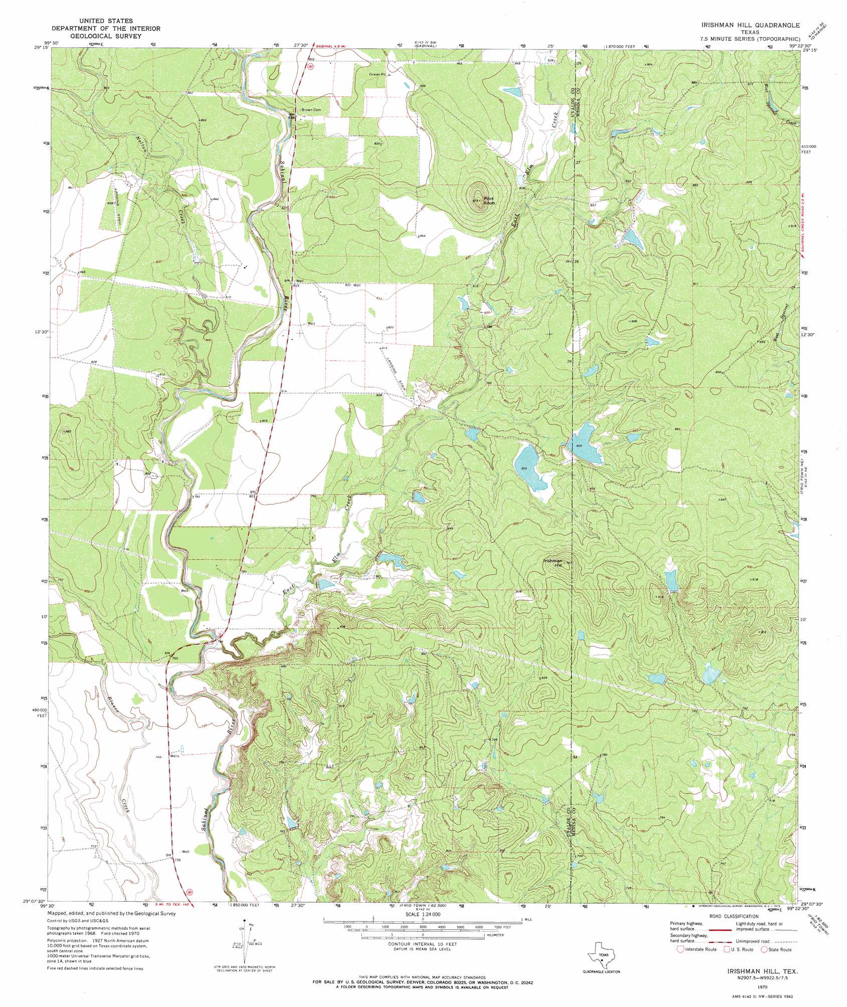
Irishman Hill Topo Map Texas
To zoom in, hover over the map of Irishman Hill
USGS Topo Quad 29099b4 - 1:24,000 scale
| Topo Map Name: | Irishman Hill |
| USGS Topo Quad ID: | 29099b4 |
| Print Size: | ca. 21 1/4" wide x 27" high |
| Southeast Coordinates: | 29.125° N latitude / 99.375° W longitude |
| Map Center Coordinates: | 29.1875° N latitude / 99.4375° W longitude |
| U.S. State: | TX |
| Filename: | o29099b4.jpg |
| Download Map JPG Image: | Irishman Hill topo map 1:24,000 scale |
| Map Type: | Topographic |
| Topo Series: | 7.5´ |
| Map Scale: | 1:24,000 |
| Source of Map Images: | United States Geological Survey (USGS) |
| Alternate Map Versions: |
Irishman Hill TX 1970, updated 1973 Download PDF Buy paper map Irishman Hill TX 2010 Download PDF Buy paper map Irishman Hill TX 2013 Download PDF Buy paper map Irishman Hill TX 2016 Download PDF Buy paper map |
1:24,000 Topo Quads surrounding Irishman Hill
Concan |
Trio |
Comanche Waterhole |
Sabinal Ne |
Mustang Valley |
Knippa |
Blanco Lake |
Sabinal |
D'Hanis |
Hondo |
Garner Field |
Garner Field Ne |
Irishman Hill |
Frio Town Ne |
Yancey |
Batesville Hill |
Lone Tree Hill |
Gross Tank |
Frio Town |
Wilson Ranch |
Batesville Nw |
Batesville |
Johnnie Little Hill |
Holcomb Reservoir |
Halff Ranch |
> Back to 29099a1 at 1:100,000 scale
> Back to 29098a1 at 1:250,000 scale
> Back to U.S. Topo Maps home
Irishman Hill topo map: Gazetteer
Irishman Hill: Dams
Nunley Lake Number 1 Dam elevation 243m 797′Nunley Lake Number 2 Dam elevation 247m 810′
Rehm Lake Dam elevation 243m 797′
Texas No Name Number 3 Dam elevation 261m 856′
Texas No Name Number 4 Dam elevation 261m 856′
Irishman Hill: Reservoirs
Nunley Lake Number 1 elevation 243m 797′Nunley Lake Number 2 elevation 247m 810′
Rehm Lake elevation 243m 797′
Irishman Hill: Streams
East Elm Creek elevation 224m 734′Nolton Creek elevation 233m 764′
Irishman Hill: Summits
Irishman Hill elevation 291m 954′Pilot Knob elevation 294m 964′
Irishman Hill digital topo map on disk
Buy this Irishman Hill topo map showing relief, roads, GPS coordinates and other geographical features, as a high-resolution digital map file on DVD: