Blanco Lake Topo Map Texas
To zoom in, hover over the map of Blanco Lake
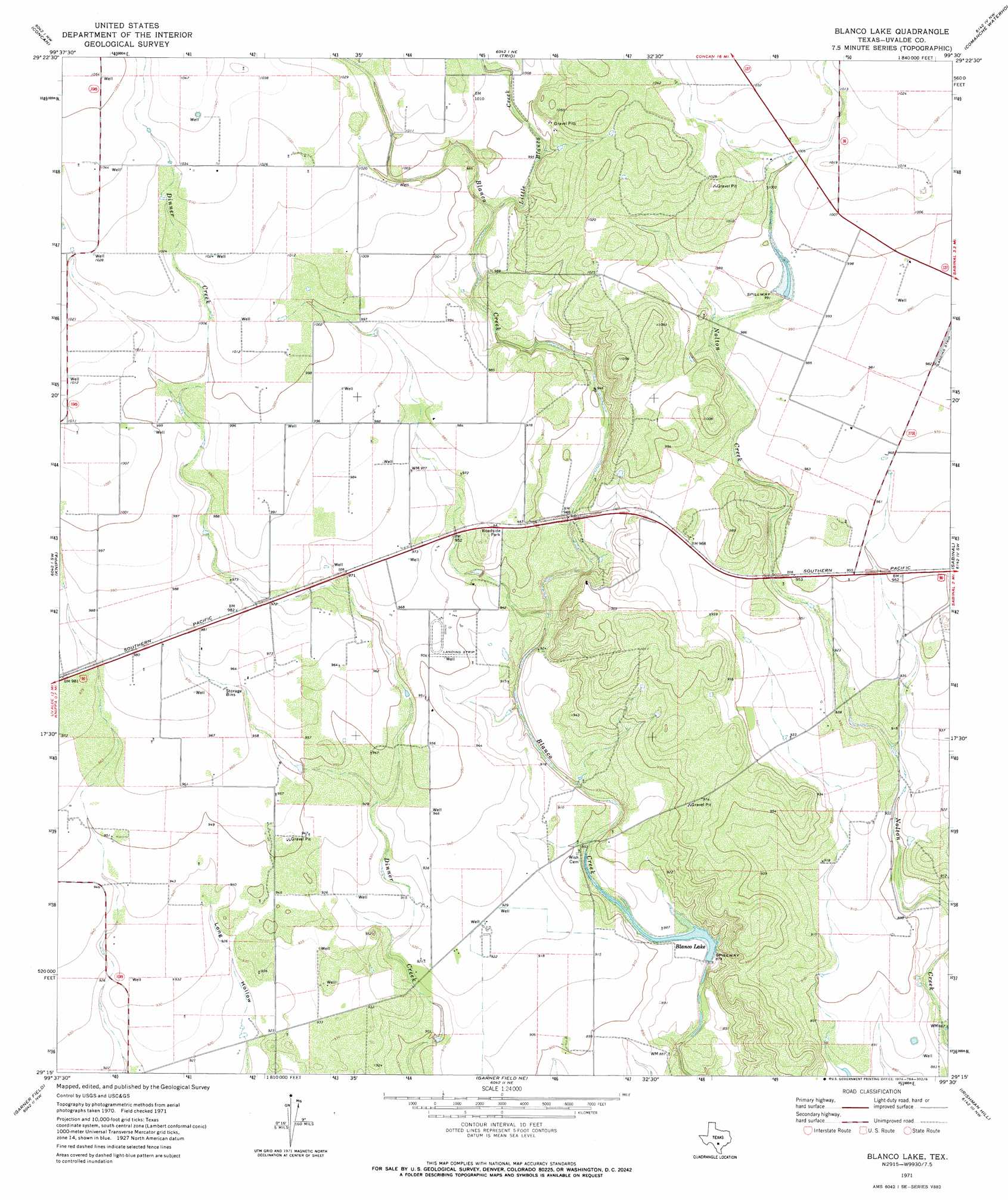
USGS Topo Quad 29099c5 - 1:24,000 scale
| Topo Map Name: | Blanco Lake |
| USGS Topo Quad ID: | 29099c5 |
| Print Size: | ca. 21 1/4" wide x 27" high |
| Southeast Coordinates: | 29.25° N latitude / 99.5° W longitude |
| Map Center Coordinates: | 29.3125° N latitude / 99.5625° W longitude |
| U.S. State: | TX |
| Filename: | o29099c5.jpg |
| Download Map JPG Image: | Blanco Lake topo map 1:24,000 scale |
| Map Type: | Topographic |
| Topo Series: | 7.5´ |
| Map Scale: | 1:24,000 |
| Source of Map Images: | United States Geological Survey (USGS) |
| Alternate Map Versions: |
Blanco Lake TX 1971, updated 1974 Download PDF Buy paper map Blanco Lake TX 2010 Download PDF Buy paper map Blanco Lake TX 2012 Download PDF Buy paper map Blanco Lake TX 2016 Download PDF Buy paper map |
1:24,000 Topo Quads surrounding Blanco Lake
Reagan Wells |
Magers Crossing |
Utopia |
Flatrock Crossing |
Texas Mountain |
Deep Creek |
Concan |
Trio |
Comanche Waterhole |
Sabinal Ne |
Sevenmile Hill |
Knippa |
Blanco Lake |
Sabinal |
D'Hanis |
Uvalde |
Garner Field |
Garner Field Ne |
Irishman Hill |
Frio Town Ne |
Pulliam Ranch |
Batesville Hill |
Lone Tree Hill |
Gross Tank |
Frio Town |
> Back to 29099a1 at 1:100,000 scale
> Back to 29098a1 at 1:250,000 scale
> Back to U.S. Topo Maps home
Blanco Lake topo map: Gazetteer
Blanco Lake: Dams
Reagan Dam elevation 266m 872′Blanco Lake: Reservoirs
Blanco Lake elevation 268m 879′Blanco Lake: Streams
Little Blanco Creek elevation 300m 984′Blanco Lake digital topo map on disk
Buy this Blanco Lake topo map showing relief, roads, GPS coordinates and other geographical features, as a high-resolution digital map file on DVD: