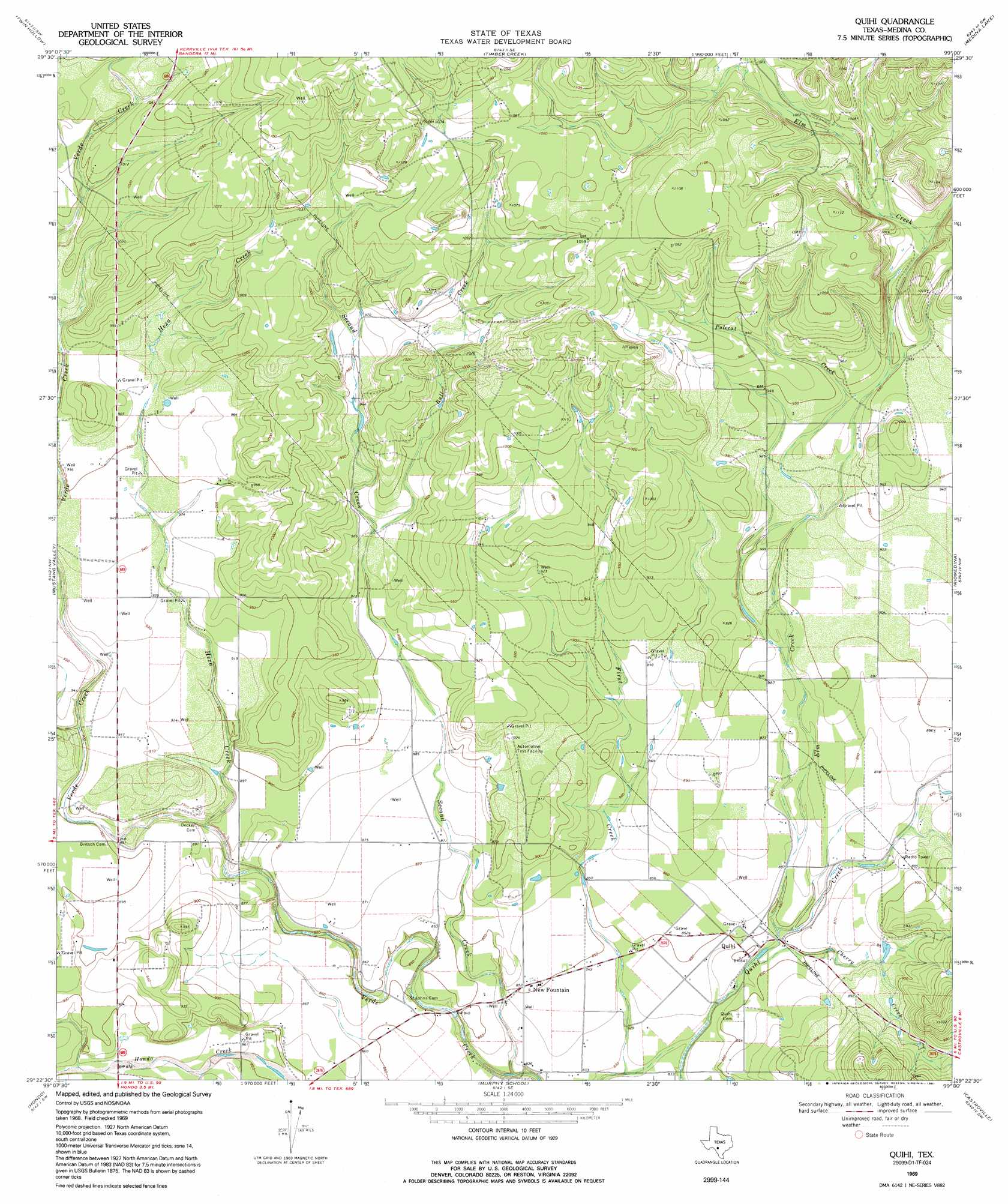
Quihi Topo Map Texas
To zoom in, hover over the map of Quihi
USGS Topo Quad 29099d1 - 1:24,000 scale
| Topo Map Name: | Quihi |
| USGS Topo Quad ID: | 29099d1 |
| Print Size: | ca. 21 1/4" wide x 27" high |
| Southeast Coordinates: | 29.375° N latitude / 99° W longitude |
| Map Center Coordinates: | 29.4375° N latitude / 99.0625° W longitude |
| U.S. State: | TX |
| Filename: | o29099d1.jpg |
| Download Map JPG Image: | Quihi topo map 1:24,000 scale |
| Map Type: | Topographic |
| Topo Series: | 7.5´ |
| Map Scale: | 1:24,000 |
| Source of Map Images: | United States Geological Survey (USGS) |
| Alternate Map Versions: |
Quihi TX 1969, updated 1972 Download PDF Buy paper map Quihi TX 1969, updated 1991 Download PDF Buy paper map Quihi TX 2010 Download PDF Buy paper map Quihi TX 2013 Download PDF Buy paper map Quihi TX 2016 Download PDF Buy paper map |
1:24,000 Topo Quads surrounding Quihi
Tarpley |
Tarpley Pass |
Bandera |
Pipe Creek |
Jack Mountain |
Texas Mountain |
Twin Hollow |
Timber Creek |
Medina Lake |
San Geronimo |
Sabinal Ne |
Mustang Valley |
Quihi |
Riomedina |
Lacoste Ne |
D'Hanis |
Hondo |
Murphy School |
Castroville |
Lacoste |
Frio Town Ne |
Yancey |
Biry |
Devine |
Lytle |
> Back to 29099a1 at 1:100,000 scale
> Back to 29098a1 at 1:250,000 scale
> Back to U.S. Topo Maps home
Quihi topo map: Gazetteer
Quihi: Populated Places
New Fountain elevation 260m 853′Quihi elevation 257m 843′
Quihi: Streams
Bull Creek elevation 277m 908′Cherry Creek elevation 256m 839′
Elm Creek elevation 256m 839′
Hexa Creek elevation 261m 856′
Main Quihi Creek elevation 299m 980′
Polecat Creek elevation 277m 908′
Second Creek elevation 247m 810′
Quihi digital topo map on disk
Buy this Quihi topo map showing relief, roads, GPS coordinates and other geographical features, as a high-resolution digital map file on DVD: