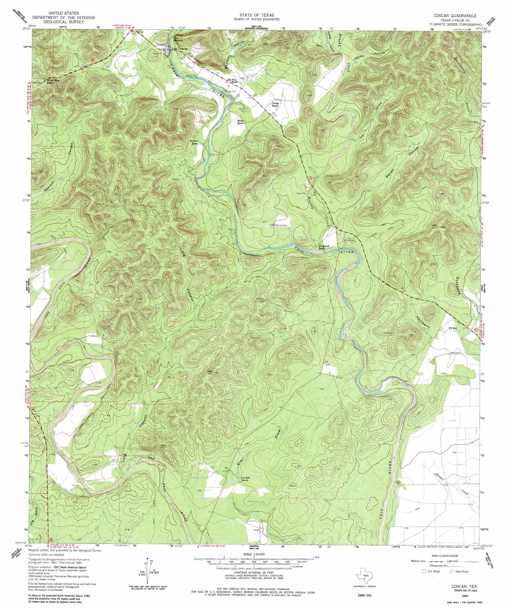
Concan Topo Map Texas
To zoom in, hover over the map of Concan
USGS Topo Quad 29099d6 - 1:24,000 scale
| Topo Map Name: | Concan |
| USGS Topo Quad ID: | 29099d6 |
| Print Size: | ca. 21 1/4" wide x 27" high |
| Southeast Coordinates: | 29.375° N latitude / 99.625° W longitude |
| Map Center Coordinates: | 29.4375° N latitude / 99.6875° W longitude |
| U.S. State: | TX |
| Filename: | o29099d6.jpg |
| Download Map JPG Image: | Concan topo map 1:24,000 scale |
| Map Type: | Topographic |
| Topo Series: | 7.5´ |
| Map Scale: | 1:24,000 |
| Source of Map Images: | United States Geological Survey (USGS) |
| Alternate Map Versions: |
Concan TX 1960, updated 1962 Download PDF Buy paper map Concan TX 1960, updated 1984 Download PDF Buy paper map Concan TX 2010 Download PDF Buy paper map Concan TX 2012 Download PDF Buy paper map Concan TX 2016 Download PDF Buy paper map |
1:24,000 Topo Quads surrounding Concan
Crown Mountain |
Leakey |
Rio Frio |
Vanderpool |
Seco Pass |
Lake Creek |
Reagan Wells |
Magers Crossing |
Utopia |
Flatrock Crossing |
Sycamore Mountain |
Deep Creek |
Concan |
Trio |
Comanche Waterhole |
Chalk Bluff |
Sevenmile Hill |
Knippa |
Blanco Lake |
Sabinal |
Hacienda |
Uvalde |
Garner Field |
Garner Field Ne |
Irishman Hill |
> Back to 29099a1 at 1:100,000 scale
> Back to 29098a1 at 1:250,000 scale
> Back to U.S. Topo Maps home
Concan topo map: Gazetteer
Concan: Airports
Annandale Ranch Airport elevation 366m 1200′Concan: Gaps
Silver Mine Pass elevation 439m 1440′Concan: Populated Places
Concan elevation 382m 1253′First Crossing elevation 375m 1230′
Concan: Streams
Brushy Creek elevation 344m 1128′Deep Creek elevation 365m 1197′
Concan: Summits
The Shut-In elevation 412m 1351′Concan: Valleys
Baylock Hollow elevation 377m 1236′Hackberry Draw elevation 339m 1112′
Jones Hollow elevation 409m 1341′
Long Canyon elevation 339m 1112′
Pear Hollow elevation 384m 1259′
Pecan Hollow elevation 366m 1200′
Van Pelt Hollow elevation 411m 1348′
Concan digital topo map on disk
Buy this Concan topo map showing relief, roads, GPS coordinates and other geographical features, as a high-resolution digital map file on DVD: