Sycamore Mountain Topo Map Texas
To zoom in, hover over the map of Sycamore Mountain
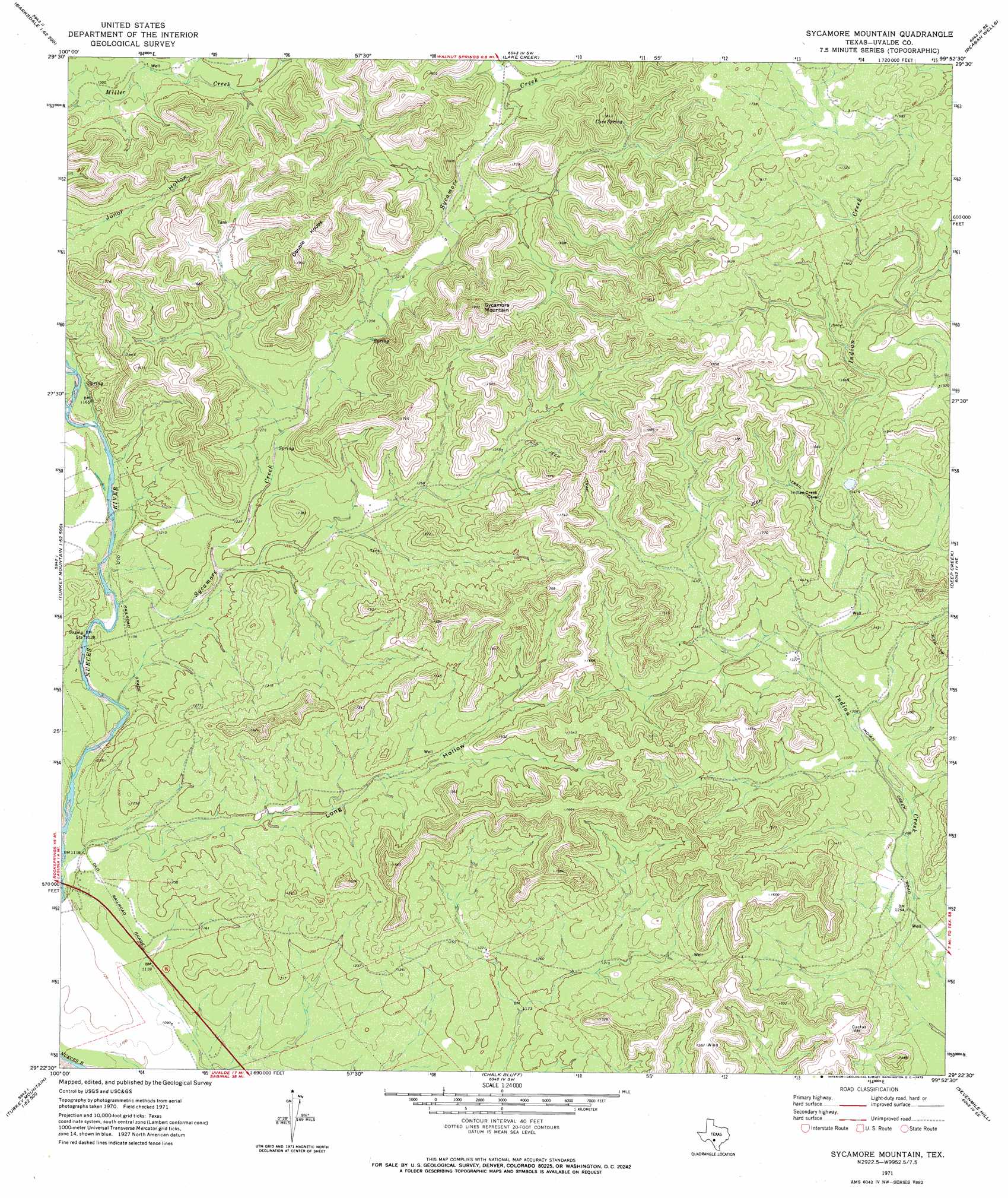
USGS Topo Quad 29099d8 - 1:24,000 scale
| Topo Map Name: | Sycamore Mountain |
| USGS Topo Quad ID: | 29099d8 |
| Print Size: | ca. 21 1/4" wide x 27" high |
| Southeast Coordinates: | 29.375° N latitude / 99.875° W longitude |
| Map Center Coordinates: | 29.4375° N latitude / 99.9375° W longitude |
| U.S. State: | TX |
| Filename: | o29099d8.jpg |
| Download Map JPG Image: | Sycamore Mountain topo map 1:24,000 scale |
| Map Type: | Topographic |
| Topo Series: | 7.5´ |
| Map Scale: | 1:24,000 |
| Source of Map Images: | United States Geological Survey (USGS) |
| Alternate Map Versions: |
Sycamore Mountain TX 1971, updated 1973 Download PDF Buy paper map Sycamore Mountain TX 2010 Download PDF Buy paper map Sycamore Mountain TX 2013 Download PDF Buy paper map Sycamore Mountain TX 2016 Download PDF Buy paper map |
1:24,000 Topo Quads surrounding Sycamore Mountain
Kelley Peak |
Camp Wood |
Crown Mountain |
Leakey |
Rio Frio |
Bull Waterhole |
Montell |
Lake Creek |
Reagan Wells |
Magers Crossing |
Salmon Peak |
Laguna |
Sycamore Mountain |
Deep Creek |
Concan |
Turkey Mountain |
Mustang Waterhole |
Chalk Bluff |
Sevenmile Hill |
Knippa |
Odlaw |
Cline |
Hacienda |
Uvalde |
Garner Field |
> Back to 29099a1 at 1:100,000 scale
> Back to 29098a1 at 1:250,000 scale
> Back to U.S. Topo Maps home
Sycamore Mountain topo map: Gazetteer
Sycamore Mountain: Springs
Cave Spring elevation 470m 1541′Sycamore Mountain: Streams
Miller Creek elevation 354m 1161′Sycamore Creek elevation 347m 1138′
Sycamore Mountain: Summits
Double Knobs elevation 572m 1876′Sycamore Mountain elevation 562m 1843′
Sycamore Mountain: Valleys
Long Hollow elevation 350m 1148′Sycamore Mountain digital topo map on disk
Buy this Sycamore Mountain topo map showing relief, roads, GPS coordinates and other geographical features, as a high-resolution digital map file on DVD: