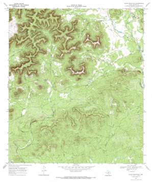
Texas Mountain Topo Map Texas
To zoom in, hover over the map of Texas Mountain
USGS Topo Quad 29099e3 - 1:24,000 scale
| Topo Map Name: | Texas Mountain |
| USGS Topo Quad ID: | 29099e3 |
| Print Size: | ca. 21 1/4" wide x 27" high |
| Southeast Coordinates: | 29.5° N latitude / 99.25° W longitude |
| Map Center Coordinates: | 29.5625° N latitude / 99.3125° W longitude |
| U.S. State: | TX |
| Filename: | o29099e3.jpg |
| Download Map JPG Image: | Texas Mountain topo map 1:24,000 scale |
| Map Type: | Topographic |
| Topo Series: | 7.5´ |
| Map Scale: | 1:24,000 |
| Source of Map Images: | United States Geological Survey (USGS) |
| Alternate Map Versions: |
Texas Mountain TX 1969, updated 1972 Download PDF Buy paper map Texas Mountain TX 2010 Download PDF Buy paper map Texas Mountain TX 2013 Download PDF Buy paper map Texas Mountain TX 2016 Download PDF Buy paper map |
1:24,000 Topo Quads surrounding Texas Mountain
> Back to 29099e1 at 1:100,000 scale
> Back to 29098a1 at 1:250,000 scale
> Back to U.S. Topo Maps home
Texas Mountain topo map: Gazetteer
Texas Mountain: Cliffs
Eagle Bluff elevation 366m 1200′Texas Mountain: Lakes
Blue Waterhole elevation 372m 1220′Texas Mountain: Springs
Bear Spring elevation 423m 1387′Twin Springs elevation 438m 1437′
Yellow Spring elevation 469m 1538′
Texas Mountain: Streams
Bandera Creek elevation 366m 1200′Bear Spring Creek elevation 365m 1197′
Springs Creek elevation 401m 1315′
Wards Creek elevation 368m 1207′
Texas Mountain: Summits
Round Mountain elevation 546m 1791′Saathoff Mountain elevation 601m 1971′
Split Mountain elevation 547m 1794′
Texas Mountain elevation 596m 1955′
Texas Mountain: Valleys
Deadman Hollow elevation 403m 1322′Hay Hollow elevation 418m 1371′
Ney Hollow elevation 414m 1358′
Texas Mountain digital topo map on disk
Buy this Texas Mountain topo map showing relief, roads, GPS coordinates and other geographical features, as a high-resolution digital map file on DVD:


