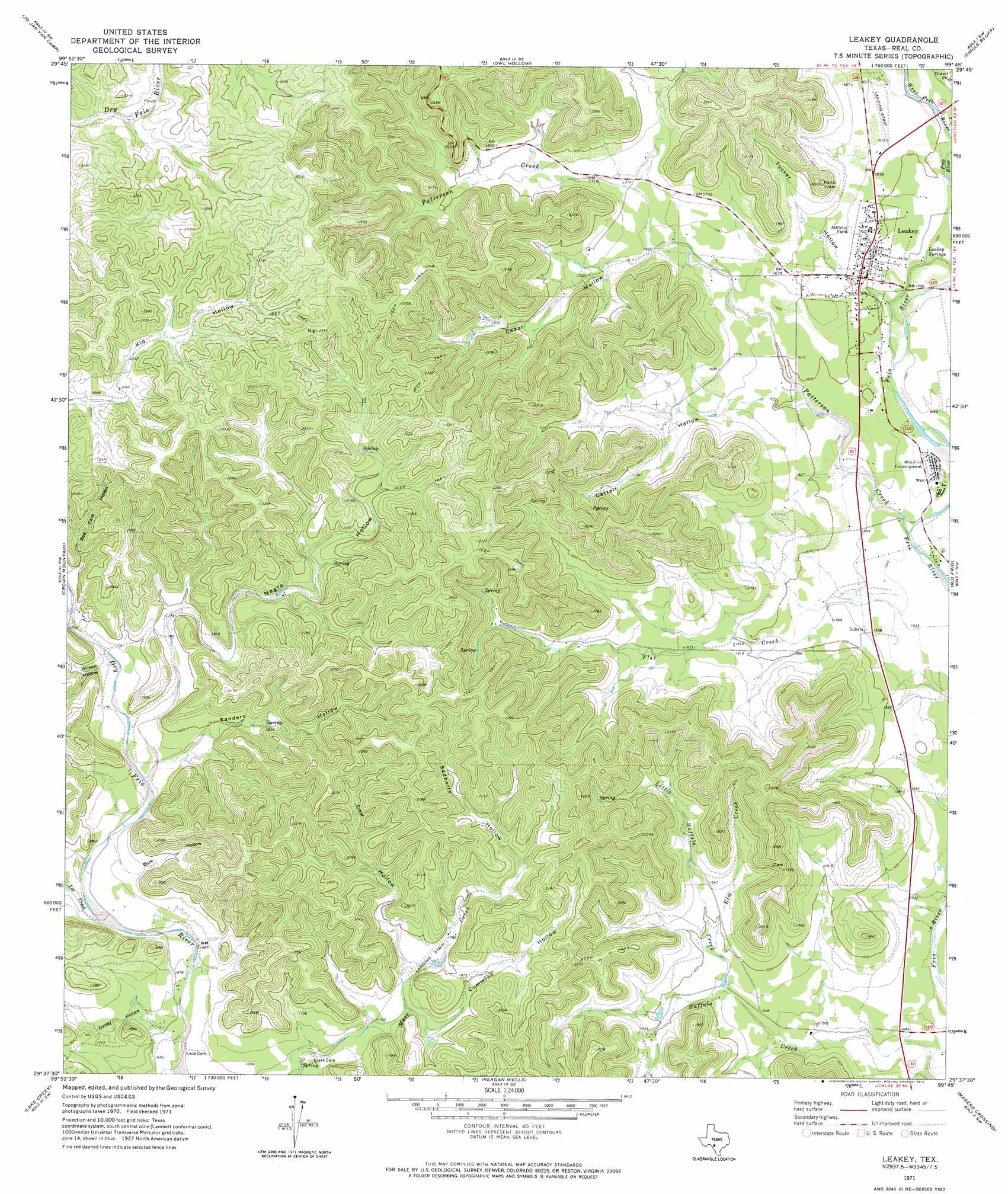
Leakey Topo Map Texas
To zoom in, hover over the map of Leakey
USGS Topo Quad 29099f7 - 1:24,000 scale
| Topo Map Name: | Leakey |
| USGS Topo Quad ID: | 29099f7 |
| Print Size: | ca. 21 1/4" wide x 27" high |
| Southeast Coordinates: | 29.625° N latitude / 99.75° W longitude |
| Map Center Coordinates: | 29.6875° N latitude / 99.8125° W longitude |
| U.S. State: | TX |
| Filename: | o29099f7.jpg |
| Download Map JPG Image: | Leakey topo map 1:24,000 scale |
| Map Type: | Topographic |
| Topo Series: | 7.5´ |
| Map Scale: | 1:24,000 |
| Source of Map Images: | United States Geological Survey (USGS) |
| Alternate Map Versions: |
Leakey TX 1971, updated 1974 Download PDF Buy paper map Leakey TX 2010 Download PDF Buy paper map Leakey TX 2012 Download PDF Buy paper map Leakey TX 2016 Download PDF Buy paper map |
1:24,000 Topo Quads surrounding Leakey
Hackberry |
Joy Hollow |
Bee Cave Hollow |
Hillcrest Ranch |
Well Hollow |
Vance |
Jo Jan Van Camp |
Owl Hollow |
Circle Bluff |
Sabinal Canyon |
Camp Wood |
Crown Mountain |
Leakey |
Rio Frio |
Vanderpool |
Montell |
Lake Creek |
Reagan Wells |
Magers Crossing |
Utopia |
Laguna |
Sycamore Mountain |
Deep Creek |
Concan |
Trio |
> Back to 29099e1 at 1:100,000 scale
> Back to 29098a1 at 1:250,000 scale
> Back to U.S. Topo Maps home
Leakey topo map: Gazetteer
Leakey: Airports
Real County Airport elevation 497m 1630′Leakey: Dams
Big Lake Dam elevation 677m 2221′Leakey: Populated Places
Leakey elevation 489m 1604′Leakey: Reservoirs
Big Lake elevation 677m 2221′Leakey: Springs
Leakey Springs elevation 481m 1578′Spring Branch Springs elevation 487m 1597′
Leakey: Streams
Buffalo Creek elevation 439m 1440′Elm Creek elevation 473m 1551′
Lee Creek elevation 511m 1676′
Little Buffalo Creek elevation 476m 1561′
Patterson Creek elevation 463m 1519′
Leakey: Valleys
Bee Cave Hollow elevation 545m 1788′Buck Hollow elevation 530m 1738′
Cattail Hollow elevation 498m 1633′
Cedar Hollow elevation 511m 1676′
Cow Hollow elevation 536m 1758′
Cummins Hollow elevation 536m 1758′
Daliby Hollow elevation 504m 1653′
Negro Hollow elevation 528m 1732′
Sanders Hollow elevation 531m 1742′
Sedberry Hollow elevation 579m 1899′
Tucker Hollow elevation 490m 1607′
Wilson Hollow elevation 534m 1751′
Leakey digital topo map on disk
Buy this Leakey topo map showing relief, roads, GPS coordinates and other geographical features, as a high-resolution digital map file on DVD: