Crown Mountain Topo Map Texas
To zoom in, hover over the map of Crown Mountain
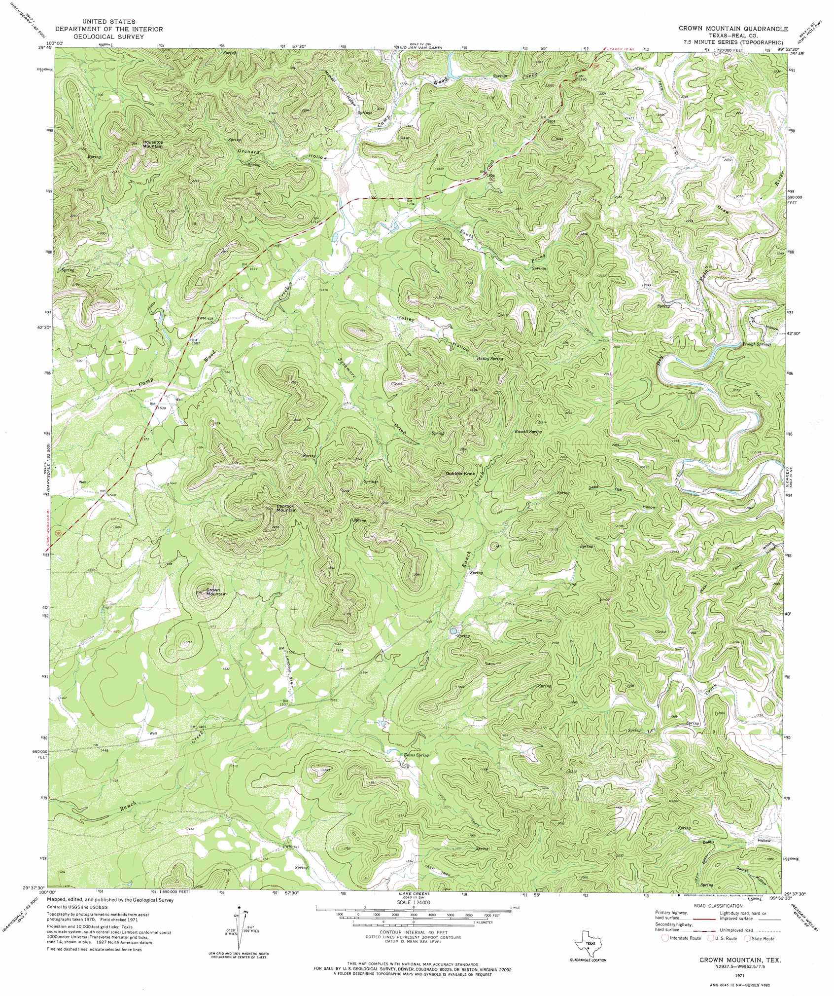
USGS Topo Quad 29099f8 - 1:24,000 scale
| Topo Map Name: | Crown Mountain |
| USGS Topo Quad ID: | 29099f8 |
| Print Size: | ca. 21 1/4" wide x 27" high |
| Southeast Coordinates: | 29.625° N latitude / 99.875° W longitude |
| Map Center Coordinates: | 29.6875° N latitude / 99.9375° W longitude |
| U.S. State: | TX |
| Filename: | o29099f8.jpg |
| Download Map JPG Image: | Crown Mountain topo map 1:24,000 scale |
| Map Type: | Topographic |
| Topo Series: | 7.5´ |
| Map Scale: | 1:24,000 |
| Source of Map Images: | United States Geological Survey (USGS) |
| Alternate Map Versions: |
Crown Mountain TX 1971, updated 1974 Download PDF Buy paper map Crown Mountain TX 2010 Download PDF Buy paper map Crown Mountain TX 2012 Download PDF Buy paper map Crown Mountain TX 2016 Download PDF Buy paper map |
1:24,000 Topo Quads surrounding Crown Mountain
Cub Lake |
Hackberry |
Joy Hollow |
Bee Cave Hollow |
Hillcrest Ranch |
Half Moon Prairie |
Vance |
Jo Jan Van Camp |
Owl Hollow |
Circle Bluff |
Kelley Peak |
Camp Wood |
Crown Mountain |
Leakey |
Rio Frio |
Bull Waterhole |
Montell |
Lake Creek |
Reagan Wells |
Magers Crossing |
Salmon Peak |
Laguna |
Sycamore Mountain |
Deep Creek |
Concan |
> Back to 29099e1 at 1:100,000 scale
> Back to 29098a1 at 1:250,000 scale
> Back to U.S. Topo Maps home
Crown Mountain topo map: Gazetteer
Crown Mountain: Springs
Eads Springs elevation 533m 1748′Evans Spring elevation 487m 1597′
Russell Spring elevation 569m 1866′
Trough Springs elevation 581m 1906′
Crown Mountain: Streams
South Camp Wood Creek elevation 507m 1663′Sycamore Creek elevation 487m 1597′
Crown Mountain: Summits
Caprock Mountain elevation 695m 2280′Crown Mountain elevation 617m 2024′
Gobbler Knob elevation 670m 2198′
Housetop Mountain elevation 707m 2319′
Crown Mountain: Valleys
Devils Canyon elevation 556m 1824′Hatley Hollow elevation 495m 1624′
Kid Hollow elevation 590m 1935′
Michael Hollow elevation 528m 1732′
Orchard Hollow elevation 512m 1679′
Seed Tick Hollow elevation 555m 1820′
T-O Draw elevation 618m 2027′
Crown Mountain digital topo map on disk
Buy this Crown Mountain topo map showing relief, roads, GPS coordinates and other geographical features, as a high-resolution digital map file on DVD: