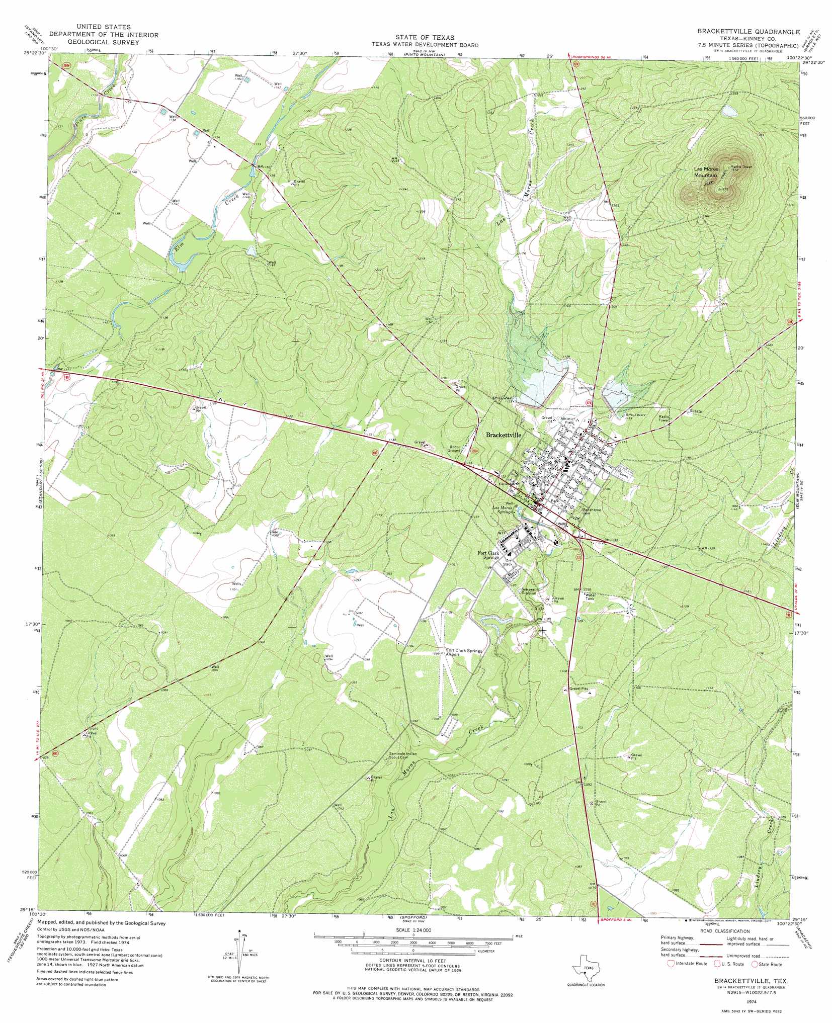
Brackettville Topo Map Texas
To zoom in, hover over the map of Brackettville
USGS Topo Quad 29100c4 - 1:24,000 scale
| Topo Map Name: | Brackettville |
| USGS Topo Quad ID: | 29100c4 |
| Print Size: | ca. 21 1/4" wide x 27" high |
| Southeast Coordinates: | 29.25° N latitude / 100.375° W longitude |
| Map Center Coordinates: | 29.3125° N latitude / 100.4375° W longitude |
| U.S. State: | TX |
| Filename: | o29100c4.jpg |
| Download Map JPG Image: | Brackettville topo map 1:24,000 scale |
| Map Type: | Topographic |
| Topo Series: | 7.5´ |
| Map Scale: | 1:24,000 |
| Source of Map Images: | United States Geological Survey (USGS) |
| Alternate Map Versions: |
Brackettville TX 1974, updated 1977 Download PDF Buy paper map Brackettville TX 2010 Download PDF Buy paper map Brackettville TX 2013 Download PDF Buy paper map Brackettville TX 2016 Download PDF Buy paper map |
1:24,000 Topo Quads surrounding Brackettville
Flat Rock Creek Sw |
Flat Rock Creek South |
Kickapoo Caverns |
Silver Lake |
Bull Waterhole |
Mud Creek North |
Mud Springs |
Pinto Mountain |
Brackettville Ne |
Salmon Peak |
Mud Creek South |
Standart |
Brackettville |
Elm Mountain |
Turkey Mountain |
Cow Creek Tank |
Tequesquite Creek Ne |
Spofford |
Anacacho |
Odlaw |
Tequesquite Creek Sw |
Tequesquite Spring |
Imperialist Tank |
Peloncillo Peak |
Goofy Lake |
> Back to 29100a1 at 1:100,000 scale
> Back to 29100a1 at 1:250,000 scale
> Back to U.S. Topo Maps home
Brackettville topo map: Gazetteer
Brackettville: Airports
Fort Clark Springs Airport elevation 335m 1099′Brackettville: Dams
Soil Conservation Service Site 1 Dam elevation 345m 1131′Soil Conservation Service Site 2 Dam elevation 349m 1145′
Brackettville: Populated Places
Brackettville elevation 337m 1105′Fort Clark Springs elevation 351m 1151′
Brackettville: Reservoirs
Soil Conservation Service Site 1 Reservoir elevation 345m 1131′Soil Conservation Service Site 2 Reservoir elevation 349m 1145′
Brackettville: Springs
Las Moras Spring elevation 339m 1112′Brackettville: Summits
Las Moras Mountain elevation 511m 1676′Brackettville digital topo map on disk
Buy this Brackettville topo map showing relief, roads, GPS coordinates and other geographical features, as a high-resolution digital map file on DVD: