Satan Canyon Topo Map Texas
To zoom in, hover over the map of Satan Canyon
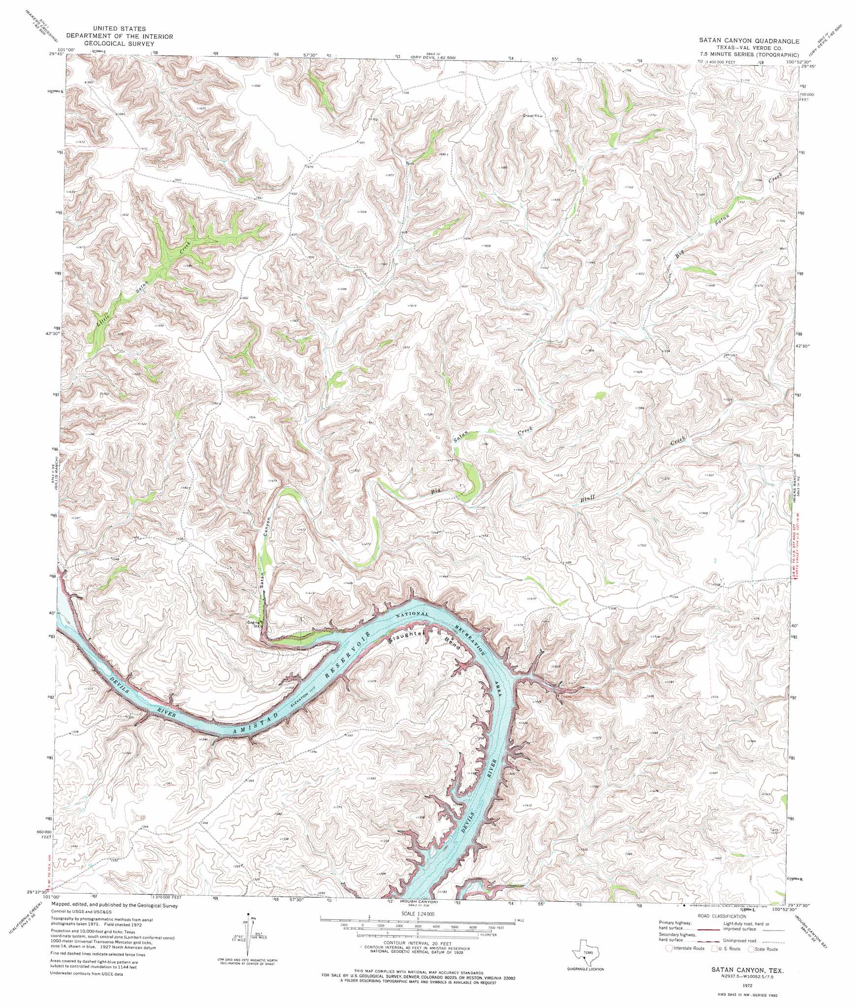
USGS Topo Quad 29100f8 - 1:24,000 scale
| Topo Map Name: | Satan Canyon |
| USGS Topo Quad ID: | 29100f8 |
| Print Size: | ca. 21 1/4" wide x 27" high |
| Southeast Coordinates: | 29.625° N latitude / 100.875° W longitude |
| Map Center Coordinates: | 29.6875° N latitude / 100.9375° W longitude |
| U.S. State: | TX |
| Filename: | o29100f8.jpg |
| Download Map JPG Image: | Satan Canyon topo map 1:24,000 scale |
| Map Type: | Topographic |
| Topo Series: | 7.5´ |
| Map Scale: | 1:24,000 |
| Source of Map Images: | United States Geological Survey (USGS) |
| Alternate Map Versions: |
Satan Canyon TX 1972, updated 1975 Download PDF Buy paper map Satan Canyon TX 2010 Download PDF Buy paper map Satan Canyon TX 2012 Download PDF Buy paper map Satan Canyon TX 2016 Download PDF Buy paper map |
1:24,000 Topo Quads surrounding Satan Canyon
Bakers Crossing |
Telephone Canyon |
Dolan Springs |
Open Hollow |
Holcomb Draw |
Dead Mans Pass |
Lechuguilla Creek |
Clark Waterhole |
Carruthers Draw |
Carta Valley |
Comstock |
Gillis Ranch |
Satan Canyon |
Miers Ranch |
Flat Rock Creek Nw |
Box Canyon |
California Creek |
Rough Canyon |
Rough Canyon Se |
Flat Rock Creek Sw |
Amistad Dam |
Del Rio Nw |
Del Rio Ne |
Mud Creek North |
> Back to 29100e1 at 1:100,000 scale
> Back to 29100a1 at 1:250,000 scale
> Back to U.S. Topo Maps home
Satan Canyon topo map: Gazetteer
Satan Canyon: Airports
Devils River Ranch Airport elevation 513m 1683′Satan Canyon: Bends
Slaughter Bend elevation 354m 1161′Satan Canyon: Cliffs
Indian Cliffs elevation 432m 1417′Satan Canyon: Springs
Indian Springs elevation 352m 1154′Lowry Springs elevation 357m 1171′
Slaughter Bend Springs elevation 417m 1368′
Satan Canyon: Streams
Big Satan Creek elevation 341m 1118′Bluff Creek elevation 392m 1286′
Satan Canyon: Valleys
Satan Canyon elevation 341m 1118′Satan Canyon digital topo map on disk
Buy this Satan Canyon topo map showing relief, roads, GPS coordinates and other geographical features, as a high-resolution digital map file on DVD: