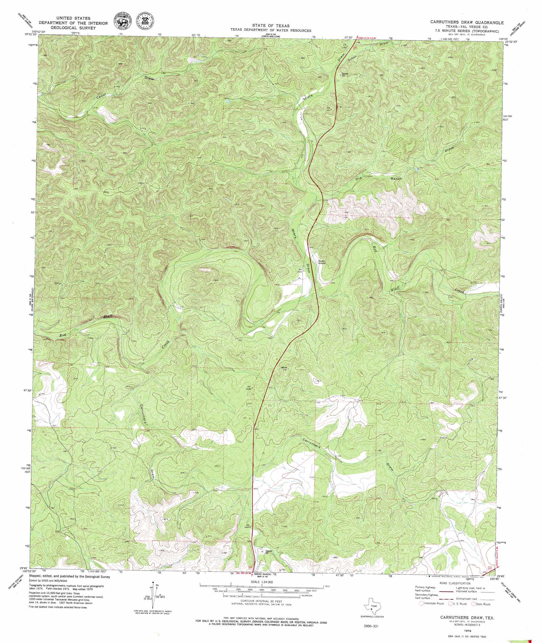
Carruthers Draw Topo Map Texas
To zoom in, hover over the map of Carruthers Draw
USGS Topo Quad 29100g7 - 1:24,000 scale
| Topo Map Name: | Carruthers Draw |
| USGS Topo Quad ID: | 29100g7 |
| Print Size: | ca. 21 1/4" wide x 27" high |
| Southeast Coordinates: | 29.75° N latitude / 100.75° W longitude |
| Map Center Coordinates: | 29.8125° N latitude / 100.8125° W longitude |
| U.S. State: | TX |
| Filename: | o29100g7.jpg |
| Download Map JPG Image: | Carruthers Draw topo map 1:24,000 scale |
| Map Type: | Topographic |
| Topo Series: | 7.5´ |
| Map Scale: | 1:24,000 |
| Source of Map Images: | United States Geological Survey (USGS) |
| Alternate Map Versions: |
Carruthers Draw TX 1979, updated 1979 Download PDF Buy paper map Carruthers Draw TX 2010 Download PDF Buy paper map Carruthers Draw TX 2013 Download PDF Buy paper map Carruthers Draw TX 2016 Download PDF Buy paper map |
1:24,000 Topo Quads surrounding Carruthers Draw
Deaton Draw |
White Draw |
Robinson Draw |
Four Mills |
Turney Draw Se |
Telephone Canyon |
Dolan Springs |
Open Hollow |
Holcomb Draw |
Carta Valley Ne |
Lechuguilla Creek |
Clark Waterhole |
Carruthers Draw |
Carta Valley |
Carta Valley Se |
Gillis Ranch |
Satan Canyon |
Miers Ranch |
Flat Rock Creek Nw |
Flat Rock Creek North |
California Creek |
Rough Canyon |
Rough Canyon Se |
Flat Rock Creek Sw |
Flat Rock Creek South |
> Back to 29100e1 at 1:100,000 scale
> Back to 29100a1 at 1:250,000 scale
> Back to U.S. Topo Maps home
Carruthers Draw topo map: Gazetteer
Carruthers Draw: Valleys
Carruthers Draw elevation 457m 1499′Miers Draw elevation 494m 1620′
Old Ranch Draw elevation 508m 1666′
Piñon Draw elevation 550m 1804′
Carruthers Draw digital topo map on disk
Buy this Carruthers Draw topo map showing relief, roads, GPS coordinates and other geographical features, as a high-resolution digital map file on DVD: