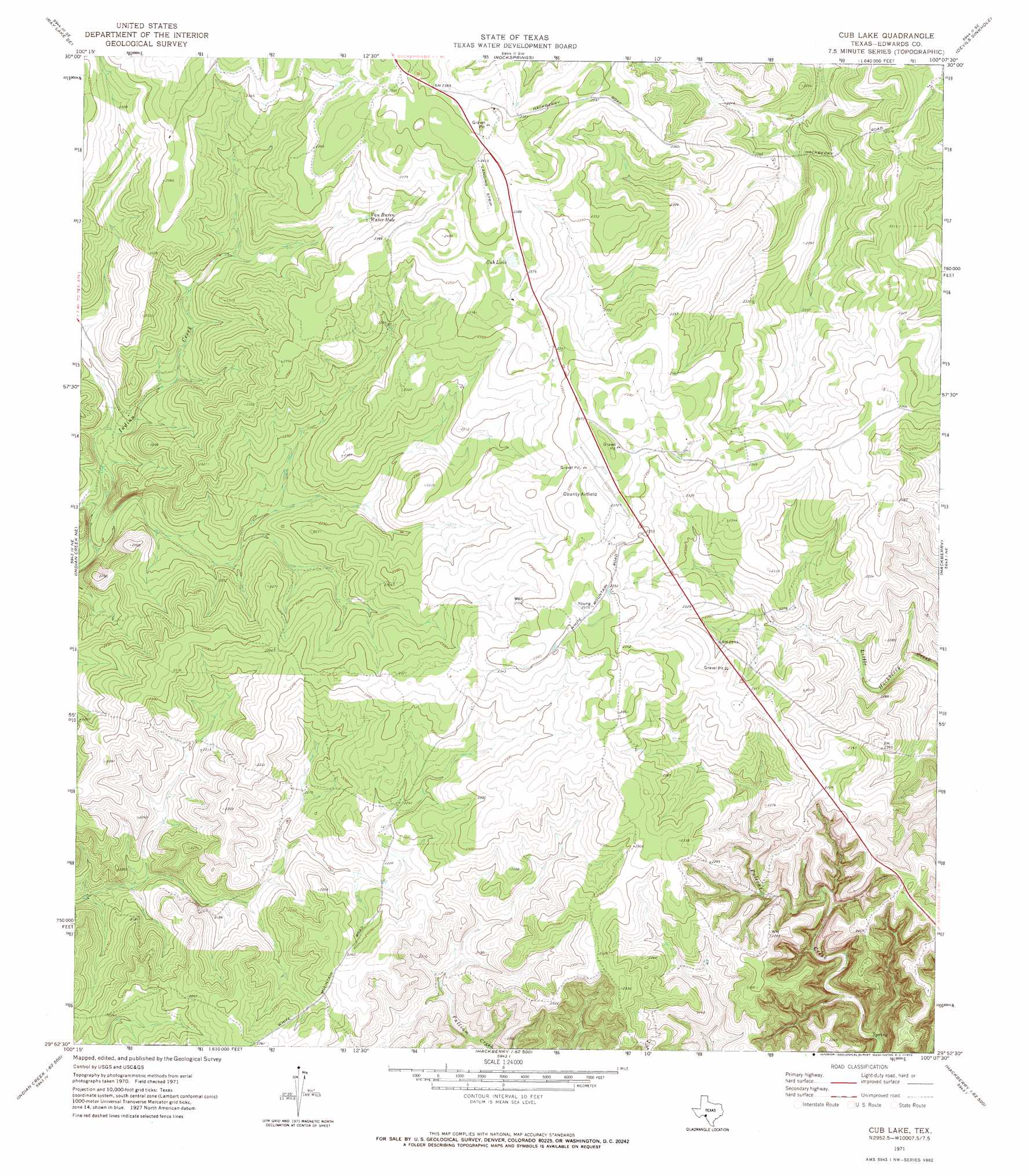
Cub Lake Topo Map Texas
To zoom in, hover over the map of Cub Lake
USGS Topo Quad 29100h2 - 1:24,000 scale
| Topo Map Name: | Cub Lake |
| USGS Topo Quad ID: | 29100h2 |
| Print Size: | ca. 21 1/4" wide x 27" high |
| Southeast Coordinates: | 29.875° N latitude / 100.125° W longitude |
| Map Center Coordinates: | 29.9375° N latitude / 100.1875° W longitude |
| U.S. State: | TX |
| Filename: | o29100h2.jpg |
| Download Map JPG Image: | Cub Lake topo map 1:24,000 scale |
| Map Type: | Topographic |
| Topo Series: | 7.5´ |
| Map Scale: | 1:24,000 |
| Source of Map Images: | United States Geological Survey (USGS) |
| Alternate Map Versions: |
Cub Lake TX 1971, updated 1973 Download PDF Buy paper map Cub Lake TX 2010 Download PDF Buy paper map Cub Lake TX 2012 Download PDF Buy paper map Cub Lake TX 2016 Download PDF Buy paper map |
1:24,000 Topo Quads surrounding Cub Lake
Ray Lake Nw |
Ray Lake |
Elbow Lake |
Paint Rock Spring |
Bradford Creek |
Ray Lake Sw |
Ray Lake Se |
Rocksprings |
Devils Sinkhole |
Earwood Creek Sw |
Black Waterhole |
Indian Creek Ne |
Cub Lake |
Hackberry |
Joy Hollow |
Twomile Draw |
Cutting Pen Draw |
Half Moon Prairie |
Vance |
Jo Jan Van Camp |
Wiley Waterhole |
Indian Mountain |
Kelley Peak |
Camp Wood |
Crown Mountain |
> Back to 29100e1 at 1:100,000 scale
> Back to 29100a1 at 1:250,000 scale
> Back to U.S. Topo Maps home
Cub Lake topo map: Gazetteer
Cub Lake: Airports
Edwards County Airport elevation 723m 2372′Freeman Ranch Airport elevation 727m 2385′
Cub Lake: Lakes
Cub Lake elevation 725m 2378′Van Buren Water Hole elevation 707m 2319′
Cub Lake digital topo map on disk
Buy this Cub Lake topo map showing relief, roads, GPS coordinates and other geographical features, as a high-resolution digital map file on DVD: