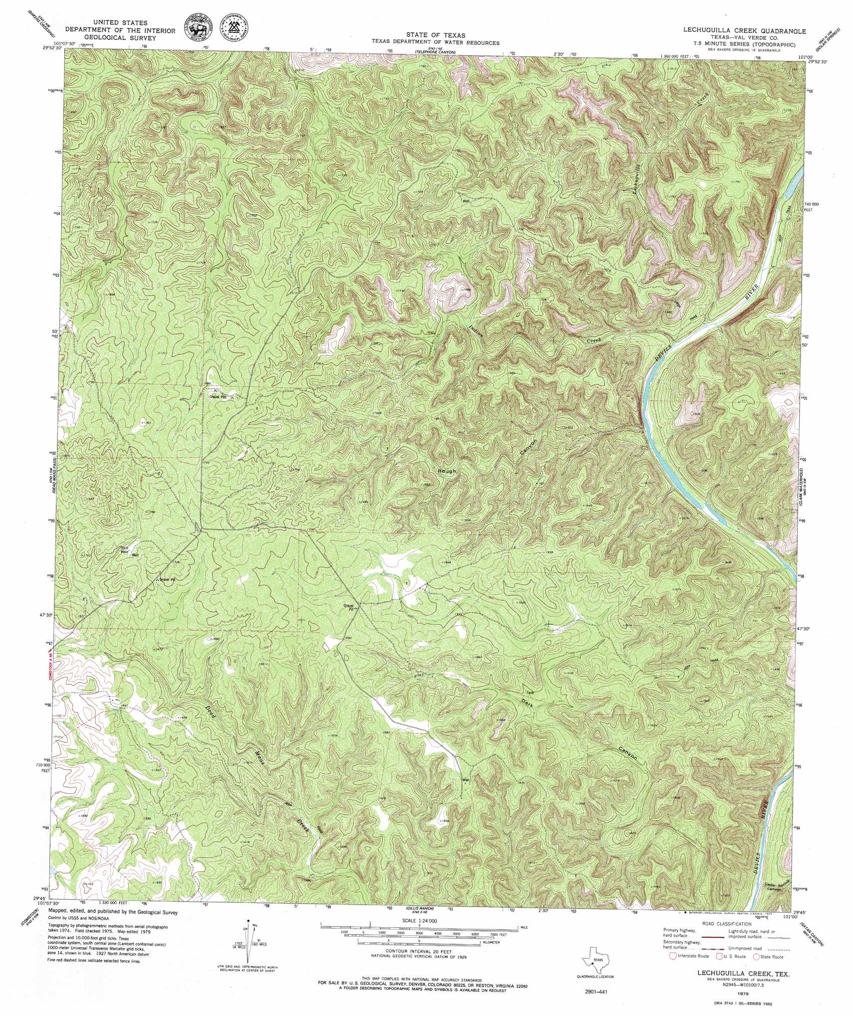
Lechuguilla Creek Topo Map Texas
To zoom in, hover over the map of Lechuguilla Creek
USGS Topo Quad 29101g1 - 1:24,000 scale
| Topo Map Name: | Lechuguilla Creek |
| USGS Topo Quad ID: | 29101g1 |
| Print Size: | ca. 21 1/4" wide x 27" high |
| Southeast Coordinates: | 29.75° N latitude / 101° W longitude |
| Map Center Coordinates: | 29.8125° N latitude / 101.0625° W longitude |
| U.S. State: | TX |
| Filename: | o29101g1.jpg |
| Download Map JPG Image: | Lechuguilla Creek topo map 1:24,000 scale |
| Map Type: | Topographic |
| Topo Series: | 7.5´ |
| Map Scale: | 1:24,000 |
| Source of Map Images: | United States Geological Survey (USGS) |
| Alternate Map Versions: |
Lechuguilla Creek TX 1979, updated 1979 Download PDF Buy paper map Lechuguilla Creek TX 2010 Download PDF Buy paper map Lechuguilla Creek TX 2013 Download PDF Buy paper map Lechuguilla Creek TX 2016 Download PDF Buy paper map |
1:24,000 Topo Quads surrounding Lechuguilla Creek
Blue Hills |
Sycamore Canyon |
Deaton Draw |
White Draw |
Robinson Draw |
Mayfield Canyon |
Bakers Crossing |
Telephone Canyon |
Dolan Springs |
Open Hollow |
Pecos High Bridge |
Dead Mans Pass |
Lechuguilla Creek |
Clark Waterhole |
Carruthers Draw |
Seminole Canyon |
Comstock |
Gillis Ranch |
Satan Canyon |
Miers Ranch |
Zuberbueler Bend |
Box Canyon |
California Creek |
Rough Canyon |
Rough Canyon Se |
> Back to 29101e1 at 1:100,000 scale
> Back to 29100a1 at 1:250,000 scale
> Back to U.S. Topo Maps home
Lechuguilla Creek topo map: Gazetteer
Lechuguilla Creek: Streams
Indian Creek elevation 399m 1309′Lechuguilla Creek elevation 388m 1272′
Lechuguilla Creek: Valleys
Cedar Spring Canyon elevation 365m 1197′Rough Canyon elevation 382m 1253′
Lechuguilla Creek digital topo map on disk
Buy this Lechuguilla Creek topo map showing relief, roads, GPS coordinates and other geographical features, as a high-resolution digital map file on DVD: