Shumla Topo Map Texas
To zoom in, hover over the map of Shumla
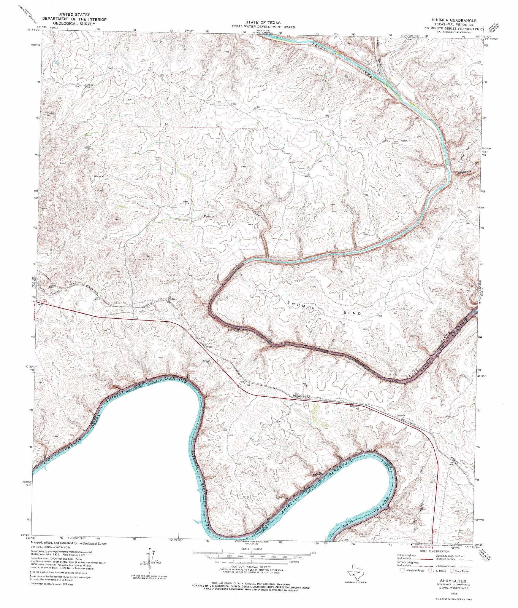
USGS Topo Quad 29101g4 - 1:24,000 scale
| Topo Map Name: | Shumla |
| USGS Topo Quad ID: | 29101g4 |
| Print Size: | ca. 21 1/4" wide x 27" high |
| Southeast Coordinates: | 29.75° N latitude / 101.375° W longitude |
| Map Center Coordinates: | 29.8125° N latitude / 101.4375° W longitude |
| U.S. State: | TX |
| Filename: | o29101g4.jpg |
| Download Map JPG Image: | Shumla topo map 1:24,000 scale |
| Map Type: | Topographic |
| Topo Series: | 7.5´ |
| Map Scale: | 1:24,000 |
| Source of Map Images: | United States Geological Survey (USGS) |
| Alternate Map Versions: |
Shumla TX 1973, updated 1976 Download PDF Buy paper map Shumla TX 2010 Download PDF Buy paper map Shumla TX 2013 Download PDF Buy paper map Shumla TX 2016 Download PDF Buy paper map |
1:24,000 Topo Quads surrounding Shumla
Roundhill Ranch |
Little Fielder Draw |
Everett Canyon |
Blue Hills |
Sycamore Canyon |
Pumpville |
Harkell Canyon |
Still Canyon |
Mayfield Canyon |
Bakers Crossing |
Ramsey Canyon |
Langtry |
Shumla |
Pecos High Bridge |
Dead Mans Pass |
Zuberbueler Bend Nw |
Seminole Canyon |
Comstock |
||
Zuberbueler Bend |
Box Canyon |
> Back to 29101e1 at 1:100,000 scale
> Back to 29100a1 at 1:250,000 scale
> Back to U.S. Topo Maps home
Shumla topo map: Gazetteer
Shumla: Bends
Shumla Bend elevation 420m 1377′Shumla: Populated Places
Shumla elevation 433m 1420′Shumla: Valleys
Lewis Canyon elevation 372m 1220′Painted Canyon elevation 379m 1243′
Shackelford Canyon elevation 364m 1194′
Shumla digital topo map on disk
Buy this Shumla topo map showing relief, roads, GPS coordinates and other geographical features, as a high-resolution digital map file on DVD: