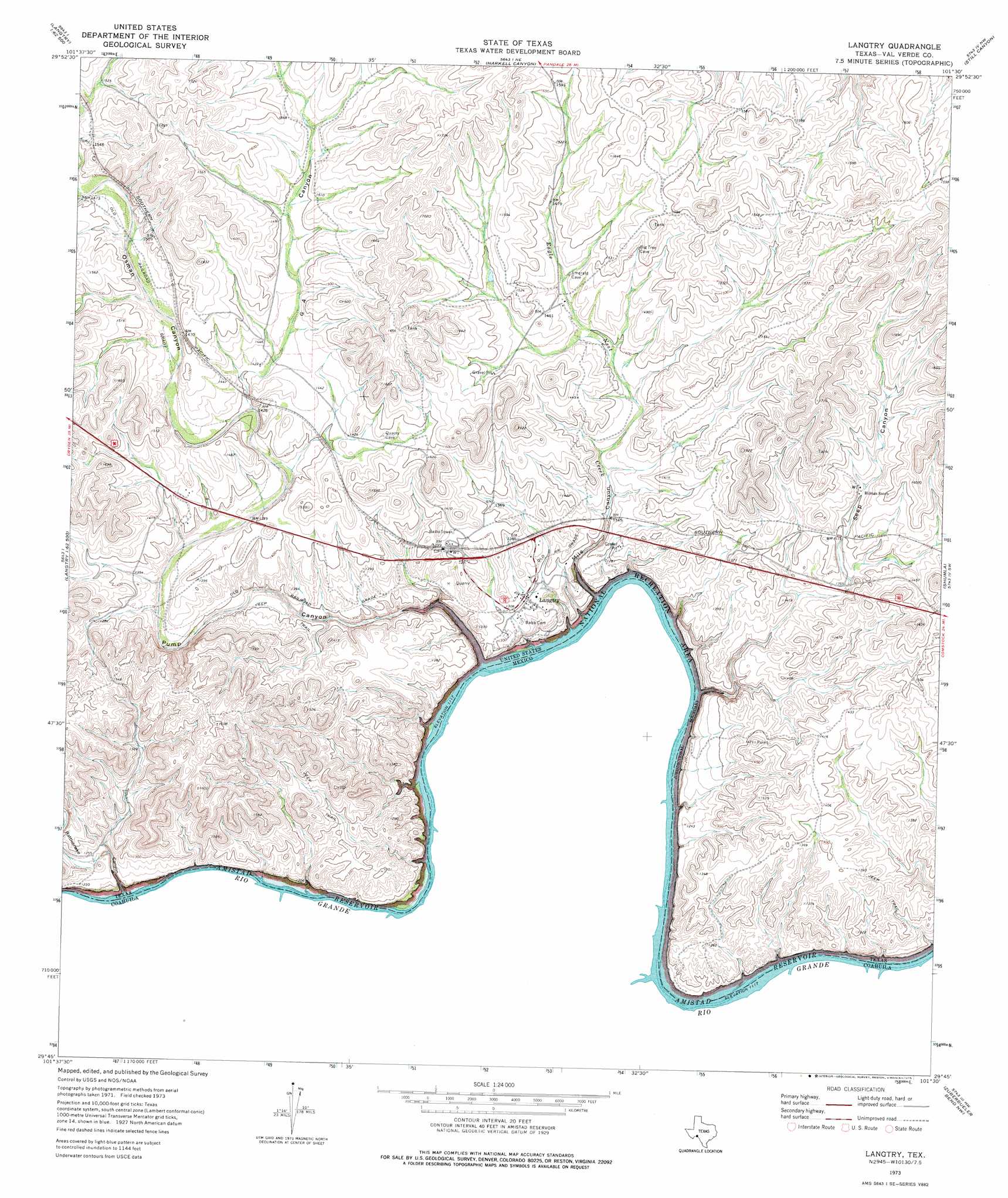
Langtry Topo Map Texas
To zoom in, hover over the map of Langtry
USGS Topo Quad 29101g5 - 1:24,000 scale
| Topo Map Name: | Langtry |
| USGS Topo Quad ID: | 29101g5 |
| Print Size: | ca. 21 1/4" wide x 27" high |
| Southeast Coordinates: | 29.75° N latitude / 101.5° W longitude |
| Map Center Coordinates: | 29.8125° N latitude / 101.5625° W longitude |
| U.S. State: | TX |
| Filename: | o29101g5.jpg |
| Download Map JPG Image: | Langtry topo map 1:24,000 scale |
| Map Type: | Topographic |
| Topo Series: | 7.5´ |
| Map Scale: | 1:24,000 |
| Source of Map Images: | United States Geological Survey (USGS) |
| Alternate Map Versions: |
Langtry TX 1973, updated 1975 Download PDF Buy paper map Langtry TX 2010 Download PDF Buy paper map Langtry TX 2013 Download PDF Buy paper map Langtry TX 2016 Download PDF Buy paper map |
1:24,000 Topo Quads surrounding Langtry
Sevenmile Canyon |
Roundhill Ranch |
Little Fielder Draw |
Everett Canyon |
Blue Hills |
Lozier Canyon North |
Pumpville |
Harkell Canyon |
Still Canyon |
Mayfield Canyon |
Lozier Canyon South |
Ramsey Canyon |
Langtry |
Shumla |
Pecos High Bridge |
Zuberbueler Bend Nw |
Seminole Canyon |
|||
Zuberbueler Bend |
> Back to 29101e1 at 1:100,000 scale
> Back to 29100a1 at 1:250,000 scale
> Back to U.S. Topo Maps home
Langtry topo map: Gazetteer
Langtry: Flats
Smokeys Vega elevation 350m 1148′Langtry: Populated Places
Langtry elevation 393m 1289′Langtry: Springs
Seep Springs elevation 435m 1427′Langtry: Streams
Eagle Nest Creek elevation 340m 1115′Langtry: Valleys
G4 Canyon elevation 421m 1381′Mile Canyon elevation 340m 1115′
Osman Canyon elevation 421m 1381′
Pump Canyon elevation 346m 1135′
Rattlesnake Canyon elevation 342m 1122′
Seep Canyon elevation 342m 1122′
Langtry digital topo map on disk
Buy this Langtry topo map showing relief, roads, GPS coordinates and other geographical features, as a high-resolution digital map file on DVD: