Cook Creek South Topo Map Texas
To zoom in, hover over the map of Cook Creek South
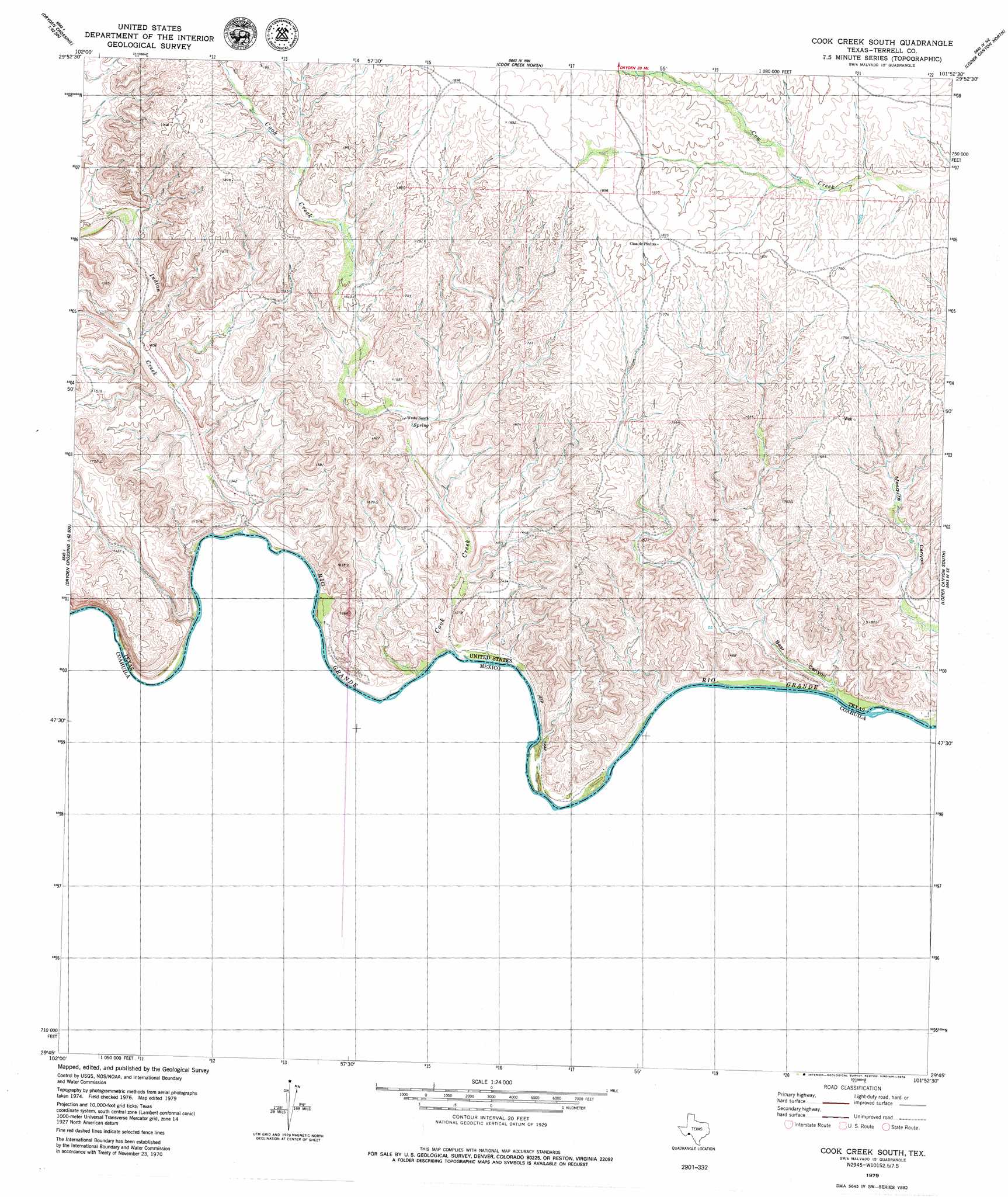
USGS Topo Quad 29101g8 - 1:24,000 scale
| Topo Map Name: | Cook Creek South |
| USGS Topo Quad ID: | 29101g8 |
| Print Size: | ca. 21 1/4" wide x 27" high |
| Southeast Coordinates: | 29.75° N latitude / 101.875° W longitude |
| Map Center Coordinates: | 29.8125° N latitude / 101.9375° W longitude |
| U.S. State: | TX |
| Filename: | o29101g8.jpg |
| Download Map JPG Image: | Cook Creek South topo map 1:24,000 scale |
| Map Type: | Topographic |
| Topo Series: | 7.5´ |
| Map Scale: | 1:24,000 |
| Source of Map Images: | United States Geological Survey (USGS) |
| Alternate Map Versions: |
Cook Creek South TX 1979, updated 1979 Download PDF Buy paper map Cook Creek South TX 2010 Download PDF Buy paper map Cook Creek South TX 2013 Download PDF Buy paper map Cook Creek South TX 2016 Download PDF Buy paper map |
1:24,000 Topo Quads surrounding Cook Creek South
Mofeta |
Dryden |
Meyers Canyon |
Sevenmile Canyon |
Roundhill Ranch |
Mcclain Canyon |
Balcon Creek |
Cook Creek North |
Lozier Canyon North |
Pumpville |
Taylor Canyon |
Shafter Canyon |
Cook Creek South |
Lozier Canyon South |
Ramsey Canyon |
> Back to 29101e1 at 1:100,000 scale
> Back to 29100a1 at 1:250,000 scale
> Back to U.S. Topo Maps home
Cook Creek South topo map: Gazetteer
Cook Creek South: Populated Places
Casa de Peidras elevation 555m 1820′Cook Creek South: Streams
Cook Creek elevation 377m 1236′Indian Creek elevation 381m 1250′
Cook Creek South: Valleys
Bear Canyon elevation 373m 1223′Cook Creek South digital topo map on disk
Buy this Cook Creek South topo map showing relief, roads, GPS coordinates and other geographical features, as a high-resolution digital map file on DVD: