Boquillas Topo Map Texas
To zoom in, hover over the map of Boquillas
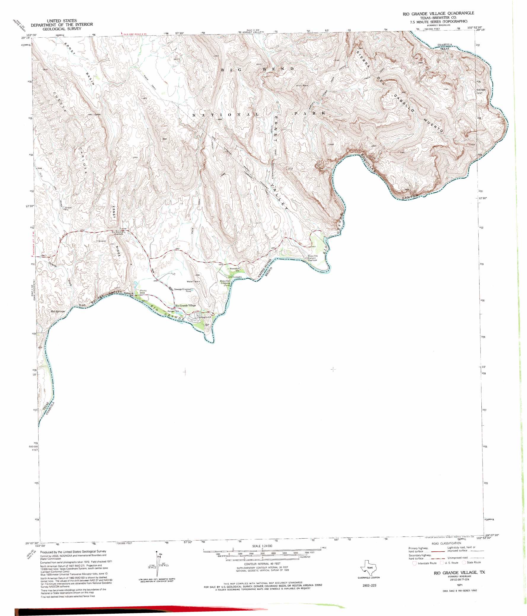
USGS Topo Quad 29102b8 - 1:24,000 scale
| Topo Map Name: | Boquillas |
| USGS Topo Quad ID: | 29102b8 |
| Print Size: | ca. 21 1/4" wide x 27" high |
| Southeast Coordinates: | 29.125° N latitude / 102.875° W longitude |
| Map Center Coordinates: | 29.1875° N latitude / 102.9375° W longitude |
| U.S. State: | TX |
| Filename: | o29102b8.jpg |
| Download Map JPG Image: | Boquillas topo map 1:24,000 scale |
| Map Type: | Topographic |
| Topo Series: | 7.5´ |
| Map Scale: | 1:24,000 |
| Source of Map Images: | United States Geological Survey (USGS) |
| Alternate Map Versions: |
Boquillas TX 1971, updated 1974 Download PDF Buy paper map Boquillas TX 1971, updated 1987 Download PDF Buy paper map Rio Grande Village TX 1971, updated 1995 Download PDF Buy paper map Rio Grande Village TX 1971, updated 1995 Download PDF Buy paper map Rio Grande Village TX 2010 Download PDF Buy paper map Rio Grande Village TX 2013 Download PDF Buy paper map Rio Grande Village TX 2016 Download PDF Buy paper map |
1:24,000 Topo Quads surrounding Boquillas
Grapevine Hills |
Mckinney Springs |
Sue Peaks |
Stillwell Crossing |
|
Panther Junction |
Roys Peak |
Ernst Valley |
||
Glenn Spring |
San Vincente |
Boquillas |
||
Mariscal Mountain |
Solis |
|||
> Back to 29102a1 at 1:100,000 scale
> Back to 29102a1 at 1:250,000 scale
> Back to U.S. Topo Maps home
Boquillas topo map: Gazetteer
Boquillas: Gaps
Dead Mans Curve elevation 627m 2057′Boquillas: Populated Places
Boquillas Crossing elevation 558m 1830′Hot Springs elevation 568m 1863′
Rio Grande Village elevation 562m 1843′
Boquillas: Springs
Boquillas Warm Springs elevation 685m 2247′Gambusia Spring elevation 572m 1876′
Hot Springs elevation 565m 1853′
Boquillas: Streams
Tornillo Creek elevation 559m 1833′Boquillas: Trails
Boquillas Canyon Trail elevation 577m 1893′Marufa Vega Trail elevation 733m 2404′
Ore Terminal Trail elevation 710m 2329′
Rio Grande Village Nature Trail elevation 585m 1919′
Boquillas: Valleys
Boquillas Canyon elevation 577m 1893′Ernst Valley elevation 550m 1804′
Hot Springs Canyon elevation 563m 1847′
Boquillas digital topo map on disk
Buy this Boquillas topo map showing relief, roads, GPS coordinates and other geographical features, as a high-resolution digital map file on DVD: