Ernst Valley Topo Map Texas
To zoom in, hover over the map of Ernst Valley
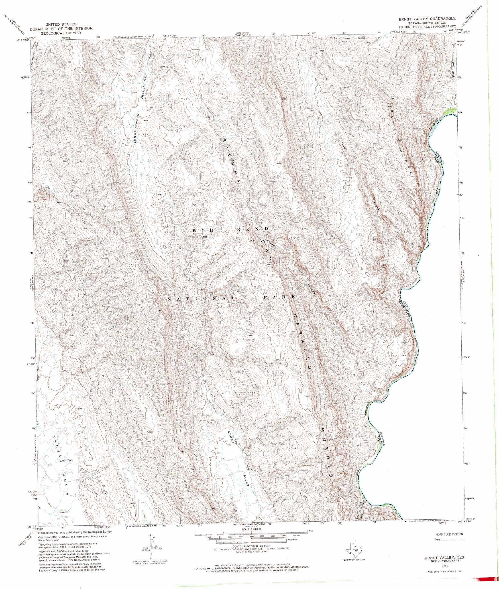
USGS Topo Quad 29102c8 - 1:24,000 scale
| Topo Map Name: | Ernst Valley |
| USGS Topo Quad ID: | 29102c8 |
| Print Size: | ca. 21 1/4" wide x 27" high |
| Southeast Coordinates: | 29.25° N latitude / 102.875° W longitude |
| Map Center Coordinates: | 29.3125° N latitude / 102.9375° W longitude |
| U.S. State: | TX |
| Filename: | o29102c8.jpg |
| Download Map JPG Image: | Ernst Valley topo map 1:24,000 scale |
| Map Type: | Topographic |
| Topo Series: | 7.5´ |
| Map Scale: | 1:24,000 |
| Source of Map Images: | United States Geological Survey (USGS) |
| Alternate Map Versions: |
Ernst Valley TX 1971, updated 1974 Download PDF Buy paper map Ernst Valley TX 2010 Download PDF Buy paper map Ernst Valley TX 2013 Download PDF Buy paper map Ernst Valley TX 2016 Download PDF Buy paper map |
1:24,000 Topo Quads surrounding Ernst Valley
Bone Spring |
Dagger Flat |
Black Gap |
Bourland Canyon |
Las Vegas De Los Ladrones Sw |
Grapevine Hills |
Mckinney Springs |
Sue Peaks |
Stillwell Crossing |
|
Panther Junction |
Roys Peak |
Ernst Valley |
||
Glenn Spring |
San Vincente |
Boquillas |
||
Mariscal Mountain |
Solis |
> Back to 29102a1 at 1:100,000 scale
> Back to 29102a1 at 1:250,000 scale
> Back to U.S. Topo Maps home
Ernst Valley topo map: Gazetteer
Ernst Valley: Basins
Ernst Basin elevation 752m 2467′Ernst Valley: Ranges
Sierra del Caballo Muerto elevation 1274m 4179′Ernst Valley: Reservoirs
Ernst Tank elevation 753m 2470′Ernst Valley: Ridges
Hubert Ridge elevation 1112m 3648′Ernst Valley: Streams
Heath Creek elevation 537m 1761′Ernst Valley: Trails
Strawhouse Trail elevation 969m 3179′Ernst Valley: Valleys
Arroyo Venado elevation 546m 1791′Cow Canyon elevation 539m 1768′
Ernst Valley digital topo map on disk
Buy this Ernst Valley topo map showing relief, roads, GPS coordinates and other geographical features, as a high-resolution digital map file on DVD: