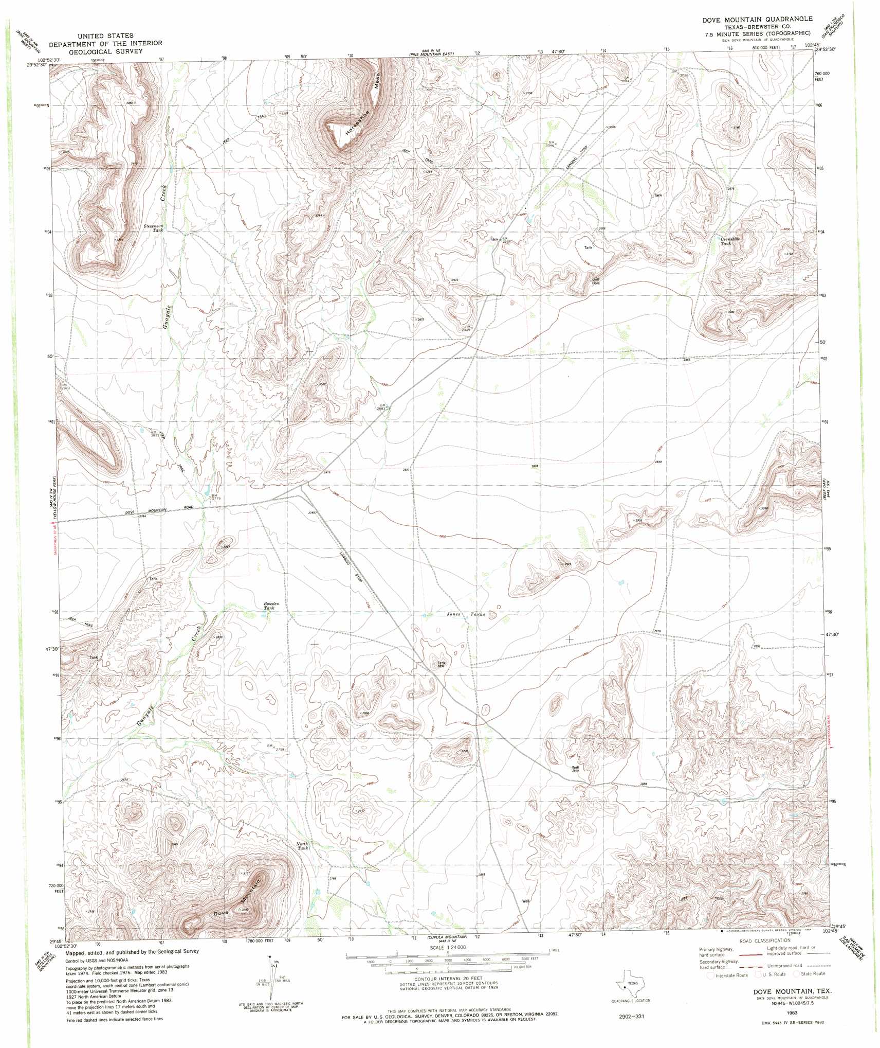
Dove Mountain Topo Map Texas
To zoom in, hover over the map of Dove Mountain
USGS Topo Quad 29102g7 - 1:24,000 scale
| Topo Map Name: | Dove Mountain |
| USGS Topo Quad ID: | 29102g7 |
| Print Size: | ca. 21 1/4" wide x 27" high |
| Southeast Coordinates: | 29.75° N latitude / 102.75° W longitude |
| Map Center Coordinates: | 29.8125° N latitude / 102.8125° W longitude |
| U.S. State: | TX |
| Filename: | o29102g7.jpg |
| Download Map JPG Image: | Dove Mountain topo map 1:24,000 scale |
| Map Type: | Topographic |
| Topo Series: | 7.5´ |
| Map Scale: | 1:24,000 |
| Source of Map Images: | United States Geological Survey (USGS) |
| Alternate Map Versions: |
Dove Mountain TX 1983, updated 1984 Download PDF Buy paper map Dove Mountain TX 2010 Download PDF Buy paper map Dove Mountain TX 2013 Download PDF Buy paper map Dove Mountain TX 2016 Download PDF Buy paper map |
1:24,000 Topo Quads surrounding Dove Mountain
Horse Mountain |
Tesnus |
Tesnus Se |
Fresno Creek |
Big Brindle Canyon |
Hood Spring |
Pine Mountain West |
Pine Mountain East |
San Francisco Shutups |
Bullis Gap Ne |
Hood Spring Se |
Yellow House Peak |
Dove Mountain |
Beef Gap |
Bullis Gap |
Bone Spring Ne |
Stillwell Mountain |
Cupola Mountain |
Las Vegas De Los Ladrones |
San Rosendo |
Dagger Flat |
Black Gap |
Bourland Canyon |
Las Vegas De Los Ladrones Sw |
> Back to 29102e1 at 1:100,000 scale
> Back to 29102a1 at 1:250,000 scale
> Back to U.S. Topo Maps home
Dove Mountain topo map: Gazetteer
Dove Mountain: Airports
Stovall Ranch Number 4 Airport elevation 921m 3021′Dove Mountain: Reservoirs
Bowden Tank elevation 829m 2719′Crenshaw Tank elevation 897m 2942′
Jones Tanks elevation 846m 2775′
North Tank elevation 844m 2769′
Stevenson Tank elevation 894m 2933′
Dove Mountain: Summits
Dove Mountain elevation 1130m 3707′Horseshoe Mesa elevation 1171m 3841′
Dove Mountain digital topo map on disk
Buy this Dove Mountain topo map showing relief, roads, GPS coordinates and other geographical features, as a high-resolution digital map file on DVD: