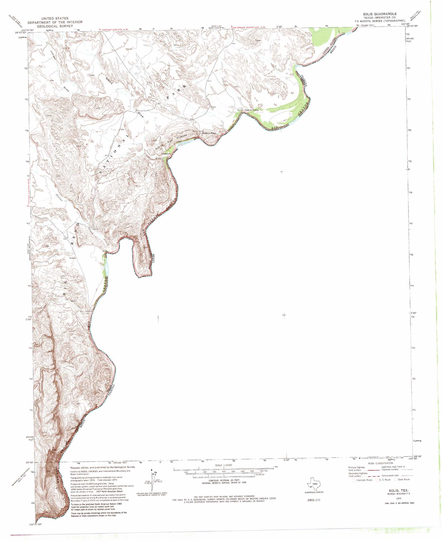
Solis Topo Map Texas
To zoom in, hover over the map of Solis
USGS Topo Quad 29103a1 - 1:24,000 scale
| Topo Map Name: | Solis |
| USGS Topo Quad ID: | 29103a1 |
| Print Size: | ca. 21 1/4" wide x 27" high |
| Southeast Coordinates: | 29° N latitude / 103° W longitude |
| Map Center Coordinates: | 29.0625° N latitude / 103.0625° W longitude |
| U.S. State: | TX |
| Filename: | o29103a1.jpg |
| Download Map JPG Image: | Solis topo map 1:24,000 scale |
| Map Type: | Topographic |
| Topo Series: | 7.5´ |
| Map Scale: | 1:24,000 |
| Source of Map Images: | United States Geological Survey (USGS) |
| Alternate Map Versions: |
Solis TX 1970, updated 1974 Download PDF Buy paper map Solis TX 1970, updated 1984 Download PDF Buy paper map Solis TX 2010 Download PDF Buy paper map Solis TX 2012 Download PDF Buy paper map Solis TX 2016 Download PDF Buy paper map |
1:24,000 Topo Quads surrounding Solis
The Basin |
Panther Junction |
Roys Peak |
Ernst Valley |
|
Emory Peak |
Glenn Spring |
San Vincente |
Boquillas |
|
Reed Camp |
Mariscal Mountain |
Solis |
||
> Back to 29103a1 at 1:100,000 scale
> Back to 29102a1 at 1:250,000 scale
> Back to U.S. Topo Maps home
Solis topo map: Gazetteer
Solis: Populated Places
Casa de Piedra elevation 573m 1879′Comptons elevation 577m 1893′
Rooneys Place elevation 578m 1896′
Solis elevation 593m 1945′
Solis Landing elevation 578m 1896′
Solis: Streams
Fresno Creek elevation 580m 1902′Solis: Summits
Iron Mountain elevation 626m 2053′Sierra San Vincente elevation 615m 2017′
Solis: Valleys
Glenn Draw elevation 583m 1912′Juniper Draw elevation 616m 2020′
Mariscal Canyon elevation 579m 1899′
San Vincent Canyon elevation 579m 1899′
Solis digital topo map on disk
Buy this Solis topo map showing relief, roads, GPS coordinates and other geographical features, as a high-resolution digital map file on DVD: