San Vincente Topo Map Texas
To zoom in, hover over the map of San Vincente
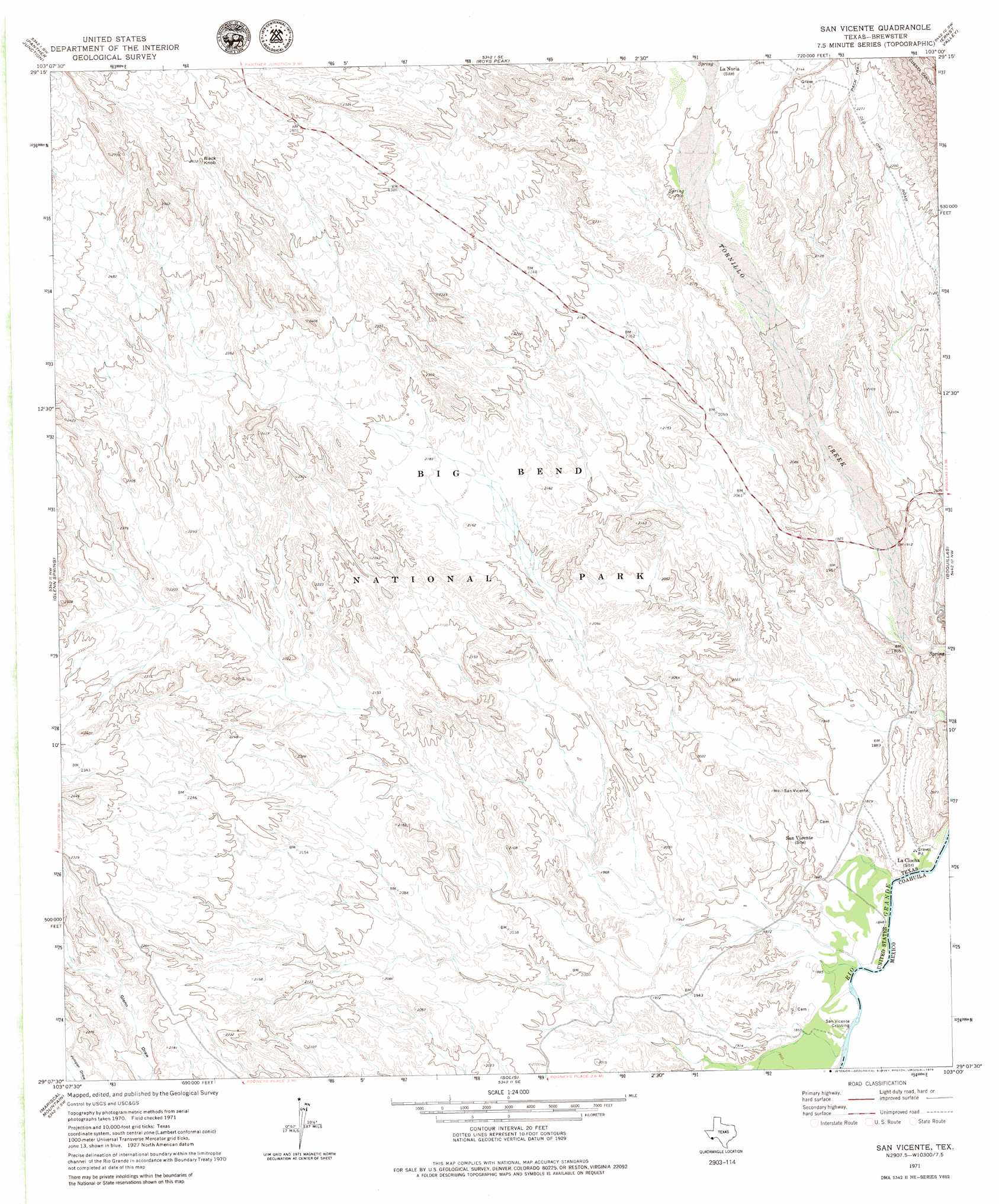
USGS Topo Quad 29103b1 - 1:24,000 scale
| Topo Map Name: | San Vincente |
| USGS Topo Quad ID: | 29103b1 |
| Print Size: | ca. 21 1/4" wide x 27" high |
| Southeast Coordinates: | 29.125° N latitude / 103° W longitude |
| Map Center Coordinates: | 29.1875° N latitude / 103.0625° W longitude |
| U.S. State: | TX |
| Filename: | o29103b1.jpg |
| Download Map JPG Image: | San Vincente topo map 1:24,000 scale |
| Map Type: | Topographic |
| Topo Series: | 7.5´ |
| Map Scale: | 1:24,000 |
| Source of Map Images: | United States Geological Survey (USGS) |
| Alternate Map Versions: |
San Vicente TX 1971, updated 1974 Download PDF Buy paper map San Vicente TX 1971, updated 1979 Download PDF Buy paper map San Vicente TX 2010 Download PDF Buy paper map San Vicente TX 2012 Download PDF Buy paper map San Vicente TX 2016 Download PDF Buy paper map |
1:24,000 Topo Quads surrounding San Vincente
Sombero Peak |
Grapevine Hills |
Mckinney Springs |
Sue Peaks |
Stillwell Crossing |
The Basin |
Panther Junction |
Roys Peak |
Ernst Valley |
|
Emory Peak |
Glenn Spring |
San Vincente |
Boquillas |
|
Reed Camp |
Mariscal Mountain |
Solis |
||
> Back to 29103a1 at 1:100,000 scale
> Back to 29102a1 at 1:250,000 scale
> Back to U.S. Topo Maps home
San Vincente topo map: Gazetteer
San Vincente: Populated Places
San Vicente Crossing elevation 566m 1856′San Vincente: Springs
Boquillas Hot Springs elevation 601m 1971′San Vincente: Summits
Black Knob elevation 799m 2621′San Vincente digital topo map on disk
Buy this San Vincente topo map showing relief, roads, GPS coordinates and other geographical features, as a high-resolution digital map file on DVD: