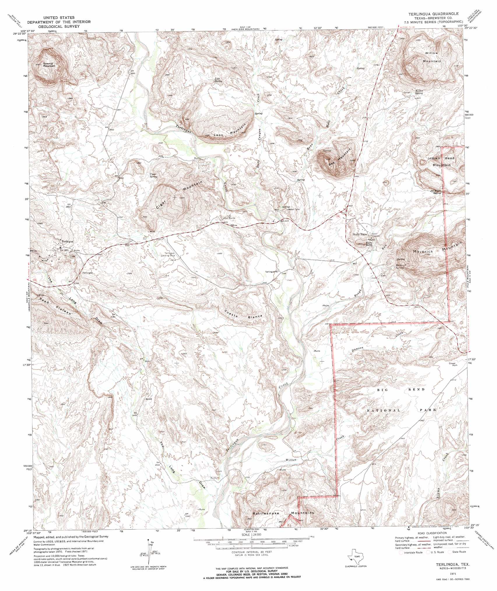
Terlingua Topo Map Texas
To zoom in, hover over the map of Terlingua
USGS Topo Quad 29103c5 - 1:24,000 scale
| Topo Map Name: | Terlingua |
| USGS Topo Quad ID: | 29103c5 |
| Print Size: | ca. 21 1/4" wide x 27" high |
| Southeast Coordinates: | 29.25° N latitude / 103.5° W longitude |
| Map Center Coordinates: | 29.3125° N latitude / 103.5625° W longitude |
| U.S. State: | TX |
| Filename: | o29103c5.jpg |
| Download Map JPG Image: | Terlingua topo map 1:24,000 scale |
| Map Type: | Topographic |
| Topo Series: | 7.5´ |
| Map Scale: | 1:24,000 |
| Source of Map Images: | United States Geological Survey (USGS) |
| Alternate Map Versions: |
Terlingua TX 1971, updated 1973 Download PDF Buy paper map Terlingua TX 1971, updated 1973 Download PDF Buy paper map Terlingua TX 1971, updated 1974 Download PDF Buy paper map Terlingua TX 2010 Download PDF Buy paper map Terlingua TX 2012 Download PDF Buy paper map Terlingua TX 2016 Download PDF Buy paper map |
1:24,000 Topo Quads surrounding Terlingua
Bandero Mesa South |
Agua Fria Mountain |
Packsaddle Mountain |
White Hills |
Twin Peaks |
The Solitario |
Yellow Hill |
Hen Egg Mountain |
Christmas Mountains |
Sombero Peak |
Lajitas |
Amarilla Mountain |
Terlingua |
Tule Mountain |
The Basin |
Mesa De Anguila |
Castolon |
Cerro Castellan |
Emory Peak |
|
Smoky Creek |
Reed Camp |
> Back to 29103a1 at 1:100,000 scale
> Back to 29102a1 at 1:250,000 scale
> Back to U.S. Topo Maps home
Terlingua topo map: Gazetteer
Terlingua: Airports
La Leona Airport elevation 792m 2598′Terlingua Airport elevation 824m 2703′
Terlingua: Populated Places
Study Butte elevation 775m 2542′Terlingua elevation 883m 2896′
Terlingua: Springs
Cigar Spring elevation 806m 2644′Joe Black Spring elevation 888m 2913′
Lost Spring elevation 842m 2762′
Maverick Spring elevation 814m 2670′
Willow Spring elevation 880m 2887′
Terlingua: Streams
Bens Hole Creek elevation 771m 2529′Dark Canyon Creek elevation 786m 2578′
Dawson Creek elevation 736m 2414′
Rough Run elevation 744m 2440′
Willow Creek elevation 718m 2355′
Terlingua: Summits
Bee Mountain elevation 1043m 3421′Cigar Mountain elevation 919m 3015′
Cuesta Blanca elevation 864m 2834′
Indian Head Mountain elevation 914m 2998′
Leon Mountain elevation 908m 2979′
Maverick Mountain elevation 1058m 3471′
Rattlesnake Mountains elevation 863m 2831′
Sawmill Mountain elevation 1145m 3756′
Study Butte elevation 846m 2775′
Willow Mountain elevation 1165m 3822′
Terlingua: Valleys
Sawmill Canyon elevation 797m 2614′The Long Draw elevation 714m 2342′
Terlingua digital topo map on disk
Buy this Terlingua topo map showing relief, roads, GPS coordinates and other geographical features, as a high-resolution digital map file on DVD: