The Solitario Topo Map Texas
To zoom in, hover over the map of The Solitario
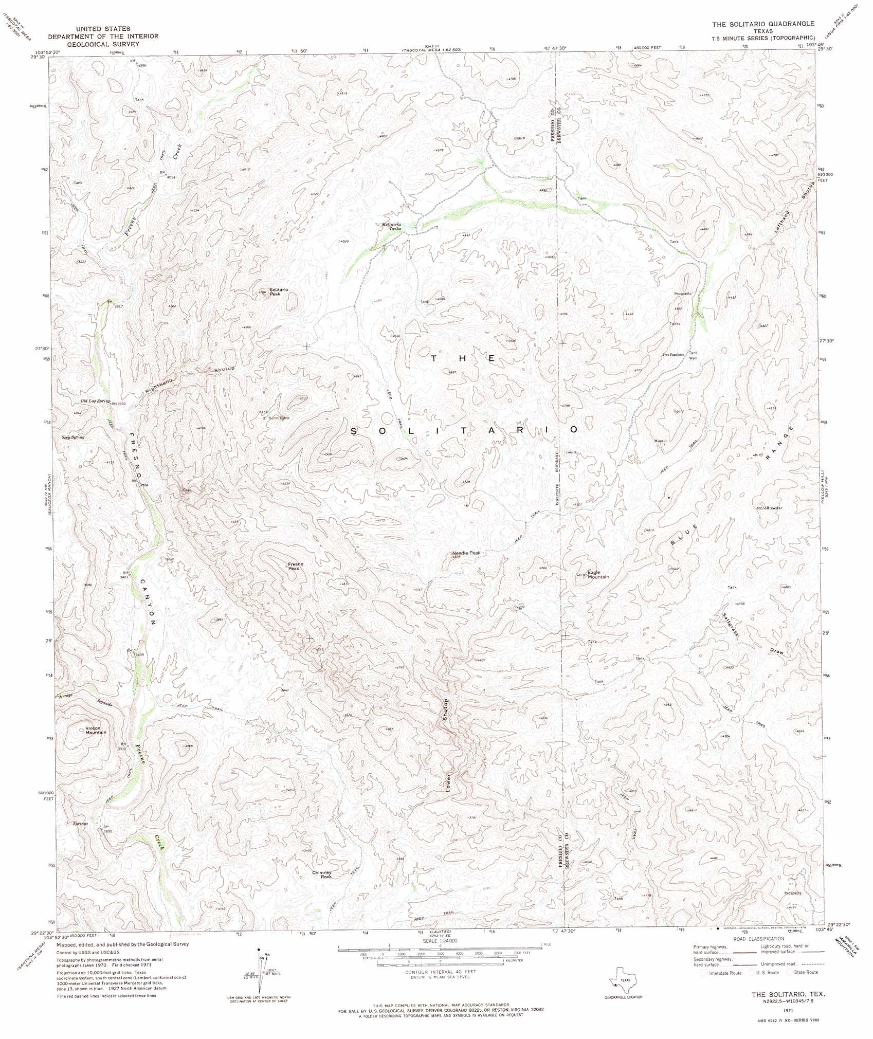
USGS Topo Quad 29103d7 - 1:24,000 scale
| Topo Map Name: | The Solitario |
| USGS Topo Quad ID: | 29103d7 |
| Print Size: | ca. 21 1/4" wide x 27" high |
| Southeast Coordinates: | 29.375° N latitude / 103.75° W longitude |
| Map Center Coordinates: | 29.4375° N latitude / 103.8125° W longitude |
| U.S. State: | TX |
| Filename: | o29103d7.jpg |
| Download Map JPG Image: | The Solitario topo map 1:24,000 scale |
| Map Type: | Topographic |
| Topo Series: | 7.5´ |
| Map Scale: | 1:24,000 |
| Source of Map Images: | United States Geological Survey (USGS) |
| Alternate Map Versions: |
The Solitario TX 1971, updated 1974 Download PDF Buy paper map The Solitario TX 2010 Download PDF Buy paper map The Solitario TX 2012 Download PDF Buy paper map The Solitario TX 2016 Download PDF Buy paper map |
1:24,000 Topo Quads surrounding The Solitario
Casa Piedra |
Horseshoe Mountain |
Bandera Mesa North |
Long Hills |
Dog Canyon |
Manzanillo Canyon |
La Mota Mountain |
Bandero Mesa South |
Agua Fria Mountain |
Packsaddle Mountain |
Agua Adentro Mountain |
Sauceda Ranch |
The Solitario |
Yellow Hill |
Hen Egg Mountain |
Redford Se |
Santana Mesa |
Lajitas |
Amarilla Mountain |
Terlingua |
Mesa De Anguila |
Castolon |
> Back to 29103a1 at 1:100,000 scale
> Back to 29102a1 at 1:250,000 scale
> Back to U.S. Topo Maps home
The Solitario topo map: Gazetteer
The Solitario: Pillars
Chimney Rock elevation 995m 3264′The Solitario: Populated Places
Tres Papalotes elevation 1351m 4432′The Solitario: Ranges
Blue Range elevation 1476m 4842′The Solitario: Reservoirs
McGuirks Tanks elevation 1332m 4370′The Solitario: Springs
Old Log Spring elevation 1139m 3736′Seep Spring elevation 1170m 3838′
The Solitario: Summits
Eagle Mountain elevation 1461m 4793′Fresno Peak elevation 1544m 5065′
Needle Peak elevation 1376m 4514′
Rincon Mountain elevation 1343m 4406′
Solitario Peak elevation 1418m 4652′
The Solitario elevation 1408m 4619′
The Solitario: Valleys
Arroyo Segundo elevation 1020m 3346′Lower Shutup elevation 949m 3113′
Righthand Shutup elevation 1142m 3746′
The Solitario digital topo map on disk
Buy this The Solitario topo map showing relief, roads, GPS coordinates and other geographical features, as a high-resolution digital map file on DVD: