White Hills Topo Map Texas
To zoom in, hover over the map of White Hills
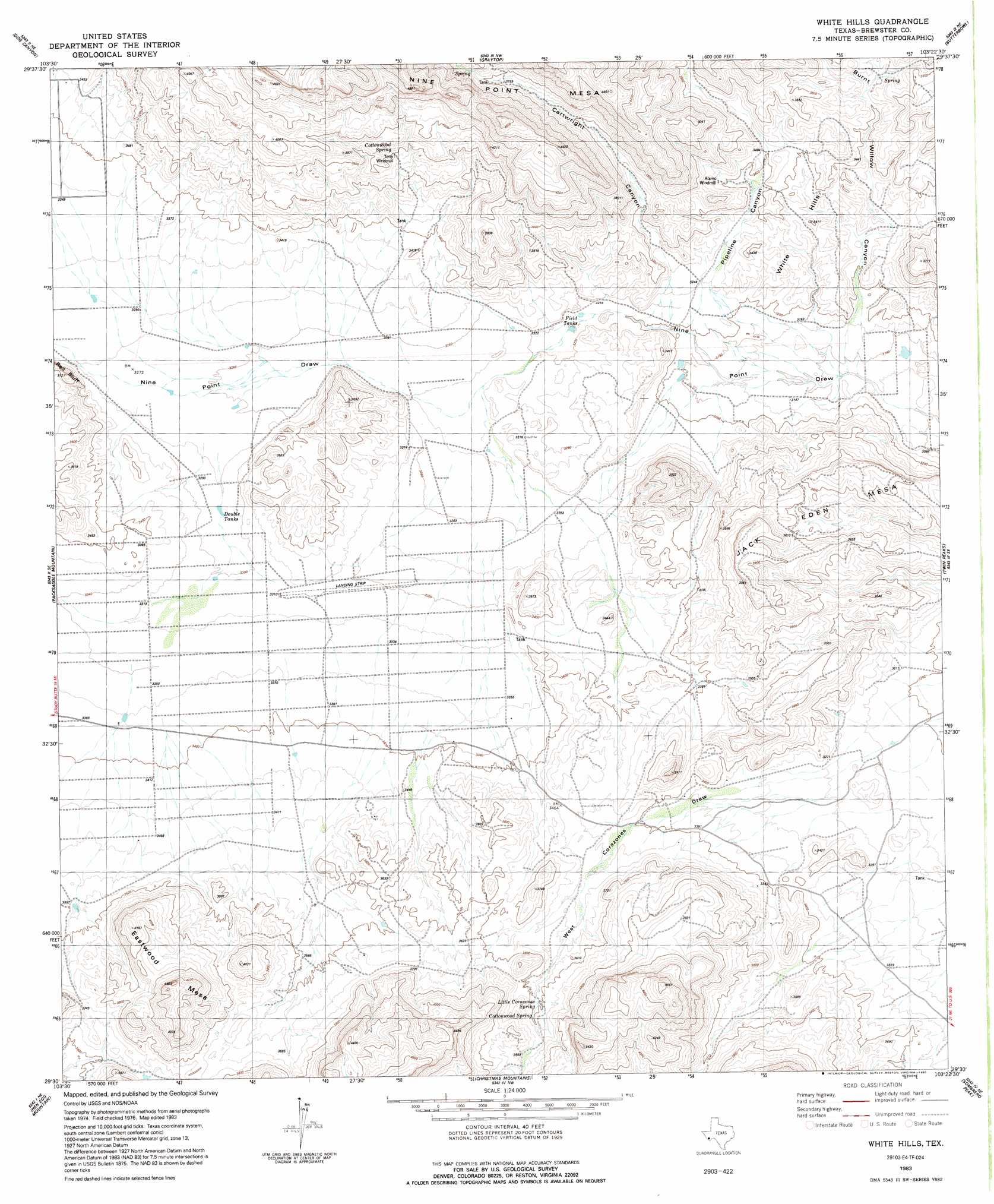
USGS Topo Quad 29103e4 - 1:24,000 scale
| Topo Map Name: | White Hills |
| USGS Topo Quad ID: | 29103e4 |
| Print Size: | ca. 21 1/4" wide x 27" high |
| Southeast Coordinates: | 29.5° N latitude / 103.375° W longitude |
| Map Center Coordinates: | 29.5625° N latitude / 103.4375° W longitude |
| U.S. State: | TX |
| Filename: | o29103e4.jpg |
| Download Map JPG Image: | White Hills topo map 1:24,000 scale |
| Map Type: | Topographic |
| Topo Series: | 7.5´ |
| Map Scale: | 1:24,000 |
| Source of Map Images: | United States Geological Survey (USGS) |
| Alternate Map Versions: |
White Hills TX 1983, updated 1984 Download PDF Buy paper map White Hills TX 1983, updated 1991 Download PDF Buy paper map White Hills TX 2010 Download PDF Buy paper map White Hills TX 2012 Download PDF Buy paper map White Hills TX 2016 Download PDF Buy paper map |
1:24,000 Topo Quads surrounding White Hills
Straddlebug Mountain |
Buck Hill |
Santiago Peak |
Ye Mesa |
Sosa Peak |
Long Hills |
Dog Canyon |
Graytop |
Butterbowl |
Persimmon Gap |
Agua Fria Mountain |
Packsaddle Mountain |
White Hills |
Twin Peaks |
Bone Spring |
Yellow Hill |
Hen Egg Mountain |
Christmas Mountains |
Sombero Peak |
Grapevine Hills |
Amarilla Mountain |
Terlingua |
Tule Mountain |
The Basin |
Panther Junction |
> Back to 29103e1 at 1:100,000 scale
> Back to 29102a1 at 1:250,000 scale
> Back to U.S. Topo Maps home
White Hills topo map: Gazetteer
White Hills: Reservoirs
Double Tanks elevation 1004m 3293′White Hills: Springs
Cottonwood Spring elevation 1155m 3789′Little Corazones Spring elevation 1088m 3569′
White Hills: Summits
Jack Eden Mesa elevation 1095m 3592′White Hills: Valleys
Burnt Willow Canyon elevation 958m 3143′Cartwright Canyon elevation 998m 3274′
Pipeline Canyon elevation 991m 3251′
White Hills digital topo map on disk
Buy this White Hills topo map showing relief, roads, GPS coordinates and other geographical features, as a high-resolution digital map file on DVD: