Paso Del Norte Topo Map Texas
To zoom in, hover over the map of Paso Del Norte
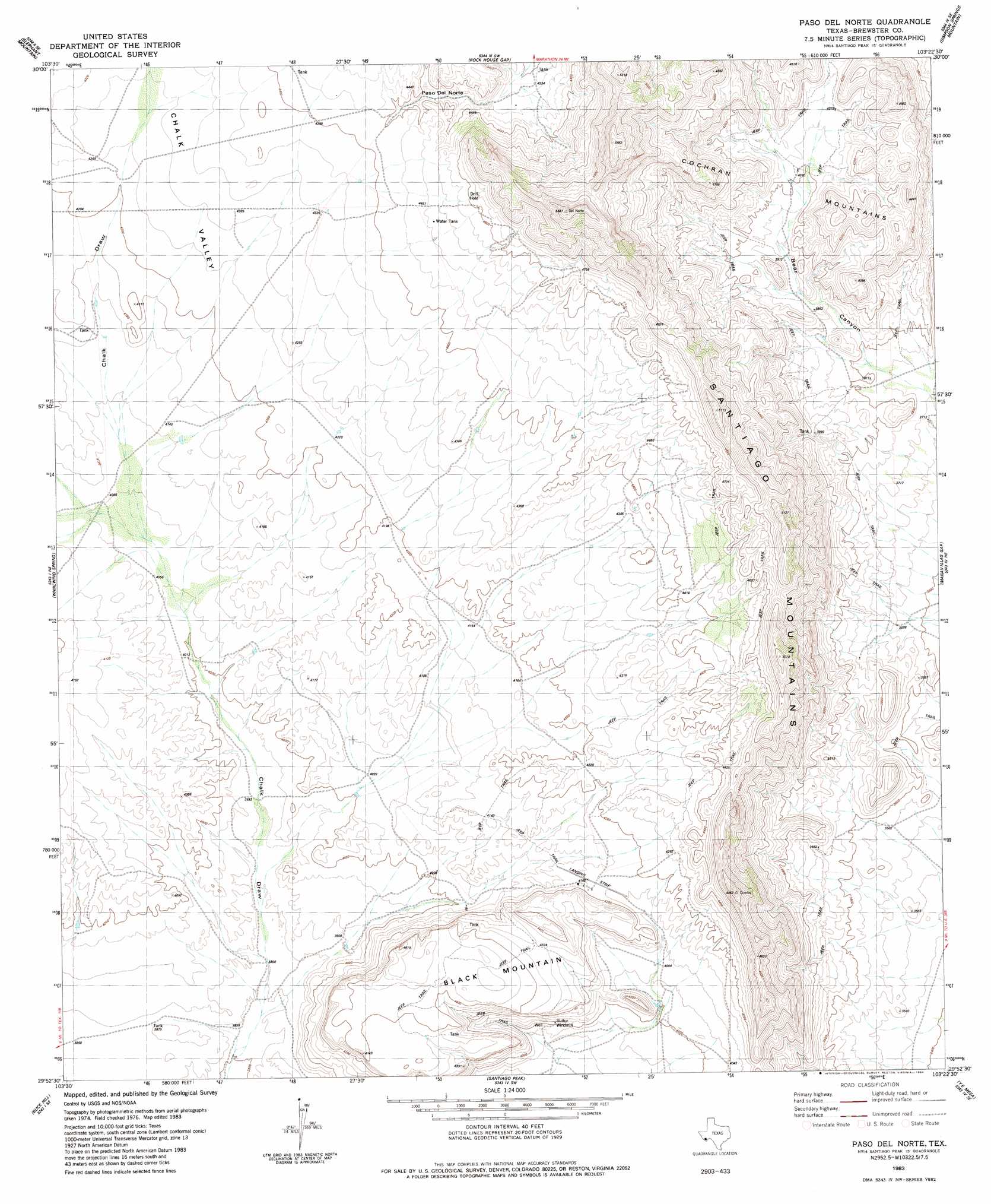
USGS Topo Quad 29103h4 - 1:24,000 scale
| Topo Map Name: | Paso Del Norte |
| USGS Topo Quad ID: | 29103h4 |
| Print Size: | ca. 21 1/4" wide x 27" high |
| Southeast Coordinates: | 29.875° N latitude / 103.375° W longitude |
| Map Center Coordinates: | 29.9375° N latitude / 103.4375° W longitude |
| U.S. State: | TX |
| Filename: | o29103h4.jpg |
| Download Map JPG Image: | Paso Del Norte topo map 1:24,000 scale |
| Map Type: | Topographic |
| Topo Series: | 7.5´ |
| Map Scale: | 1:24,000 |
| Source of Map Images: | United States Geological Survey (USGS) |
| Alternate Map Versions: |
Paso Del Norte TX 1983, updated 1984 Download PDF Buy paper map Paso Del Norte TX 2010 Download PDF Buy paper map Paso Del Norte TX 2012 Download PDF Buy paper map Paso Del Norte TX 2016 Download PDF Buy paper map |
1:24,000 Topo Quads surrounding Paso Del Norte
Cathedral Mountain |
Mount Ord |
Dugout Mountain |
Beckwith Hills |
Marathon |
Goat Mountain |
Elephant Mountain |
Rock House Gap |
Simpson Springs Mountain |
Pena Blanca Mountains |
Duff Springs |
Whirlwind Spring |
Paso Del Norte |
Maravillas Gap |
Heart Mountain |
Straddlebug Mountain |
Buck Hill |
Santiago Peak |
Ye Mesa |
Sosa Peak |
Long Hills |
Dog Canyon |
Graytop |
Butterbowl |
Persimmon Gap |
> Back to 29103e1 at 1:100,000 scale
> Back to 29102a1 at 1:250,000 scale
> Back to U.S. Topo Maps home
Paso Del Norte topo map: Gazetteer
Paso Del Norte: Gaps
Paso del Norte elevation 1322m 4337′Paso Del Norte: Summits
Black Mountain elevation 1368m 4488′Cochran Mountains elevation 1271m 4169′
Paso Del Norte: Valleys
Bear Canyon elevation 1138m 3733′Chalk Valley elevation 1259m 4130′
Paso Del Norte digital topo map on disk
Buy this Paso Del Norte topo map showing relief, roads, GPS coordinates and other geographical features, as a high-resolution digital map file on DVD: