Cerro Redondo Topo Map Texas
To zoom in, hover over the map of Cerro Redondo
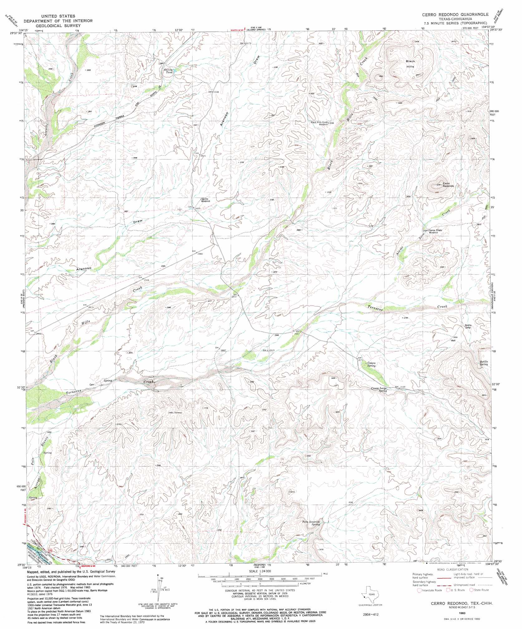
USGS Topo Quad 29104e2 - 1:24,000 scale
| Topo Map Name: | Cerro Redondo |
| USGS Topo Quad ID: | 29104e2 |
| Print Size: | ca. 21 1/4" wide x 27" high |
| Southeast Coordinates: | 29.5° N latitude / 104.125° W longitude |
| Map Center Coordinates: | 29.5625° N latitude / 104.1875° W longitude |
| U.S. State: | TX |
| Filename: | o29104e2.jpg |
| Download Map JPG Image: | Cerro Redondo topo map 1:24,000 scale |
| Map Type: | Topographic |
| Topo Series: | 7.5´ |
| Map Scale: | 1:24,000 |
| Source of Map Images: | United States Geological Survey (USGS) |
| Alternate Map Versions: |
Cerro Redondo TX 1983, updated 1983 Download PDF Buy paper map Cerro Redondo TX 2010 Download PDF Buy paper map Cerro Redondo TX 2013 Download PDF Buy paper map Cerro Redondo TX 2016 Download PDF Buy paper map |
1:24,000 Topo Quads surrounding Cerro Redondo
Cerro Orona |
Shafter |
Cienaga Mountains |
Plata |
Puerto Potrillo |
Arroyo Melado |
La Boquilla |
Alamo Spring |
Casa Piedra |
Horseshoe Mountain |
Presidio West |
Presidio East |
Cerro Redondo |
Manzanillo Canyon |
La Mota Mountain |
Redford |
Agua Adentro Mountain |
Sauceda Ranch |
||
Redford Se |
Santana Mesa |
> Back to 29104e1 at 1:100,000 scale
> Back to 29104a1 at 1:250,000 scale
> Back to U.S. Topo Maps home
Cerro Redondo topo map: Gazetteer
Cerro Redondo: Parks
Big Bend Ranch State Park elevation 999m 3277′Cerro Redondo: Springs
Rabago y Teran Springs elevation 847m 2778′Cerro Redondo: Summits
Black Hills elevation 1027m 3369′Cerro Redondo digital topo map on disk
Buy this Cerro Redondo topo map showing relief, roads, GPS coordinates and other geographical features, as a high-resolution digital map file on DVD: