Cerro Orona Topo Map Texas
To zoom in, hover over the map of Cerro Orona
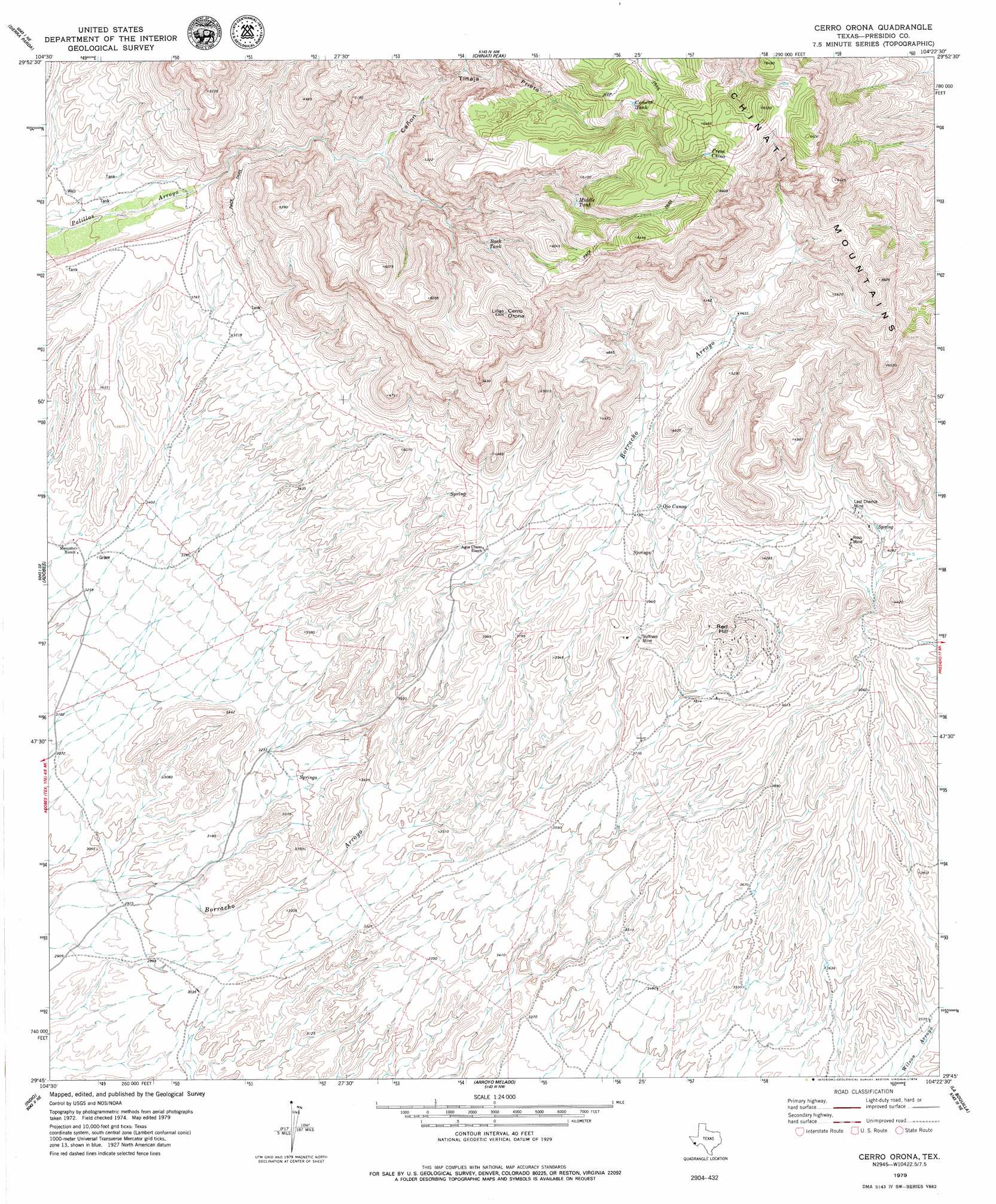
USGS Topo Quad 29104g4 - 1:24,000 scale
| Topo Map Name: | Cerro Orona |
| USGS Topo Quad ID: | 29104g4 |
| Print Size: | ca. 21 1/4" wide x 27" high |
| Southeast Coordinates: | 29.75° N latitude / 104.375° W longitude |
| Map Center Coordinates: | 29.8125° N latitude / 104.4375° W longitude |
| U.S. State: | TX |
| Filename: | o29104g4.jpg |
| Download Map JPG Image: | Cerro Orona topo map 1:24,000 scale |
| Map Type: | Topographic |
| Topo Series: | 7.5´ |
| Map Scale: | 1:24,000 |
| Source of Map Images: | United States Geological Survey (USGS) |
| Alternate Map Versions: |
Cerro Orona TX 2010 Download PDF Buy paper map Cerro Orona TX 2012 Download PDF Buy paper map Cerro Orona TX 2016 Download PDF Buy paper map |
1:24,000 Topo Quads surrounding Cerro Orona
Pueblo Nuevo |
Ruidosa Hot Springs |
Cuesta Del Burro West |
Cuesta Del Burro East |
San Estaban Lake Sw |
Las Conchas |
Sierra Parda |
Chinati Peak |
Cieneguita |
Cerros Priestos |
Vado De Piedra |
Adobes |
Cerro Orona |
Shafter |
Cienaga Mountains |
Indio |
Arroyo Melado |
La Boquilla |
Alamo Spring |
|
Presidio West |
Presidio East |
Cerro Redondo |
> Back to 29104e1 at 1:100,000 scale
> Back to 29104a1 at 1:250,000 scale
> Back to U.S. Topo Maps home
Cerro Orona topo map: Gazetteer
Cerro Orona: Mines
Last Chance Mine elevation 1316m 4317′Ross Mine elevation 1296m 4251′
Sullivan Mine elevation 1186m 3891′
Cerro Orona: Reservoirs
Back Tank elevation 1617m 5305′Cement Tank elevation 1782m 5846′
Middle Tank elevation 1731m 5679′
Presa Chino elevation 1896m 6220′
Cerro Orona: Springs
Jesusita Spring elevation 1243m 4078′La Cienaga Springs elevation 902m 2959′
Ojo Canoa elevation 1243m 4078′
Simon Gon Spring elevation 974m 3195′
Cerro Orona: Summits
Cerro Orona elevation 1912m 6272′Red Hill elevation 1292m 4238′
Cerro Orona: Valleys
Cañon Tinaja Prieta elevation 1156m 3792′Cerro Orona digital topo map on disk
Buy this Cerro Orona topo map showing relief, roads, GPS coordinates and other geographical features, as a high-resolution digital map file on DVD: