Adobes Topo Map Texas
To zoom in, hover over the map of Adobes
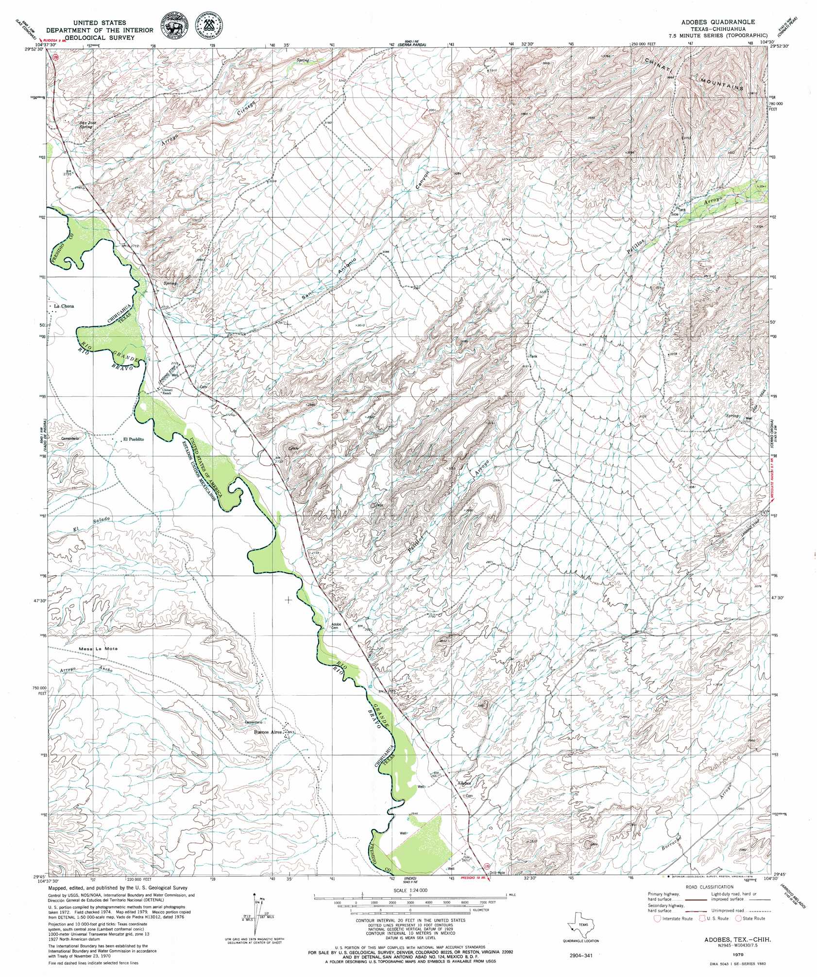
USGS Topo Quad 29104g5 - 1:24,000 scale
| Topo Map Name: | Adobes |
| USGS Topo Quad ID: | 29104g5 |
| Print Size: | ca. 21 1/4" wide x 27" high |
| Southeast Coordinates: | 29.75° N latitude / 104.5° W longitude |
| Map Center Coordinates: | 29.8125° N latitude / 104.5625° W longitude |
| U.S. State: | TX |
| Filename: | o29104g5.jpg |
| Download Map JPG Image: | Adobes topo map 1:24,000 scale |
| Map Type: | Topographic |
| Topo Series: | 7.5´ |
| Map Scale: | 1:24,000 |
| Source of Map Images: | United States Geological Survey (USGS) |
| Alternate Map Versions: |
Adobes TX 1966, updated 1969 Download PDF Buy paper map Adobes TX 2010 Download PDF Buy paper map Adobes TX 2012 Download PDF Buy paper map Adobes TX 2016 Download PDF Buy paper map |
1:24,000 Topo Quads surrounding Adobes
Pueblo Nuevo |
Ruidosa Hot Springs |
Cuesta Del Burro West |
Cuesta Del Burro East |
|
Las Conchas |
Sierra Parda |
Chinati Peak |
Cieneguita |
|
Vado De Piedra |
Adobes |
Cerro Orona |
Shafter |
|
Indio |
Arroyo Melado |
La Boquilla |
||
Presidio West |
Presidio East |
> Back to 29104e1 at 1:100,000 scale
> Back to 29104a1 at 1:250,000 scale
> Back to U.S. Topo Maps home
Adobes topo map: Gazetteer
Adobes: Populated Places
Adobes elevation 814m 2670′Chinati elevation 821m 2693′
Adobes: Springs
San Jose Spring elevation 848m 2782′Adobes: Valleys
Arroyo Cienega elevation 818m 2683′Pelillos Arroyo elevation 808m 2650′
San Antonio Canyon elevation 822m 2696′
Adobes digital topo map on disk
Buy this Adobes topo map showing relief, roads, GPS coordinates and other geographical features, as a high-resolution digital map file on DVD: