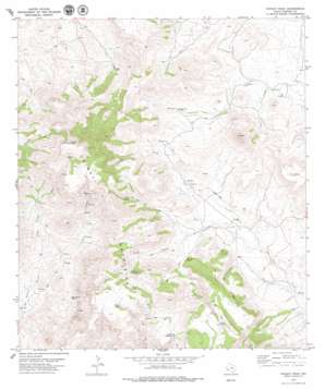
Chinati Peak Topo Map Texas
To zoom in, hover over the map of Chinati Peak
USGS Topo Quad 29104h4 - 1:24,000 scale
| Topo Map Name: | Chinati Peak |
| USGS Topo Quad ID: | 29104h4 |
| Print Size: | ca. 21 1/4" wide x 27" high |
| Southeast Coordinates: | 29.875° N latitude / 104.375° W longitude |
| Map Center Coordinates: | 29.9375° N latitude / 104.4375° W longitude |
| U.S. State: | TX |
| Filename: | o29104h4.jpg |
| Download Map JPG Image: | Chinati Peak topo map 1:24,000 scale |
| Map Type: | Topographic |
| Topo Series: | 7.5´ |
| Map Scale: | 1:24,000 |
| Source of Map Images: | United States Geological Survey (USGS) |
| Alternate Map Versions: |
Chinati Peak TX 1979, updated 1979 Download PDF Buy paper map Chinati Peak TX 2010 Download PDF Buy paper map Chinati Peak TX 2012 Download PDF Buy paper map Chinati Peak TX 2016 Download PDF Buy paper map |
1:24,000 Topo Quads surrounding Chinati Peak
> Back to 29104e1 at 1:100,000 scale
> Back to 29104a1 at 1:250,000 scale
> Back to U.S. Topo Maps home
Chinati Peak topo map: Gazetteer
Chinati Peak: Mines
San Antonio Mine elevation 1405m 4609′Chinati Peak: Populated Places
Chaffin Place elevation 1493m 4898′Chinati Peak: Ranges
Chinati Mountains elevation 1945m 6381′Chinati Peak: Reservoirs
Mesa Tank elevation 1817m 5961′Presa Llorona elevation 1624m 5328′
Presa Rincon elevation 1648m 5406′
Presa Viruelas elevation 1800m 5905′
Chinati Peak: Springs
Bull Spring elevation 1662m 5452′Deck Spring elevation 1742m 5715′
Ojo Agua Zarca elevation 1454m 4770′
Ojo Bonito elevation 1415m 4642′
Ojo Bonito Spring elevation 1475m 4839′
Chinati Peak: Summits
Aguja elevation 1827m 5994′Chinati Peak elevation 2354m 7723′
La Mesa elevation 1649m 5410′
Chinati Peak: Valleys
Cañon Cinco de Mayo elevation 1244m 4081′Pinto Canyon elevation 1244m 4081′
Tigner Canyon elevation 1351m 4432′
Chinati Peak digital topo map on disk
Buy this Chinati Peak topo map showing relief, roads, GPS coordinates and other geographical features, as a high-resolution digital map file on DVD:


