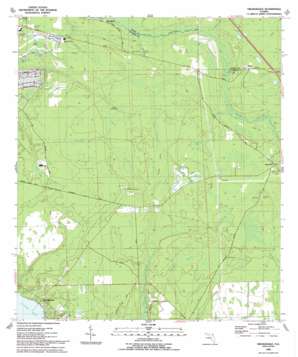
Orangedale Topo Map Florida
To zoom in, hover over the map of Orangedale
USGS Topo Quad 30081a5 - 1:24,000 scale
| Topo Map Name: | Orangedale |
| USGS Topo Quad ID: | 30081a5 |
| Print Size: | ca. 21 1/4" wide x 27" high |
| Southeast Coordinates: | 30° N latitude / 81.5° W longitude |
| Map Center Coordinates: | 30.0625° N latitude / 81.5625° W longitude |
| U.S. State: | FL |
| Filename: | O30081A5.jpg |
| Download Map JPG Image: | Orangedale topo map 1:24,000 scale |
| Map Type: | Topographic |
| Topo Series: | 7.5´ |
| Map Scale: | 1:24,000 |
| Source of Map Images: | United States Geological Survey (USGS) |
| Alternate Map Versions: |
Orangedale FL 1952, updated 1956 Download PDF Buy paper map Orangedale FL 1952, updated 1972 Download PDF Buy paper map Orangedale FL 1993, updated 1993 Download PDF Buy paper map Orangedale FL 2012 Download PDF Buy paper map Orangedale FL 2015 Download PDF Buy paper map |
1:24,000 Topo Quads surrounding Orangedale
> Back to 30081a1 at 1:100,000 scale
> Back to 30080a1 at 1:250,000 scale
> Back to U.S. Topo Maps home
Orangedale topo map: Gazetteer
Orangedale: Guts
Bowen Branch elevation 2m 6′Kendall Creek elevation 1m 3′
Molasses Branch elevation 6m 19′
Petty Branch elevation 3m 9′
Orangedale: Islands
Fever Hammock elevation 5m 16′Gopher Island elevation 6m 19′
Orangedale: Populated Places
Blacks Ford elevation 4m 13′Orangedale elevation 6m 19′
Pine Bluff elevation 4m 13′
Sampson elevation 5m 16′
Whites Ford elevation 5m 16′
Orangedale: Streams
Big Lige Branch elevation 1m 3′Corklan Branch elevation 0m 0′
Little Lige Branch elevation 3m 9′
Sampson Creek elevation 2m 6′
Orangedale: Swamps
Cartwheel Bay elevation 7m 22′Cedar Head elevation 5m 16′
Flat Swamp elevation 6m 19′
Waterhole elevation 8m 26′
Orangedale digital topo map on disk
Buy this Orangedale topo map showing relief, roads, GPS coordinates and other geographical features, as a high-resolution digital map file on DVD:


