Mickler Landing Topo Map Florida
To zoom in, hover over the map of Mickler Landing
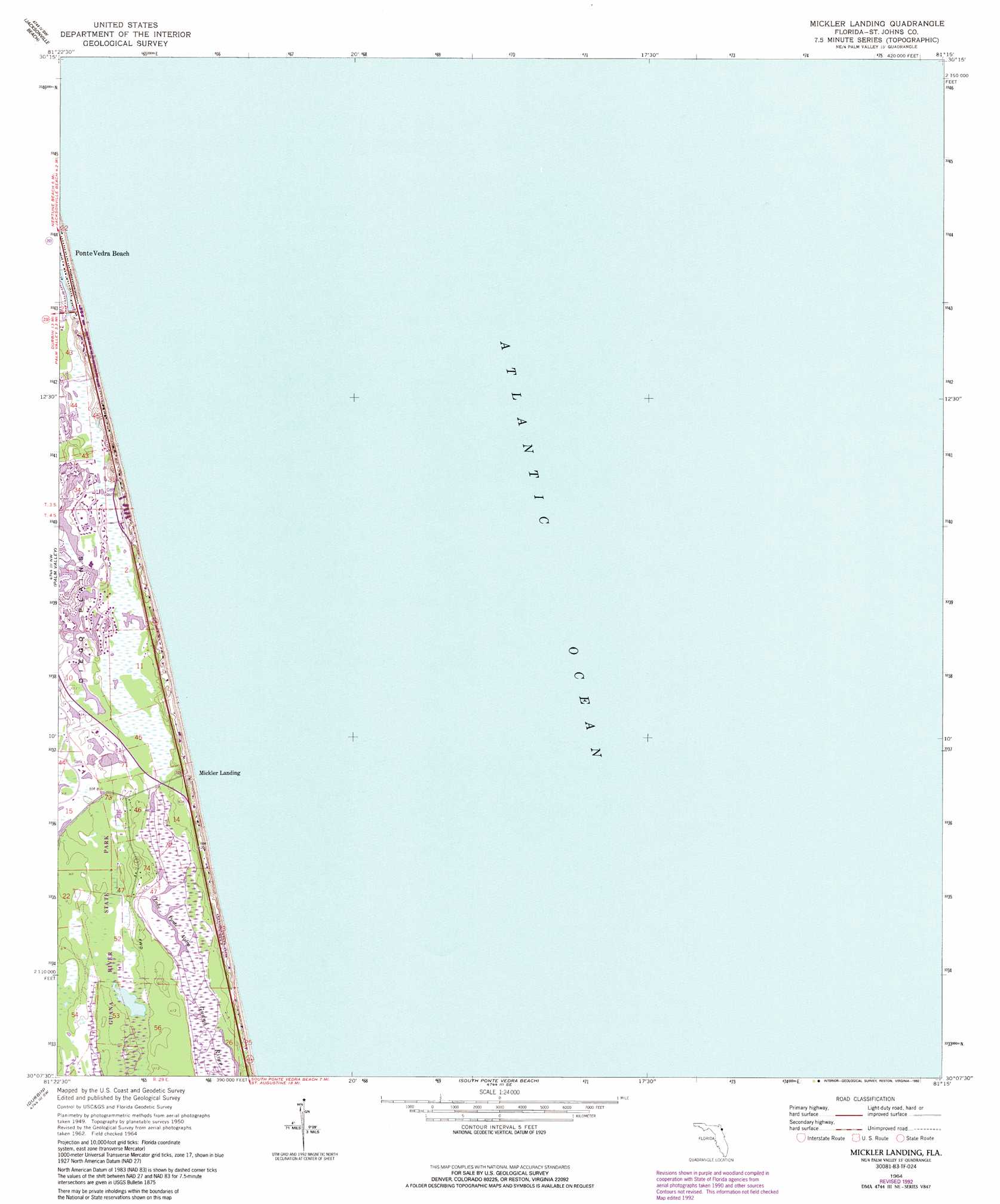
USGS Topo Quad 30081b3 - 1:24,000 scale
| Topo Map Name: | Mickler Landing |
| USGS Topo Quad ID: | 30081b3 |
| Print Size: | ca. 21 1/4" wide x 27" high |
| Southeast Coordinates: | 30.125° N latitude / 81.25° W longitude |
| Map Center Coordinates: | 30.1875° N latitude / 81.3125° W longitude |
| U.S. State: | FL |
| Filename: | O30081B3.jpg |
| Download Map JPG Image: | Mickler Landing topo map 1:24,000 scale |
| Map Type: | Topographic |
| Topo Series: | 7.5´ |
| Map Scale: | 1:24,000 |
| Source of Map Images: | United States Geological Survey (USGS) |
| Alternate Map Versions: |
Mickler Landing FL 1952, updated 1956 Download PDF Buy paper map Mickler Landing FL 1964, updated 1965 Download PDF Buy paper map Mickler Landing FL 1964, updated 1972 Download PDF Buy paper map Mickler Landing FL 1964, updated 1978 Download PDF Buy paper map Mickler Landing FL 1964, updated 1992 Download PDF Buy paper map Mickler Landing FL 2012 Download PDF Buy paper map Mickler Landing FL 2015 Download PDF Buy paper map |
1:24,000 Topo Quads surrounding Mickler Landing
Eastport |
Mayport |
|||
Arlington |
Jacksonville Beach |
|||
Bayard |
Palm Valley |
Mickler Landing |
||
Orangedale |
Durbin |
South Ponte Vedra Beach |
||
Picolata |
Bakersville |
Saint Augustine |
> Back to 30081a1 at 1:100,000 scale
> Back to 30080a1 at 1:250,000 scale
> Back to U.S. Topo Maps home
Mickler Landing topo map: Gazetteer
Mickler Landing: Flats
Diego Plains elevation 1m 3′Mickler Landing: Lakes
Lake Ponte Vedra elevation 0m 0′Mickler Landing: Populated Places
Mickler Landing elevation 5m 16′Sawgrass elevation 1m 3′
Mickler Landing digital topo map on disk
Buy this Mickler Landing topo map showing relief, roads, GPS coordinates and other geographical features, as a high-resolution digital map file on DVD: