Fiftone Topo Map Florida
To zoom in, hover over the map of Fiftone
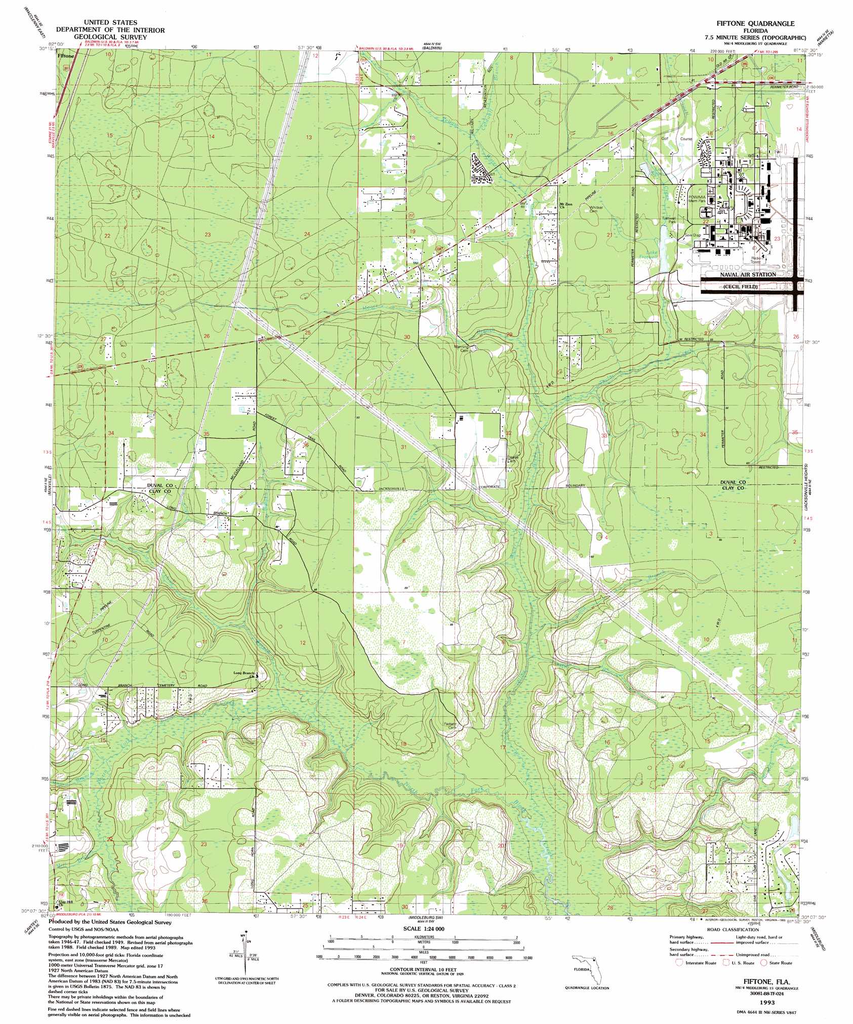
USGS Topo Quad 30081b8 - 1:24,000 scale
| Topo Map Name: | Fiftone |
| USGS Topo Quad ID: | 30081b8 |
| Print Size: | ca. 21 1/4" wide x 27" high |
| Southeast Coordinates: | 30.125° N latitude / 81.875° W longitude |
| Map Center Coordinates: | 30.1875° N latitude / 81.9375° W longitude |
| U.S. State: | FL |
| Filename: | O30081B8.jpg |
| Download Map JPG Image: | Fiftone topo map 1:24,000 scale |
| Map Type: | Topographic |
| Topo Series: | 7.5´ |
| Map Scale: | 1:24,000 |
| Source of Map Images: | United States Geological Survey (USGS) |
| Alternate Map Versions: |
Fiftone FL 1949, updated 1953 Download PDF Buy paper map Fiftone FL 1949, updated 1972 Download PDF Buy paper map Fiftone FL 1993, updated 1993 Download PDF Buy paper map Fiftone FL 1994, updated 2002 Download PDF Buy paper map Fiftone FL 2012 Download PDF Buy paper map Fiftone FL 2015 Download PDF Buy paper map |
1:24,000 Topo Quads surrounding Fiftone
Macclenny Nw |
Macclenny Ne |
Bryceville |
Dinsmore |
Trout River |
Macclenny West |
Macclenny East |
Baldwin |
Marietta |
Jacksonville |
Manning |
Maxville |
Fiftone |
Jacksonville Heights |
Orange Park |
Raiford |
Lawtey |
Middleburg Sw |
Middleburg |
Fleming Island |
Sampson |
Starke |
Kingsley |
Penney Farms |
Green Cove Springs |
> Back to 30081a1 at 1:100,000 scale
> Back to 30080a1 at 1:250,000 scale
> Back to U.S. Topo Maps home
Fiftone topo map: Gazetteer
Fiftone: Parks
Fretwell Park elevation 21m 68′POW/MIA Memorial Park elevation 24m 78′
Fiftone: Populated Places
Fiftone elevation 27m 88′Fiftone: Reservoirs
Lake Newman elevation 23m 75′Fiftone: Streams
Big Branch elevation 6m 19′Caldwell Branch elevation 20m 65′
Camp Branch elevation 8m 26′
Gum Branch elevation 10m 32′
Long Branch elevation 7m 22′
Mill Branch elevation 14m 45′
Mill Branch elevation 6m 19′
Moore Branch elevation 14m 45′
Rowell Creek elevation 12m 39′
Sal Taylor Creek elevation 11m 36′
Wheeler Branch elevation 8m 26′
Yellow Water Creek elevation 4m 13′
Fiftone digital topo map on disk
Buy this Fiftone topo map showing relief, roads, GPS coordinates and other geographical features, as a high-resolution digital map file on DVD: