Amelia City Topo Map Florida
To zoom in, hover over the map of Amelia City
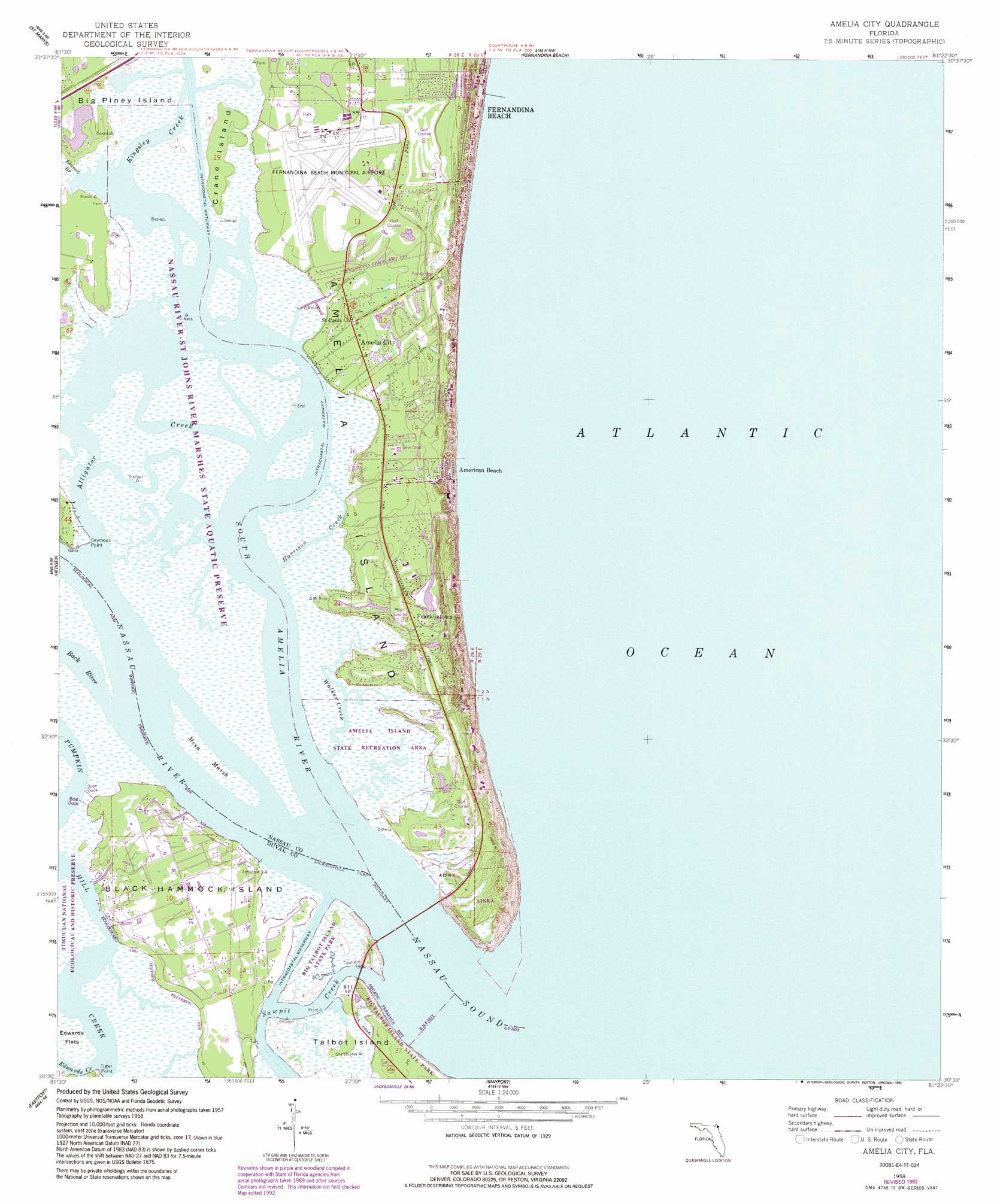
USGS Topo Quad 30081e4 - 1:24,000 scale
| Topo Map Name: | Amelia City |
| USGS Topo Quad ID: | 30081e4 |
| Print Size: | ca. 21 1/4" wide x 27" high |
| Southeast Coordinates: | 30.5° N latitude / 81.375° W longitude |
| Map Center Coordinates: | 30.5625° N latitude / 81.4375° W longitude |
| U.S. State: | FL |
| Filename: | O30081E4.jpg |
| Download Map JPG Image: | Amelia City topo map 1:24,000 scale |
| Map Type: | Topographic |
| Topo Series: | 7.5´ |
| Map Scale: | 1:24,000 |
| Source of Map Images: | United States Geological Survey (USGS) |
| Alternate Map Versions: |
Amelia City FL 1958, updated 1959 Download PDF Buy paper map Amelia City FL 1958, updated 1972 Download PDF Buy paper map Amelia City FL 1958, updated 1975 Download PDF Buy paper map Amelia City FL 1958, updated 1988 Download PDF Buy paper map Amelia City FL 1958, updated 1992 Download PDF Buy paper map Amelia City FL 1958, updated 1992 Download PDF Buy paper map Amelia City FL 2012 Download PDF Buy paper map Amelia City FL 2015 Download PDF Buy paper map |
1:24,000 Topo Quads surrounding Amelia City
Kingsland |
Harrietts Bluff |
Cumberland Island South |
||
Gross |
Saint Marys |
Fernandina Beach |
||
Italia |
Hedges |
Amelia City |
||
Trout River |
Eastport |
Mayport |
||
Jacksonville |
Arlington |
Jacksonville Beach |
> Back to 30081e1 at 1:100,000 scale
> Back to 30080a1 at 1:250,000 scale
> Back to U.S. Topo Maps home
Amelia City topo map: Gazetteer
Amelia City: Airports
Fernandina Beach Municipal Airport elevation 3m 9′Amelia City: Bays
Nassau Sound elevation 0m 0′Amelia City: Capes
Seymour Point elevation 0m 0′Tiger Point elevation 0m 0′
Amelia City: Guts
Kingsley Creek elevation 0m 0′Amelia City: Islands
Amelia Island elevation 4m 13′Big Piney Island elevation 0m 0′
Black Hammock Island elevation 4m 13′
Crane Island elevation 1m 3′
Amelia City: Parks
Amelia Island State Park elevation 3m 9′Amelia City: Populated Places
Amelia City elevation 5m 16′American Beach elevation 5m 16′
Black Hammock elevation 5m 16′
Franklintown elevation 3m 9′
Sandpiper Mobile Home Park elevation 4m 13′
Amelia City: Streams
Back River elevation 0m 0′Elwood Branch elevation 0m 0′
Harrison Creek elevation 0m 0′
Nassau River elevation 0m 0′
Sawpit Creek elevation 0m 0′
South Amelia River elevation 0m 0′
Walker Creek elevation 0m 0′
Amelia City: Swamps
Mesa Marsh elevation 0m 0′Amelia City digital topo map on disk
Buy this Amelia City topo map showing relief, roads, GPS coordinates and other geographical features, as a high-resolution digital map file on DVD: