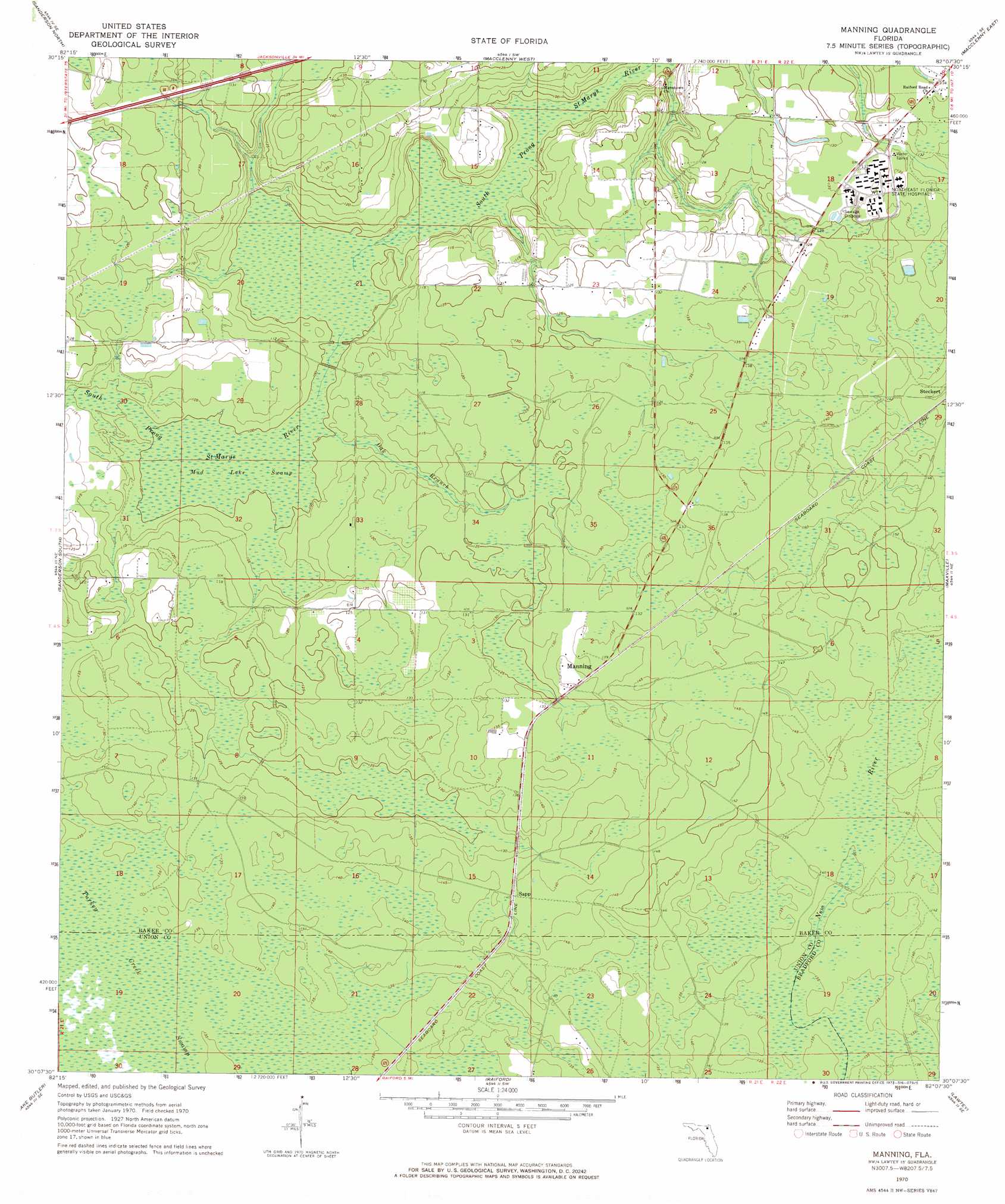
Manning Topo Map Florida
To zoom in, hover over the map of Manning
USGS Topo Quad 30082b2 - 1:24,000 scale
| Topo Map Name: | Manning |
| USGS Topo Quad ID: | 30082b2 |
| Print Size: | ca. 21 1/4" wide x 27" high |
| Southeast Coordinates: | 30.125° N latitude / 82.125° W longitude |
| Map Center Coordinates: | 30.1875° N latitude / 82.1875° W longitude |
| U.S. State: | FL |
| Filename: | O30082B2.jpg |
| Download Map JPG Image: | Manning topo map 1:24,000 scale |
| Map Type: | Topographic |
| Topo Series: | 7.5´ |
| Map Scale: | 1:24,000 |
| Source of Map Images: | United States Geological Survey (USGS) |
| Alternate Map Versions: |
Manning FL 1970, updated 1973 Download PDF Buy paper map Manning FL 2012 Download PDF Buy paper map Manning FL 2015 Download PDF Buy paper map |
| FStopo: | US Forest Service topo Manning is available: Download FStopo PDF Download FStopo TIF |
1:24,000 Topo Quads surrounding Manning
Sanderson Nw |
Taylor |
Macclenny Nw |
Macclenny Ne |
Bryceville |
Big Gum Swamp |
Sanderson North |
Macclenny West |
Macclenny East |
Baldwin |
Olustee |
Sanderson South |
Manning |
Maxville |
Fiftone |
Lulu |
Lake Butler |
Raiford |
Lawtey |
Middleburg Sw |
Worthington Springs |
Brooker |
Sampson |
Starke |
Kingsley |
> Back to 30082a1 at 1:100,000 scale
> Back to 30082a1 at 1:250,000 scale
> Back to U.S. Topo Maps home
Manning topo map: Gazetteer
Manning: Populated Places
Lee and Baker Mobile Home Park 2 elevation 39m 127′Manning elevation 41m 134′
Sapp elevation 42m 137′
Steckert elevation 44m 144′
Manning: Streams
Oak Branch elevation 30m 98′Manning: Swamps
Mud Lake Swamp elevation 30m 98′Manning digital topo map on disk
Buy this Manning topo map showing relief, roads, GPS coordinates and other geographical features, as a high-resolution digital map file on DVD: