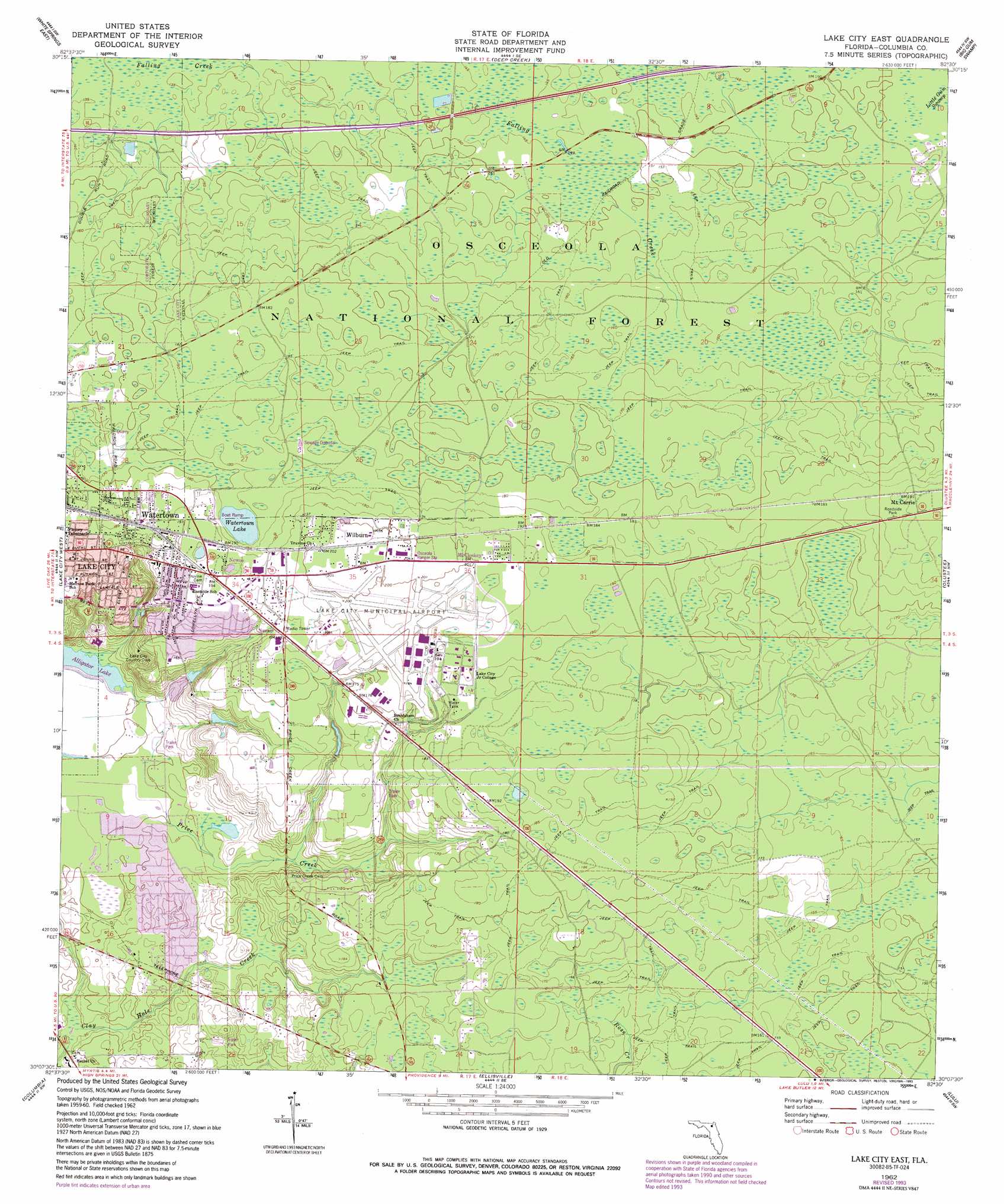
Lake City East Topo Map Florida
To zoom in, hover over the map of Lake City East
USGS Topo Quad 30082b5 - 1:24,000 scale
| Topo Map Name: | Lake City East |
| USGS Topo Quad ID: | 30082b5 |
| Print Size: | ca. 21 1/4" wide x 27" high |
| Southeast Coordinates: | 30.125° N latitude / 82.5° W longitude |
| Map Center Coordinates: | 30.1875° N latitude / 82.5625° W longitude |
| U.S. State: | FL |
| Filename: | O30082B5.jpg |
| Download Map JPG Image: | Lake City East topo map 1:24,000 scale |
| Map Type: | Topographic |
| Topo Series: | 7.5´ |
| Map Scale: | 1:24,000 |
| Source of Map Images: | United States Geological Survey (USGS) |
| Alternate Map Versions: |
Lake City East FL 1962, updated 1964 Download PDF Buy paper map Lake City East FL 1962, updated 1977 Download PDF Buy paper map Lake City East FL 1962, updated 1993 Download PDF Buy paper map Lake City East FL 2005, updated 2006 Download PDF Buy paper map Lake City East FL 2012 Download PDF Buy paper map Lake City East FL 2015 Download PDF Buy paper map |
| FStopo: | US Forest Service topo Lake City East is available: Download FStopo PDF Download FStopo TIF |
1:24,000 Topo Quads surrounding Lake City East
Genoa |
Benton |
Fairview |
Sanderson Nw |
Taylor |
White Springs West |
White Springs East |
Deep Creek |
Big Gum Swamp |
Sanderson North |
Wellborn |
Lake City West |
Lake City East |
Olustee |
Sanderson South |
O'Brien Se |
Columbia |
Ellisville |
Lulu |
Lake Butler |
Hildreth |
Fort White |
Mikesville |
Worthington Springs |
Brooker |
> Back to 30082a1 at 1:100,000 scale
> Back to 30082a1 at 1:250,000 scale
> Back to U.S. Topo Maps home
Lake City East topo map: Gazetteer
Lake City East: Airports
Hill Landing Strip elevation 46m 150′Lake City Municipal Airport elevation 59m 193′
Lake City East: Populated Places
Hideaway Mobile Home Park elevation 58m 190′Hudson Mobile Home Park elevation 60m 196′
Luther Thomas Mobile Home Park elevation 56m 183′
McColskey elevation 60m 196′
Mount Carrie elevation 60m 196′
Navair elevation 53m 173′
Newco elevation 58m 190′
Oakview Mobile Home Park elevation 54m 177′
Watertown elevation 57m 187′
Wilburn elevation 61m 200′
Lake City East: Reservoirs
Watertown Lake elevation 54m 177′Lake City East: Streams
Price Creek elevation 30m 98′Lake City East digital topo map on disk
Buy this Lake City East topo map showing relief, roads, GPS coordinates and other geographical features, as a high-resolution digital map file on DVD: